

 Børgefjell National Park 1920
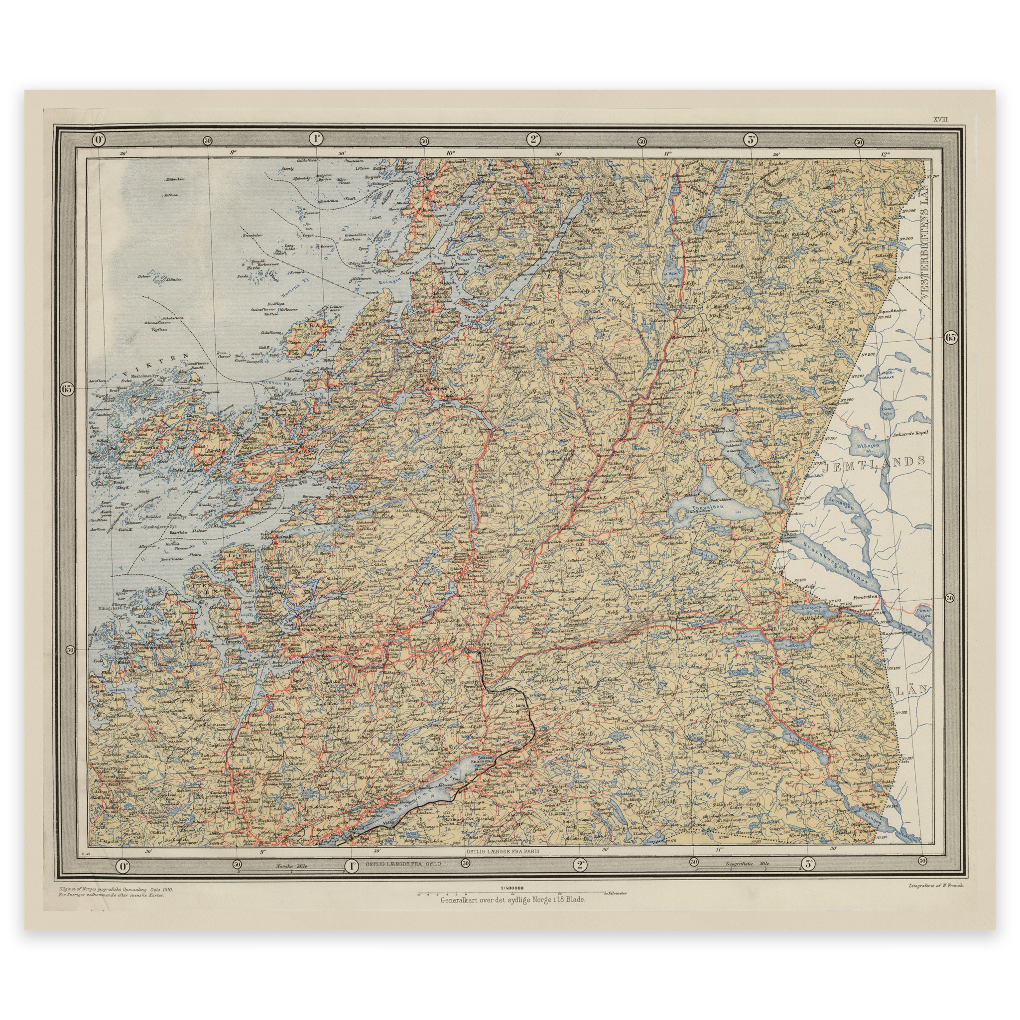
Børgefjell National Park 1920
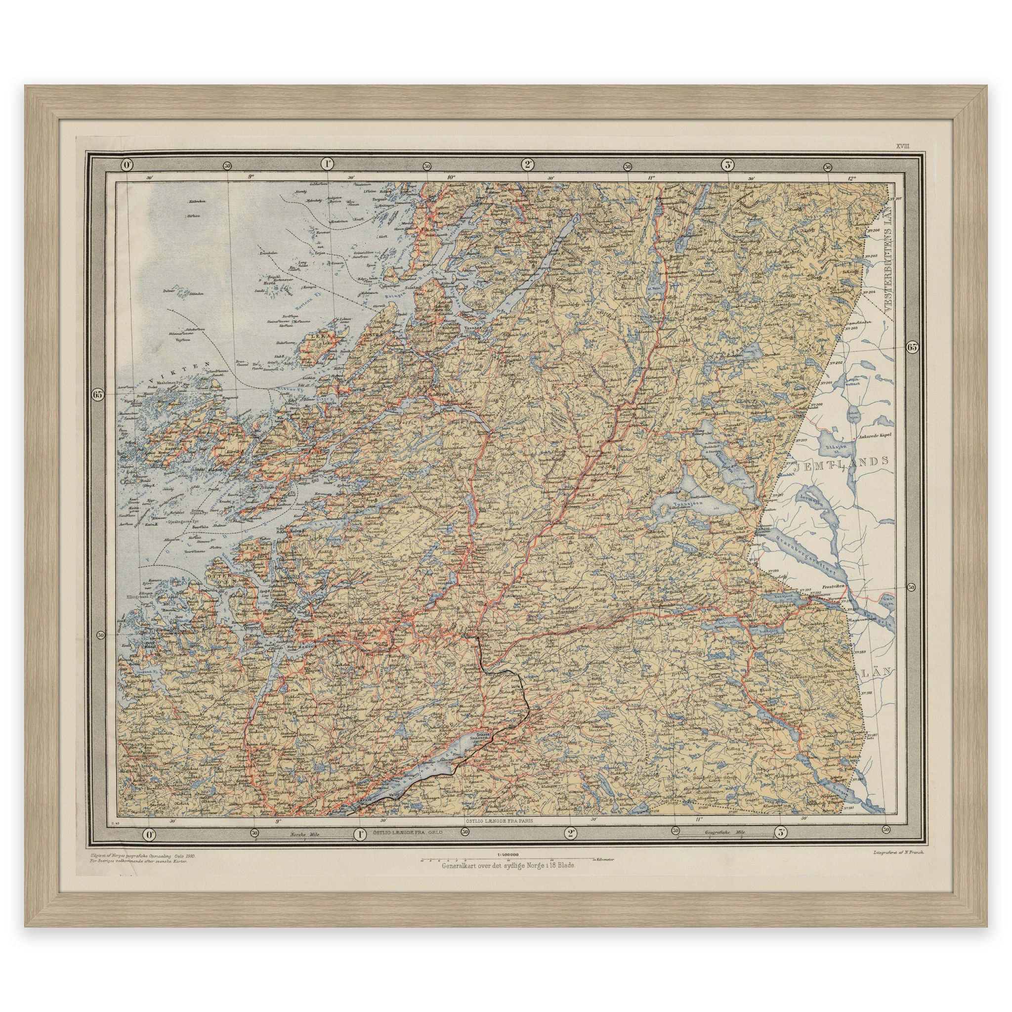
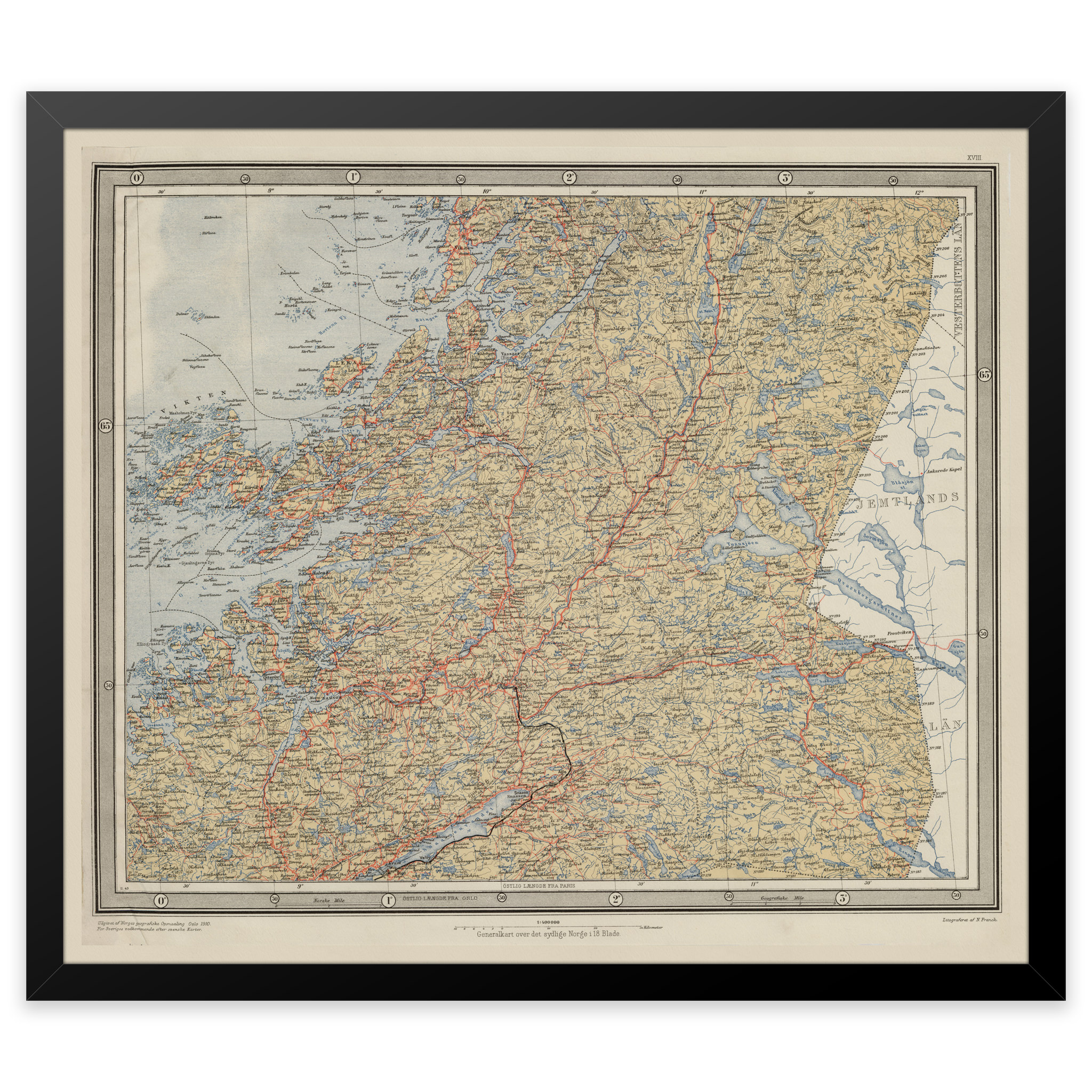
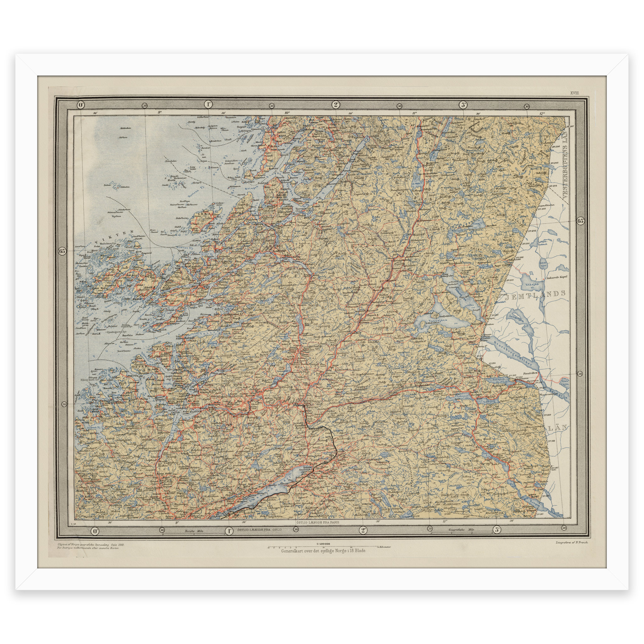
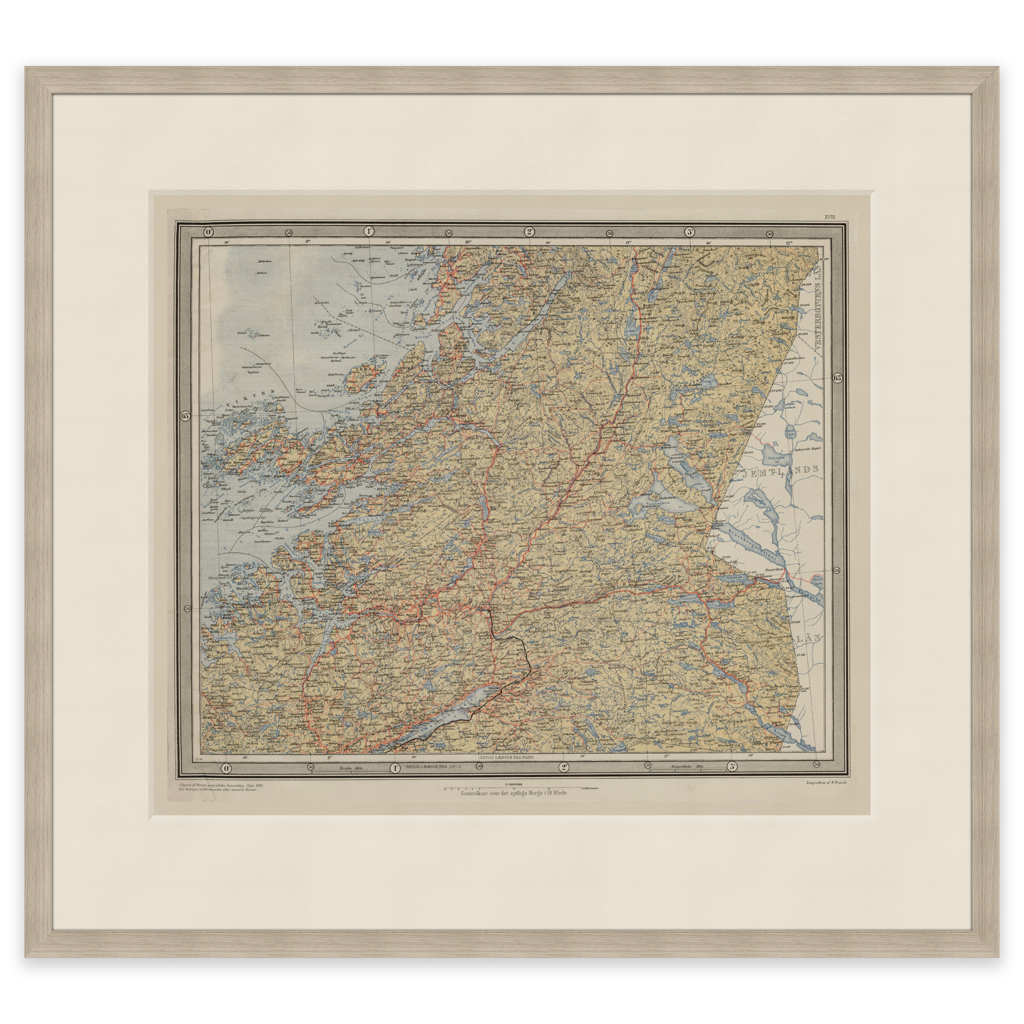
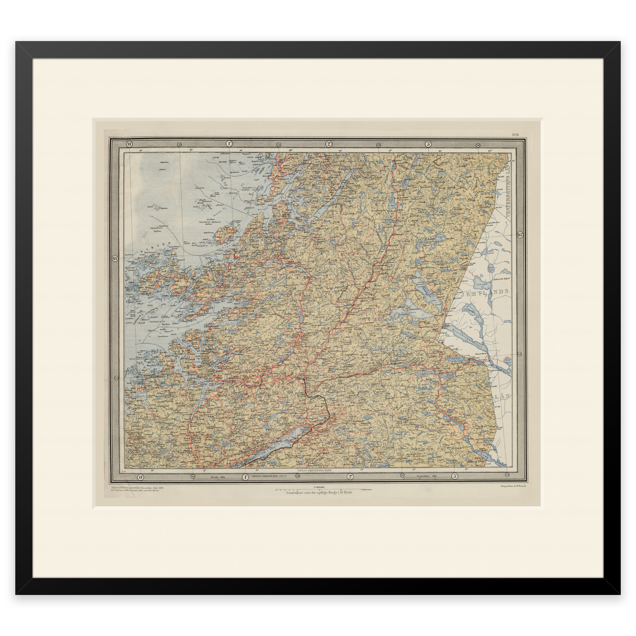
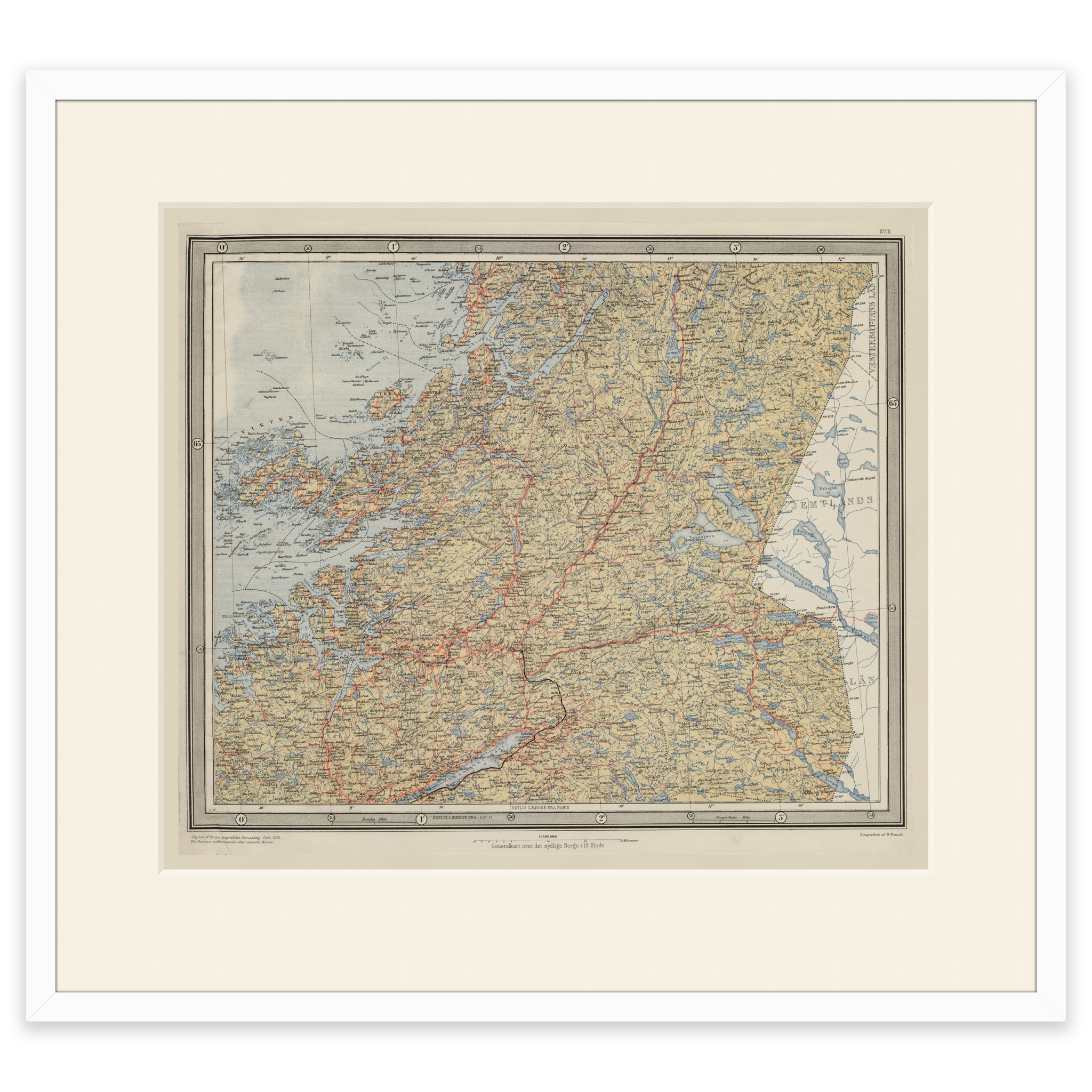
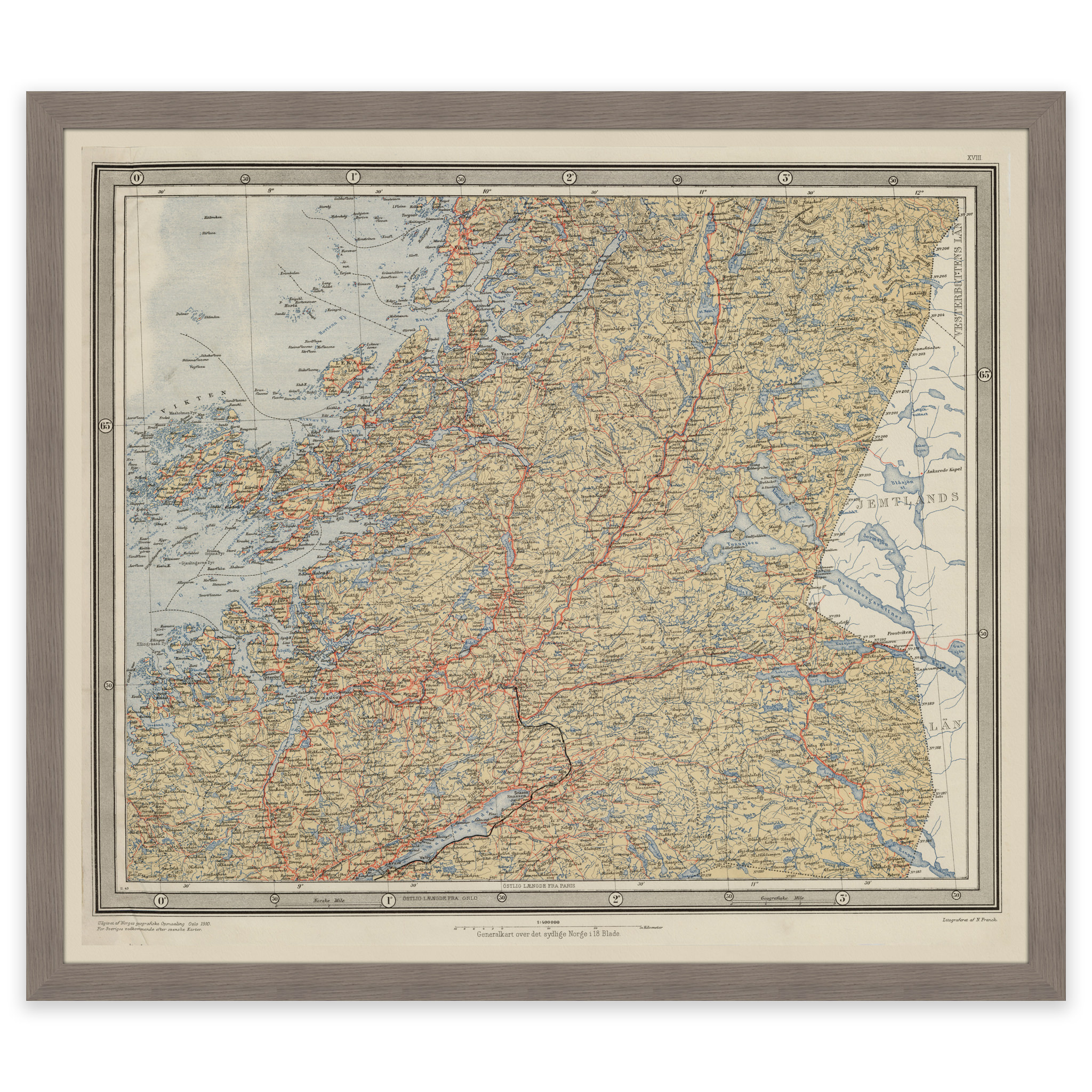
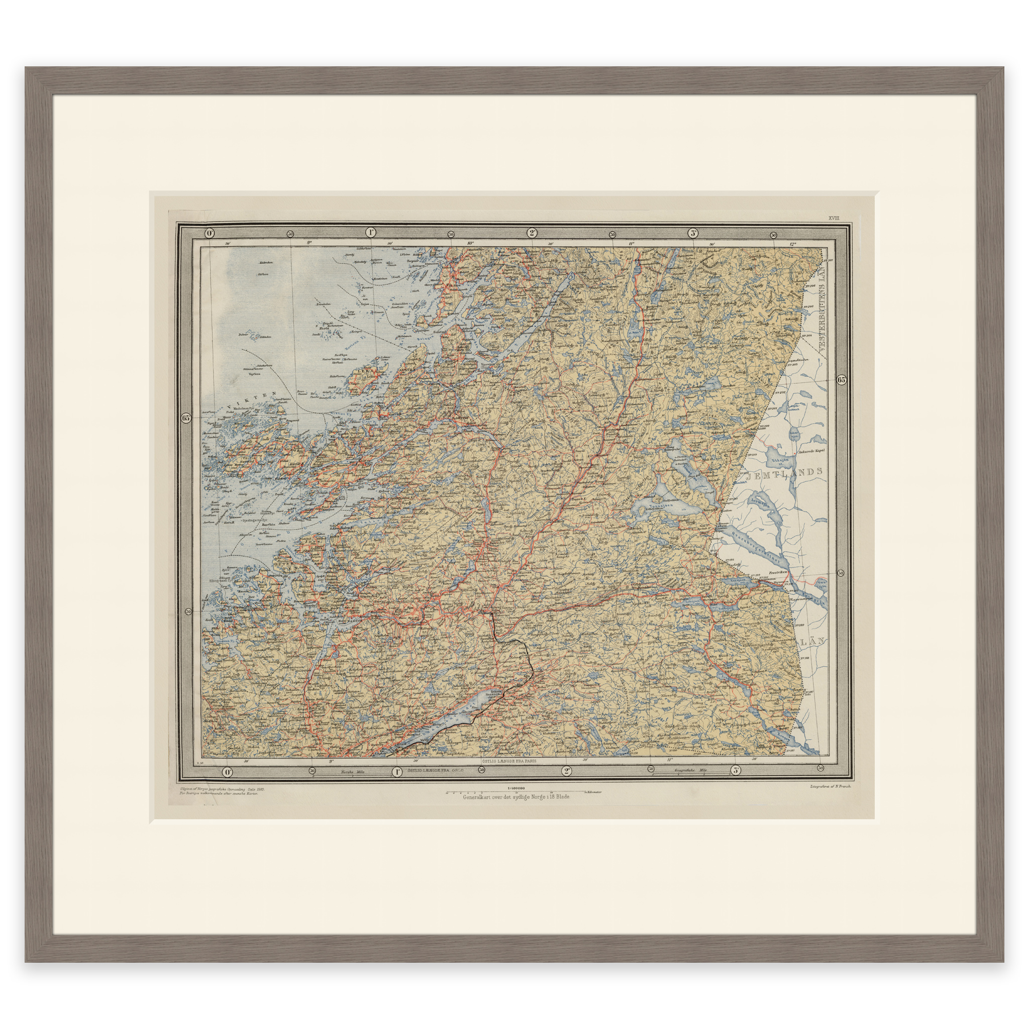
Map of central Norway from 1920 covering the area Torghatten and Børgefjell National Park in the north, up to and including Snåsavatnet and Namdalseid in the south. The map is delivered in its original size of 52.2 x 45.1 cm. The size with frame and passe-partout is 70.2 x 64.1 cm. Do you want the map in a different size? Just get in touch – we’ll be happy to give you a quote for customization.