Description
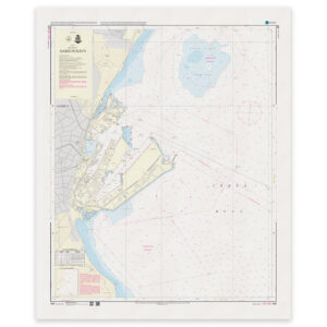
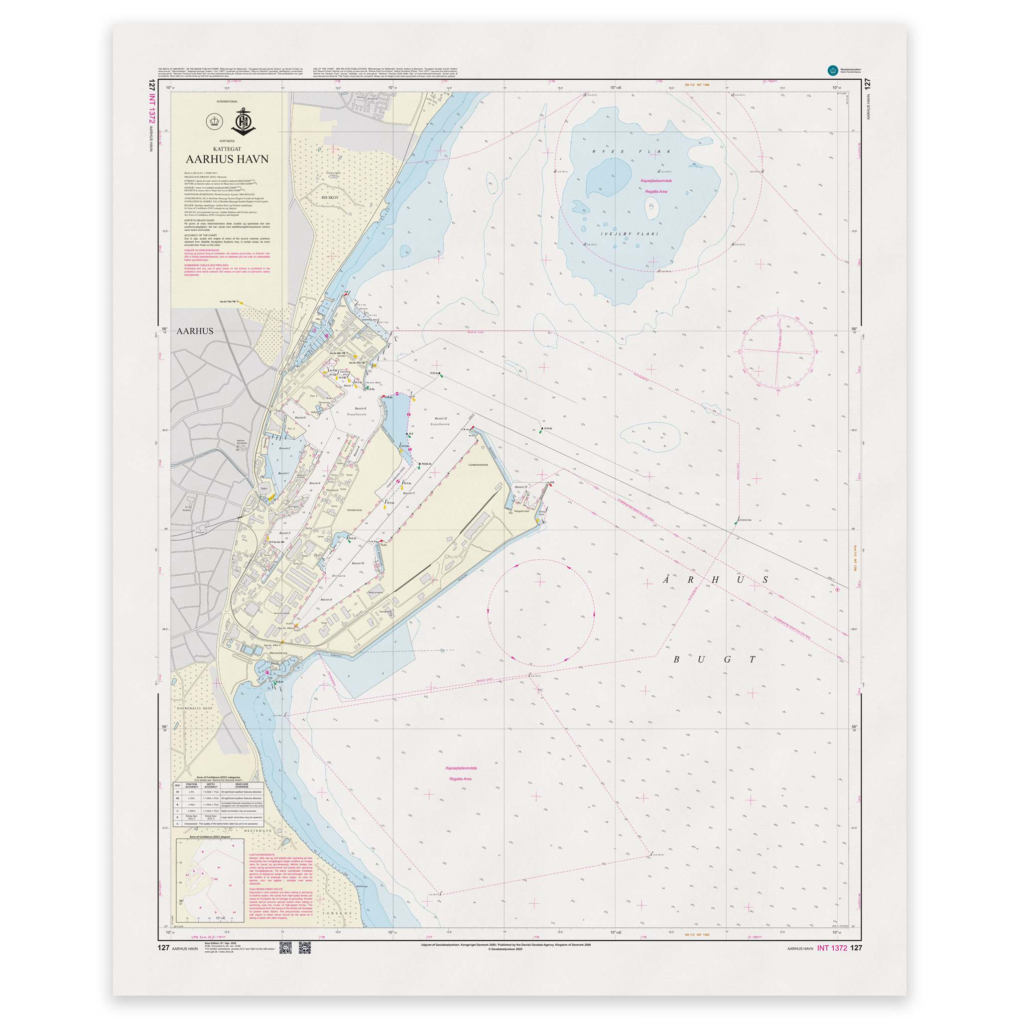
Denmark Chart 127 – Aarhus Harbor (INT 1372) is an official Danish nautical chart published by Geodatastyrelsen at a scale of 1:10 000.
The map covers the Port of Aarhus and adjacent waters, and provides a very detailed representation of quays, basins, channels, depths, beacons and other navigational installations in the port area.
This is a large-scale specialty chart, designed for precise navigation and maneuvering in port areas with heavy traffic and complex installations. The high level of detail makes the map particularly suitable for:
Port calls
Maneuvering in pools and harbor inlets
Navigation near quays
Planning of mooring
The chart is also published as INT 1372, and is part of the International Chart Series coordinated by IHO (International Hydrographic Organization). The INT number means that the chart follows international standards and is harmonized for use in international shipping.
The map is delivered as Print-on-Demand (POD) under license from Geodatastyrelsen. It is printed when ordered and updated to the latest available Notices to Mariners at the time of production.
You’ll receive a fresh and updated reprint based on current official map data.
The chart is produced on durable, matte 125 g paper approved for official nautical charts.
Corrections are published continuously and new updates may occur after printing. Print-on-Demand ensures that you get the most up-to-date paper edition available when ordering.