Description
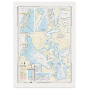
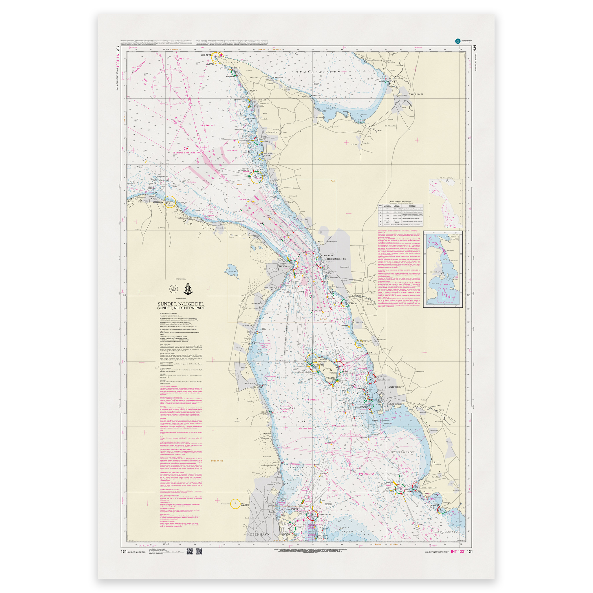
Denmark Chart 131 – Sundet, nordlige del is an official Danish nautical chart published by Geodatastyrelsen at a scale of 1:75 000.
The map covers the northern part of Øresund (Sundet), the waterway between Denmark and Sweden that connects the Kattegat and the Baltic Sea. The area is among the most heavily trafficked sea areas in the Nordic region and requires precise navigation with a good overview of shipping lanes, traffic separation zones, lighthouses, beacons and depth conditions.
This is a port of call and transit chart, developed for navigation in coastal main waters and international transits. The scale of 1:75,000 provides a good balance between overview and detail, and is suitable for both sail planning and operational navigation in the Sound.
The map is delivered as Print-on-Demand (POD) under license from Geodatastyrelsen. It is printed when ordered and updated to the latest available Notices to Mariners at the time of production.
You’ll receive a fresh and updated reprint based on current official map data.
The chart is produced on durable, matte 125 g paper approved for official nautical charts.
Corrections are published continuously and new updates may occur after printing. Print-on-Demand ensures that you get the most up-to-date paper edition available when ordering.