Description
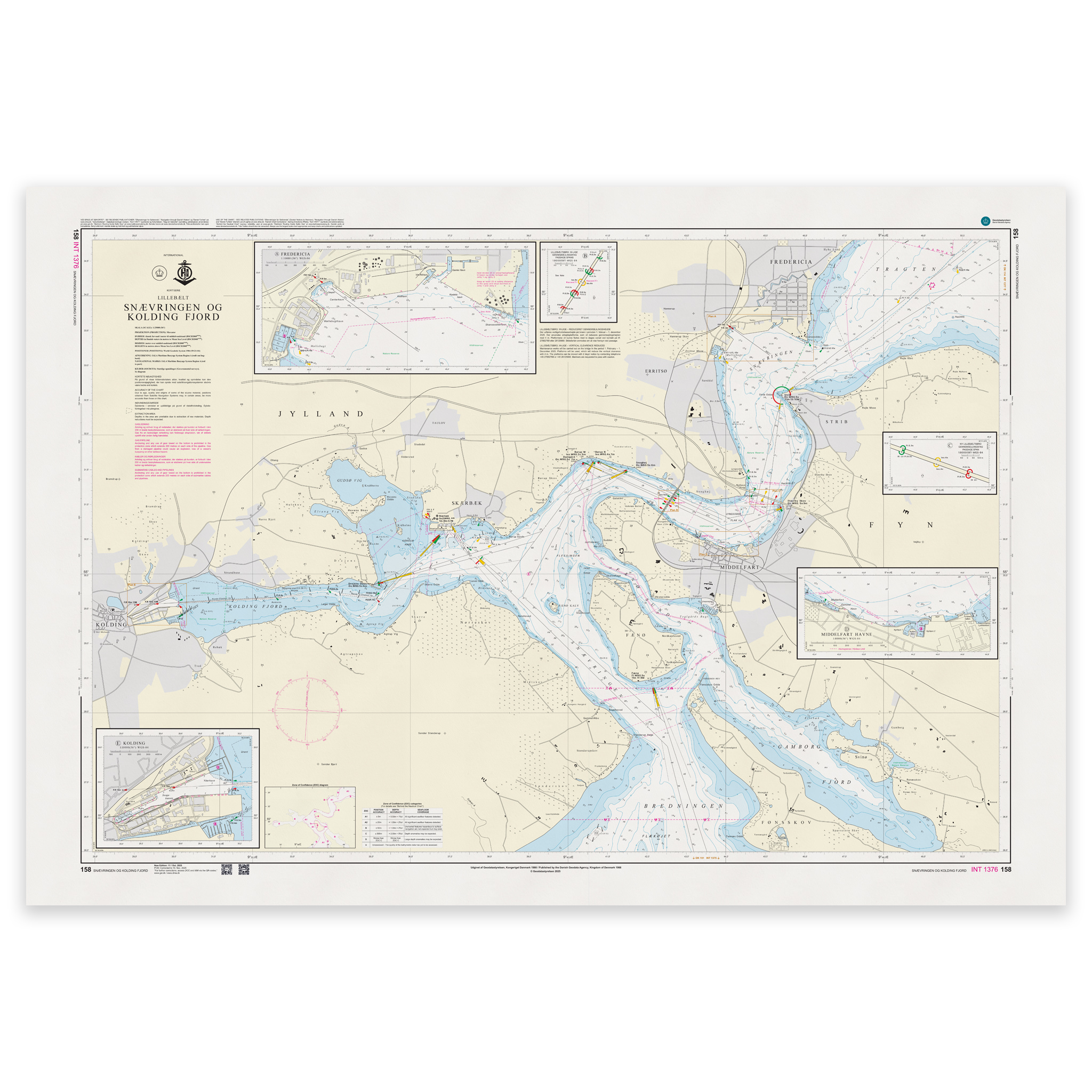
Denmark Chart 158 – Lillebælt, Snævringen and Kolding Fjord (INT 1376) is an official Danish nautical chart published by Geodatastyrelsen at a scale of 1:25 000.
The map covers Snævringen – the narrowest and busiest part of Lillebælt – and Kolding Fjord. The area has both through shipping traffic and extensive leisure boat activity, and requires precise navigation.
This is a special large-scale map, developed for detailed navigation in narrow waters and fjord areas. The 1:25,000 scale provides high precision and makes the map particularly suitable for:
Sailing through Snævringen
Navigation in Kolding Fjord
Port calls in the Kolding area
Maneuvering in narrow channels and busy passages
The map shows detailed depth conditions, leads, lighthouses, bridges, beacons and other navigation installations that are essential for safe navigation.
The chart is also published as INT 1376 and is part of the International Chart Series coordinated by IHO. The INT number means that the chart follows international standards and is harmonized for use in international shipping.
The map is delivered as Print-on-Demand (POD) under license from Geodatastyrelsen. It is printed when ordered and updated to the latest available Notices to Mariners at the time of production.
You’ll receive a fresh and updated reprint based on current official map data.
The chart is produced on durable, matte 125 g paper approved for official nautical charts.
Corrections are published continuously and new updates may occur after printing. Print-on-Demand ensures that you get the most up-to-date paper edition available when ordering.