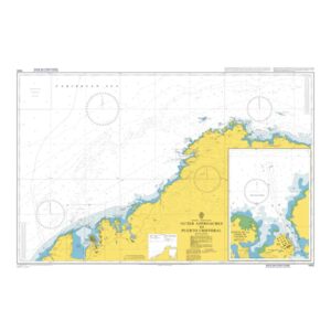
Description
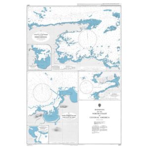
This British Admiralty chart covers the outer approaches to Puerto Cristóbal at the Caribbean entrance to the Panama Canal. The chart shows the coastline, depths, navigation marks, traffic separation and obstructions in the area where commercial ship traffic is concentrated before entering the canal area.
The chart is designed for safe navigation in open coastal waters and is particularly relevant for vessels planning or executing an approach to Puerto Cristóbal and adjacent port and anchorage areas. It is suitable for professional navigators and provides a reliable chart basis for both route planning and operational sailing in the area.