Description
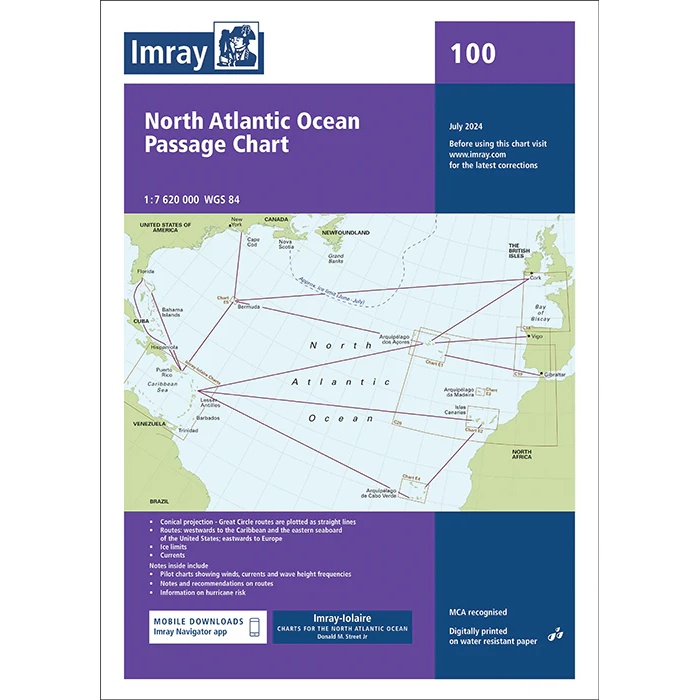
This boating chart from Imray is a comprehensive overview and passage chart for the North Atlantic. Covering the sailing routes between Europe, North America, the Caribbean and West Africa, the chart is designed specifically for planning long ocean crossings and transatlantic voyages.
The chart shows recommended sailing routes, great circle lines and traditional passages, providing a clear overview of ocean areas, continental shelves and key geographical references. It is well suited for long-distance sailors and leisure boats planning to cross the Atlantic, either east-west or north-south, and serves as a central planning chart on board.
Imray is a recognized British manufacturer of nautical charts with extensive experience in cartography for leisure and long-distance sailing. Their overview and passage charts have been developed with a focus on legibility, practicality and safe route planning over large areas of ocean.