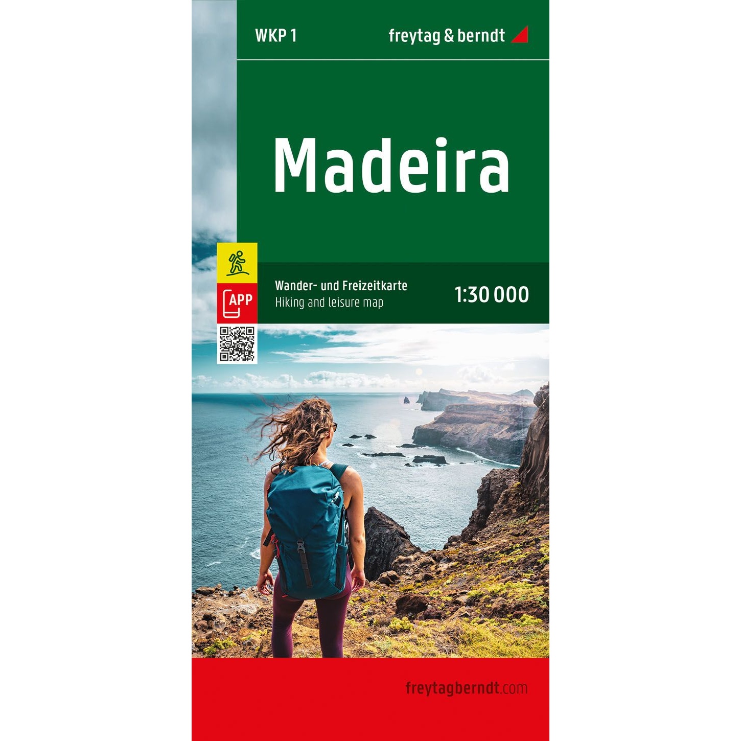

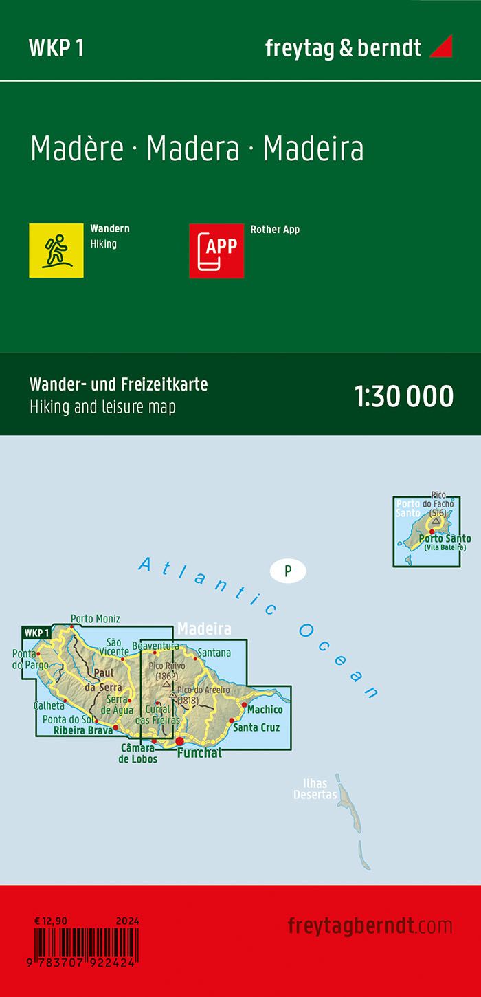
Description
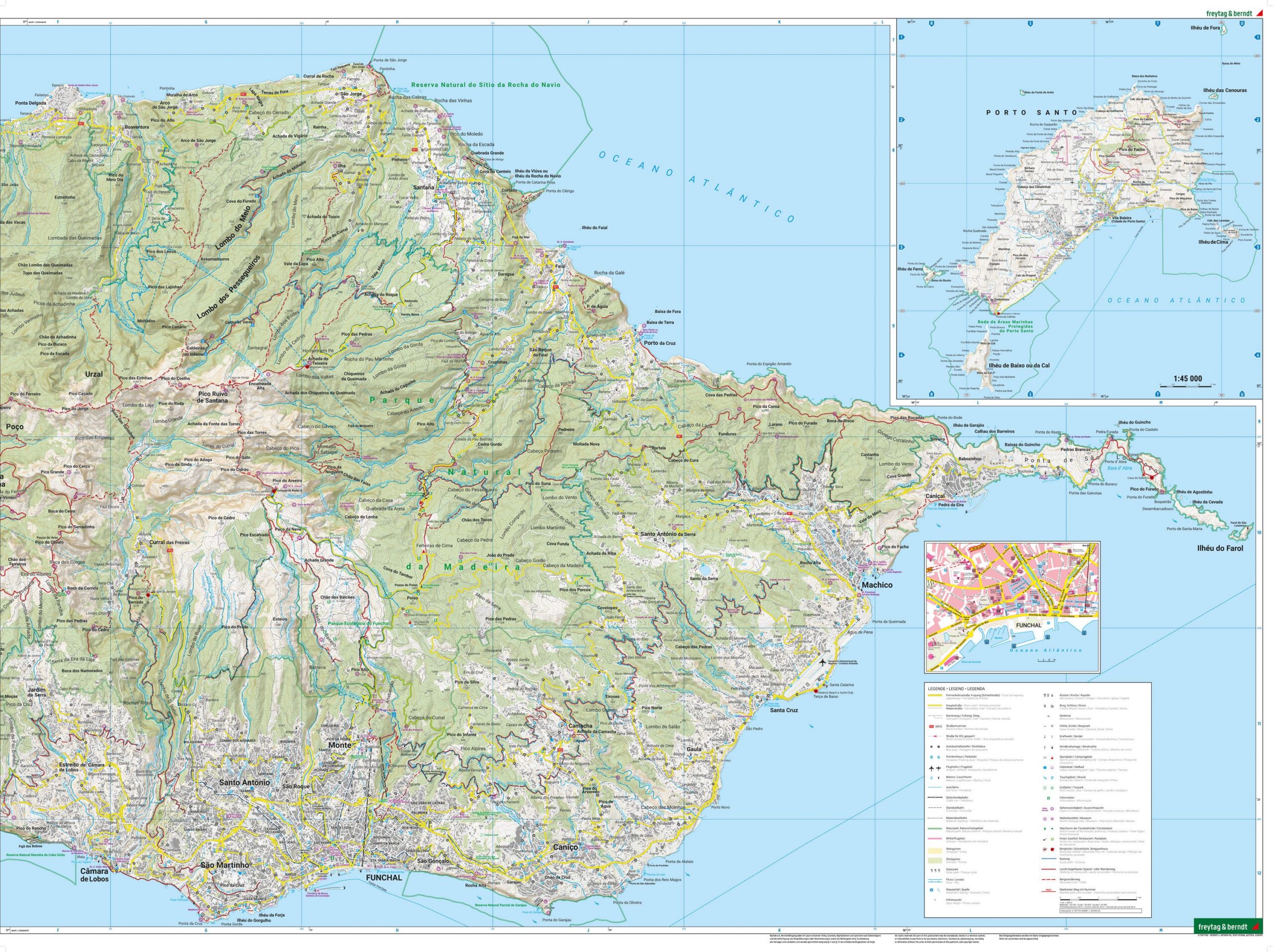
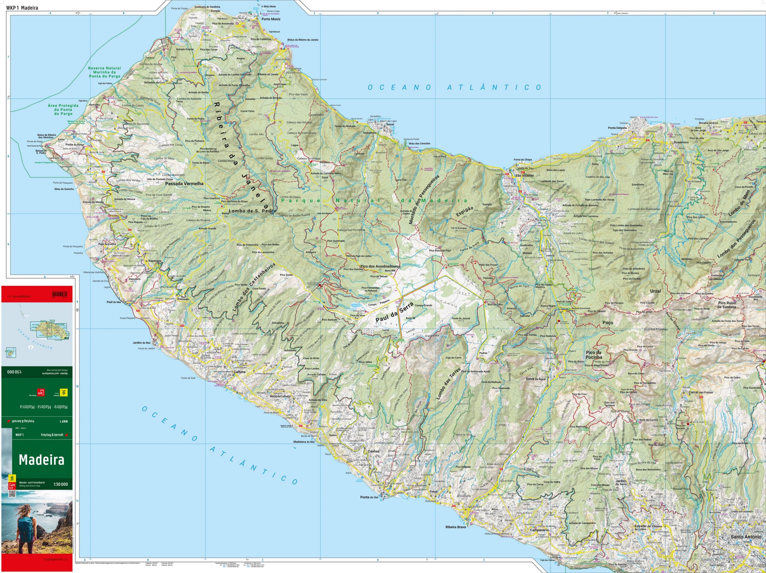
This is a detailed and accurate hiking map of Madeira, designed for hiking, day trips and longer walks on the island. The map provides an excellent overview of hiking and walking routes, including marked trails, long-distance routes and connections between different hiking areas, and is suitable for both planning and practical use in the field.
The map image is topographic and easy to read, with clear reproduction of contours, terrain shapes and landscapes. Important sights, viewpoints and natural landmarks are marked on the map, making it a useful tool for both active walkers and more leisurely excursions. The map covers the whole of Madeira and includes areas such as Funchal and the Pico Ruivo mountains.
The map is printed on a waterproof and tear-resistant material, adapted for use in varying weather conditions. It also comes with access to an associated digital map solution via an app, which makes it possible to use the map on a mobile phone during your trip. Production is resource-friendly, and the map is printed in Austria with high technical and cartographic quality.
The map is released in 2024.