

 Nord-Trøndelag 1869


Nord-Trøndelag 1869
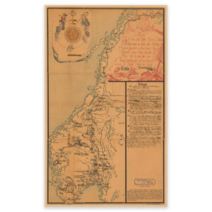
Map of Nord-Trøndelag from 1869, the area from Trondheimsfjord up to and including Vikna, Børgefjell and the Swedish border. The Fosen Peninsula was not part of Nordre Trondhjem county at this time. The map is delivered in its original size of 62.2 x 62.5 cm. The size with frame and passepartout is 80.2 x 81.5 cm. Do you want the map in a different size? Just get in touch – we’ll be happy to give you a quote for customization.