
 Coast Kvaløya-Sørøya
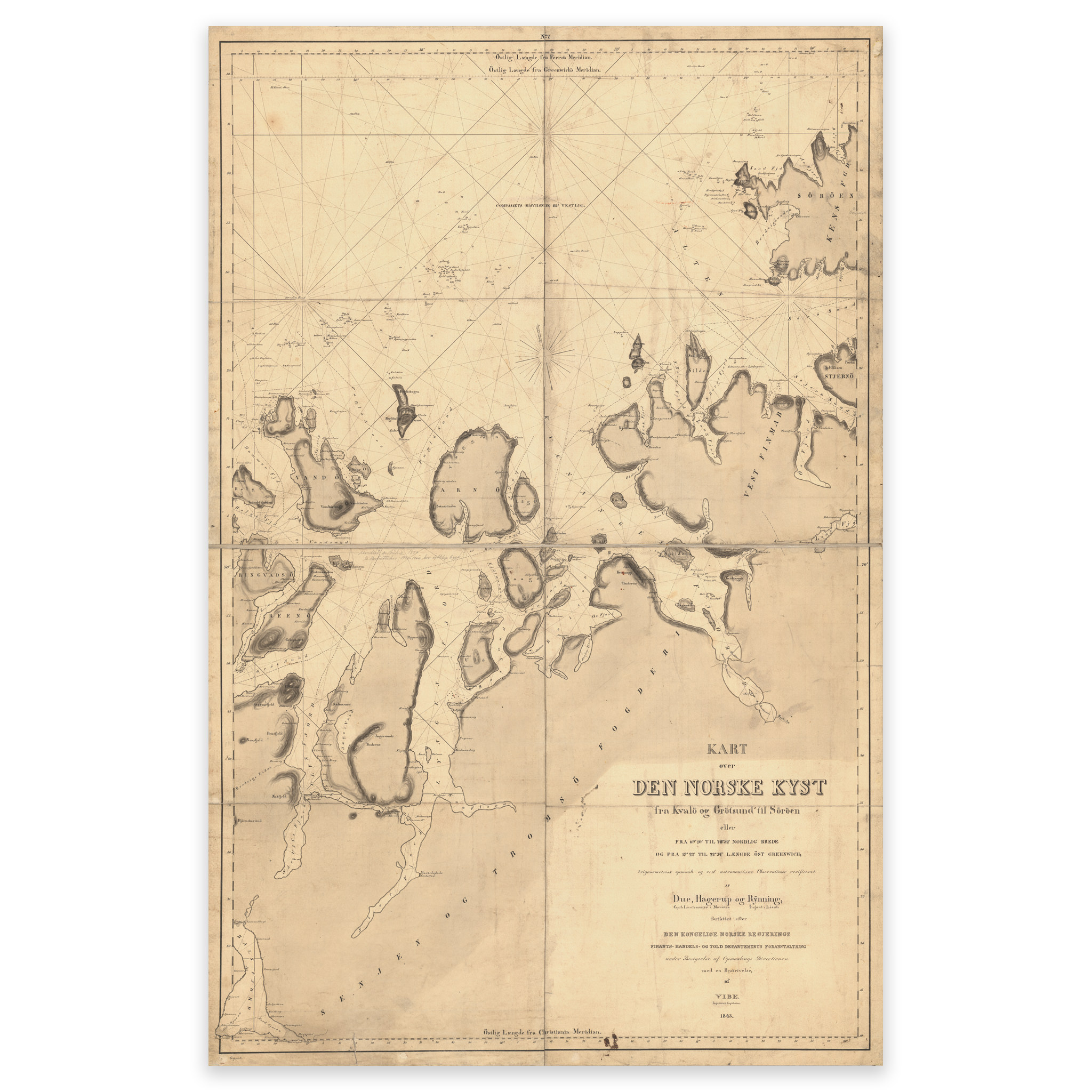


Coast Kvaløya-Sørøya
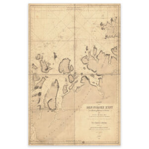
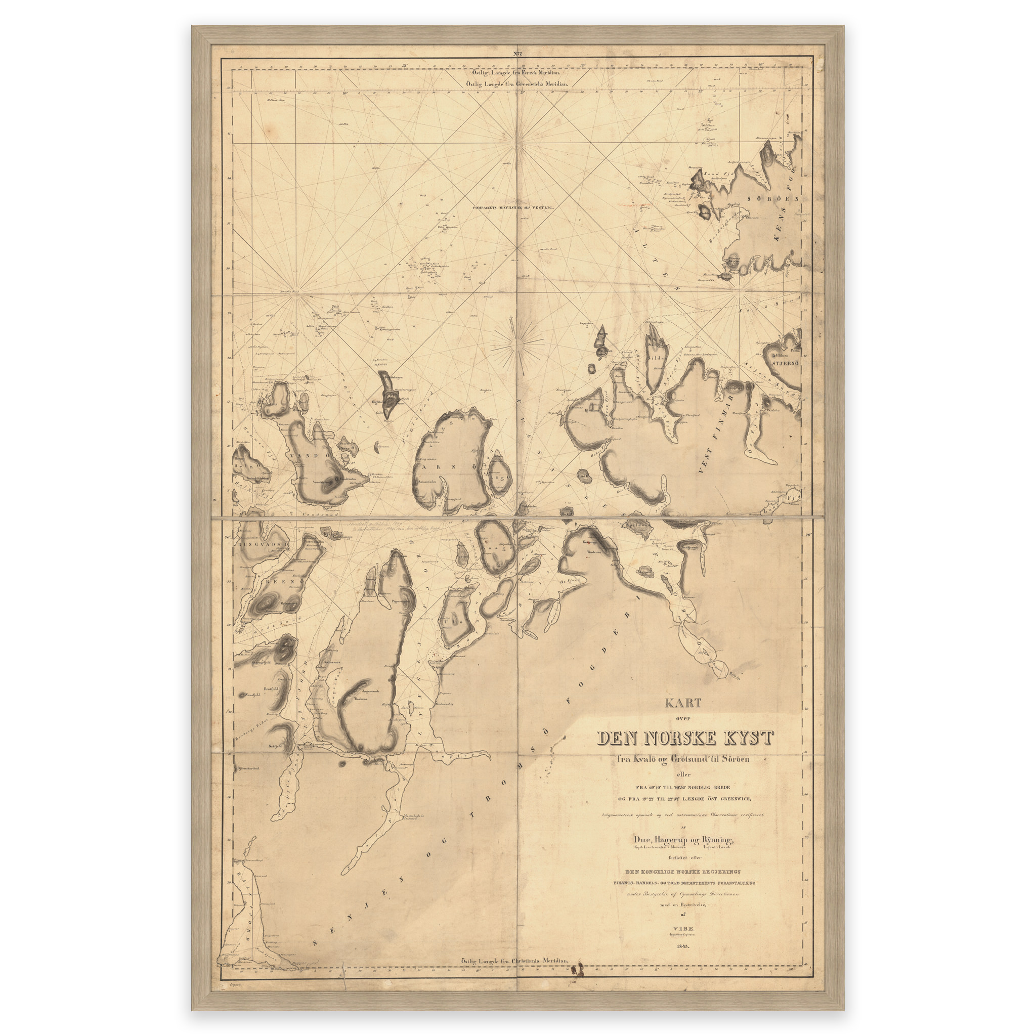
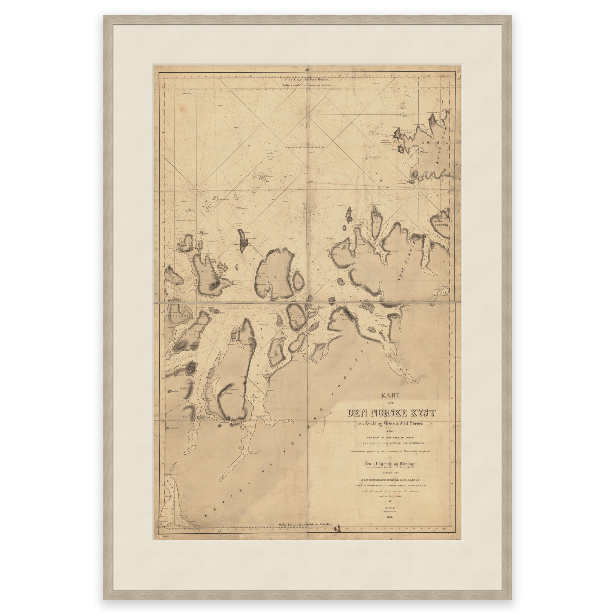
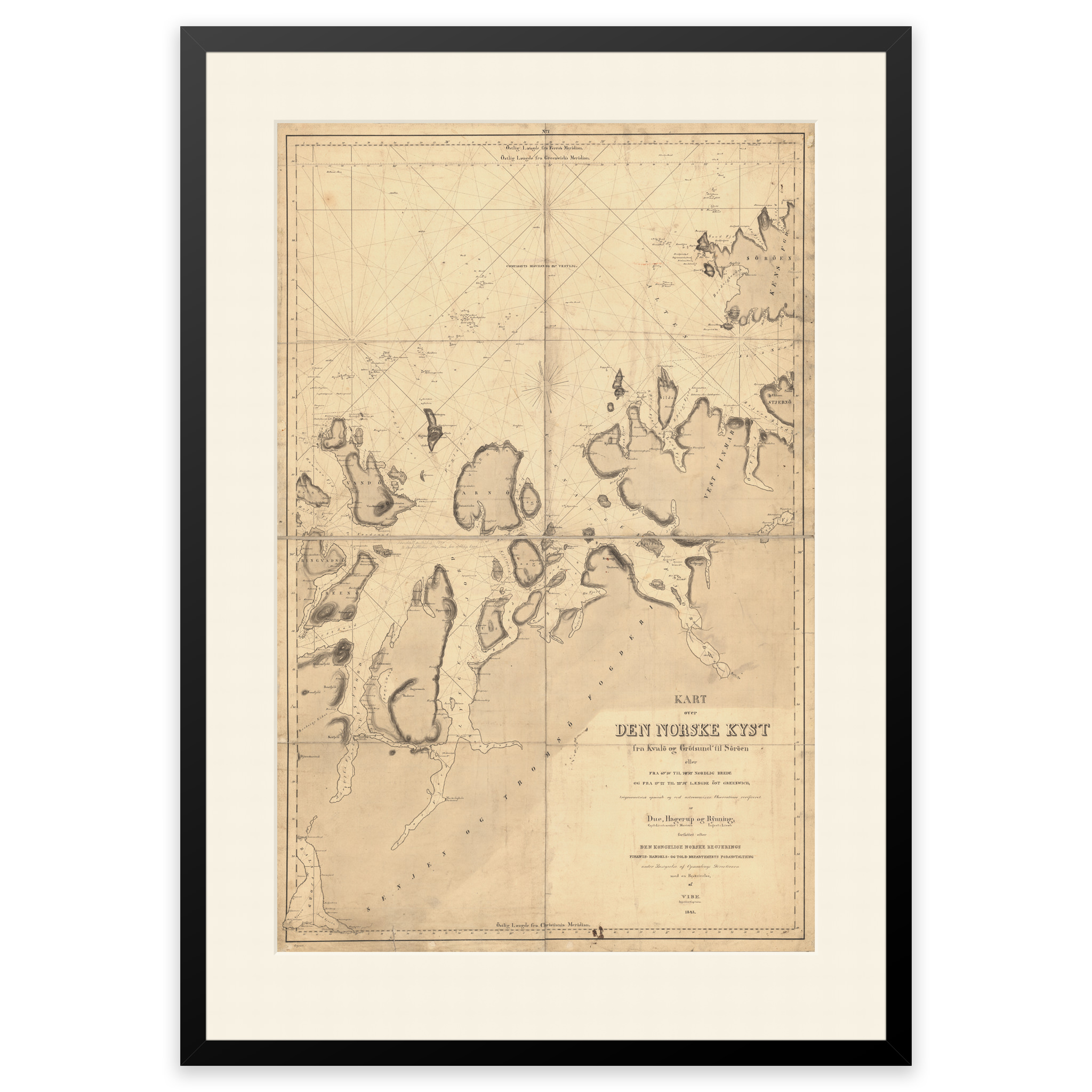
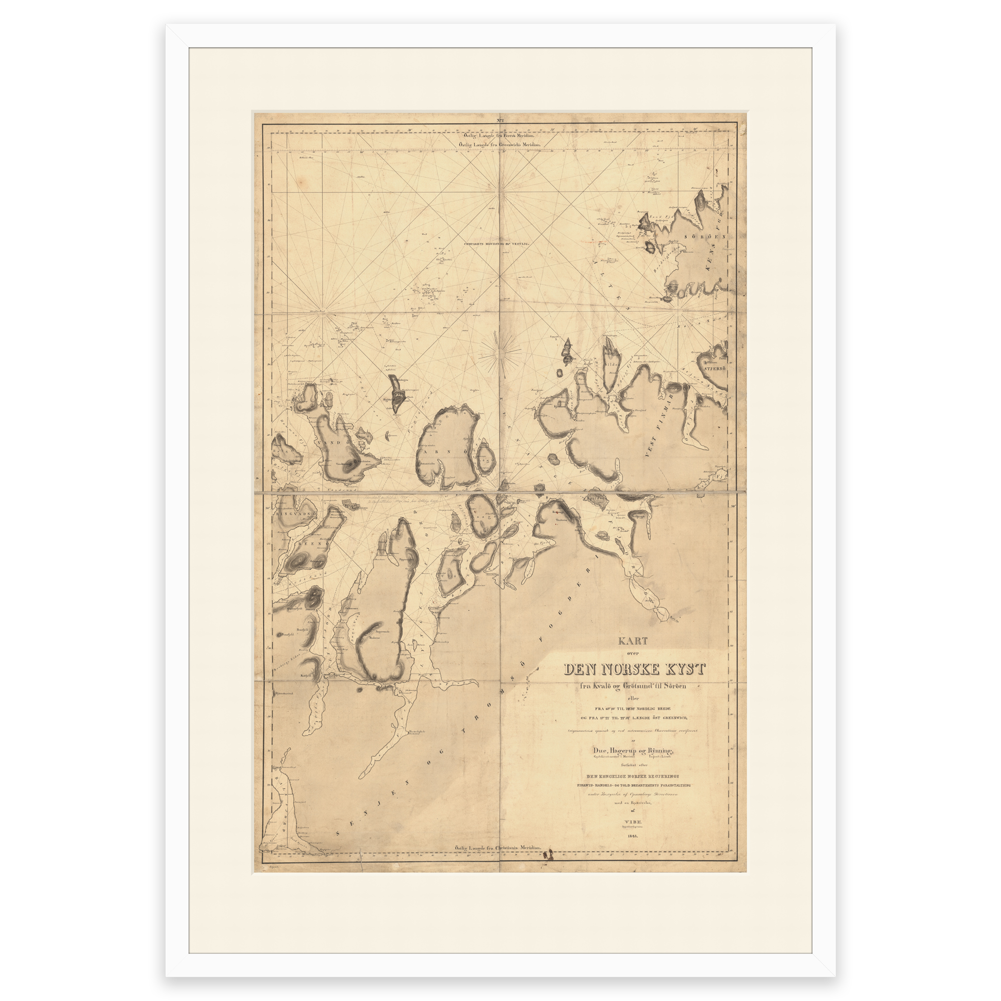
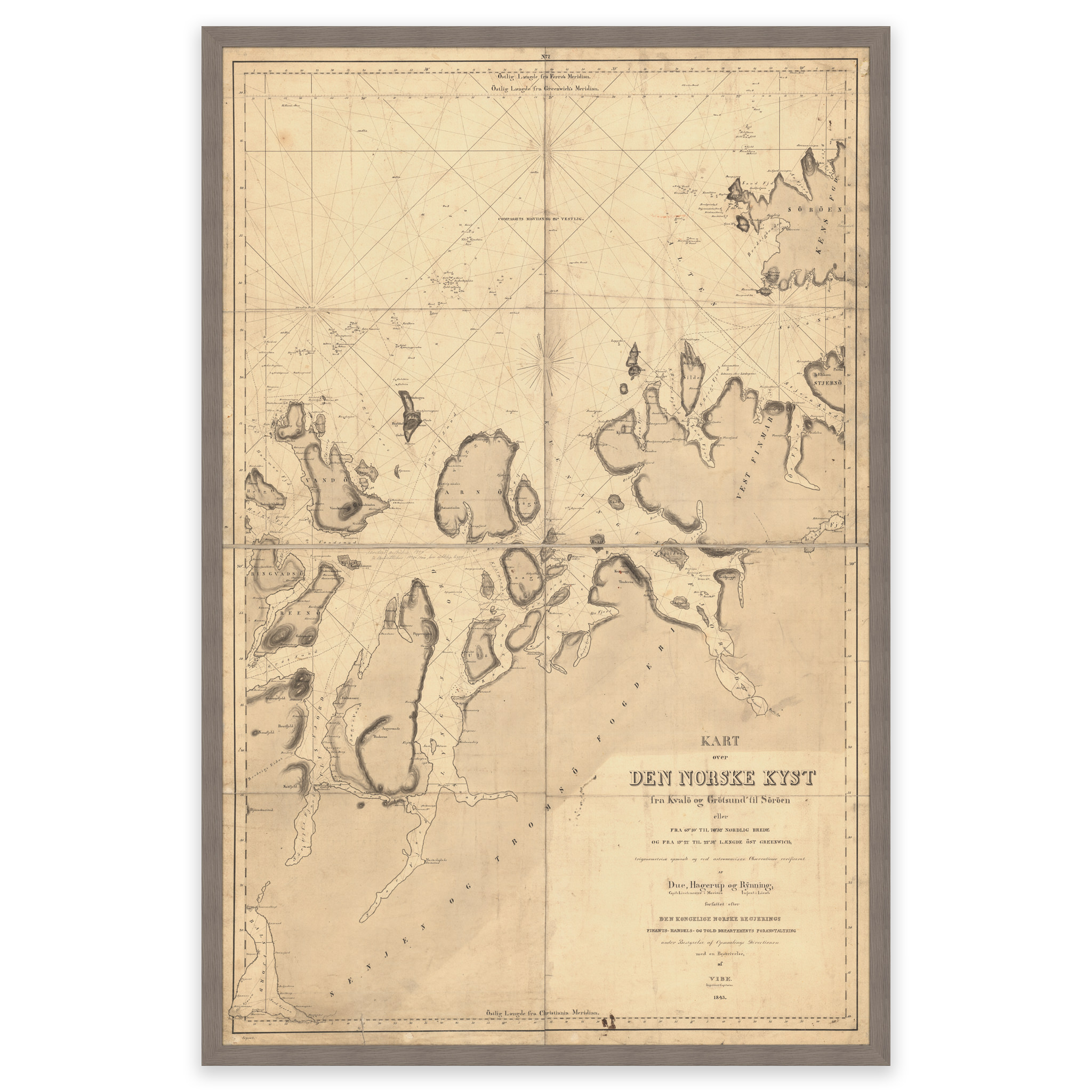
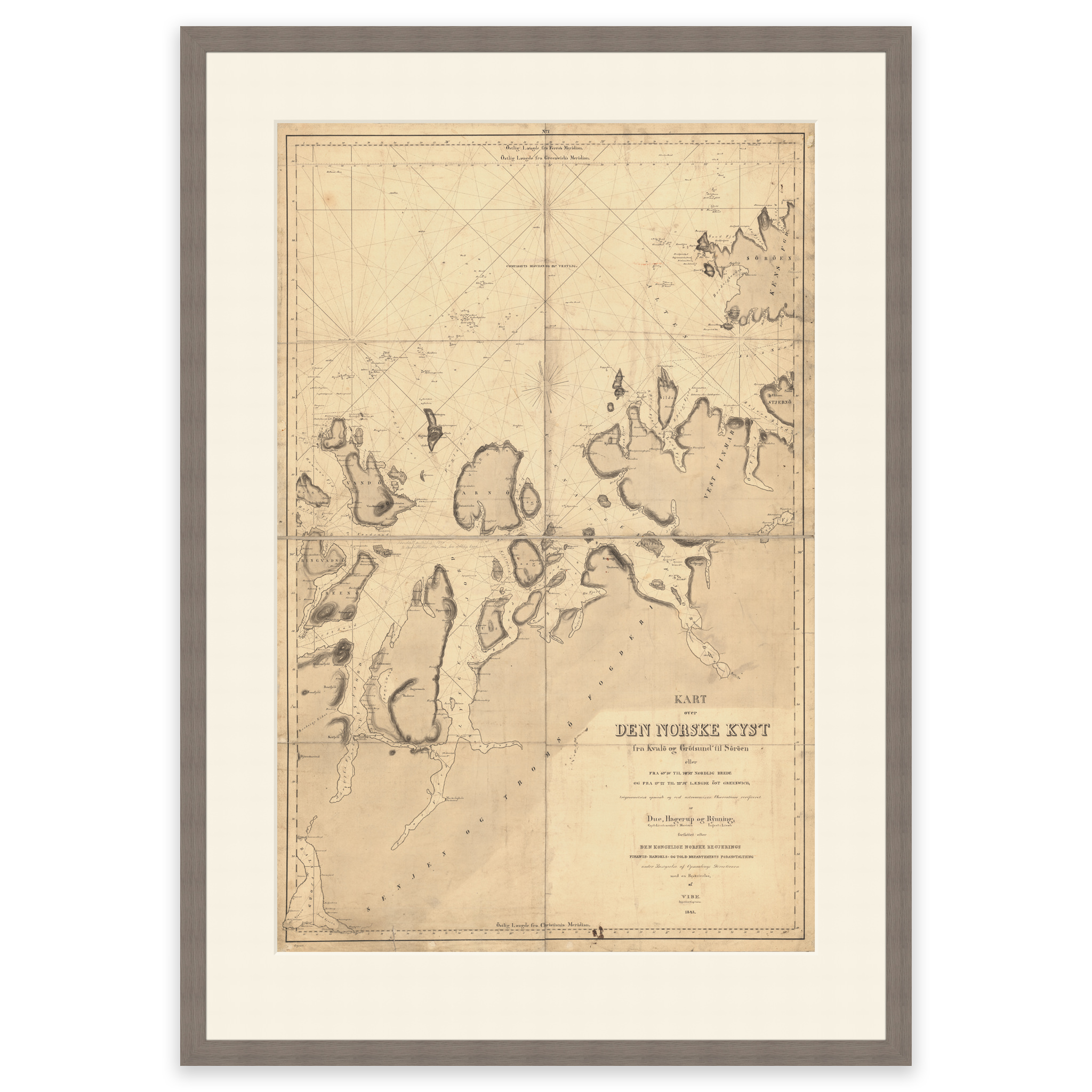
This nautical chart from 1843 is hand-drawn and covers the area Kvaløya near Tromsø to Sørøya. The map comes in its original size of 69.6 x 88 cm. The size with frame and passepartout is 89.6 x 110 cm. Do you want the map in a different size? Just get in touch – we’ll be happy to give you a quote for customization.