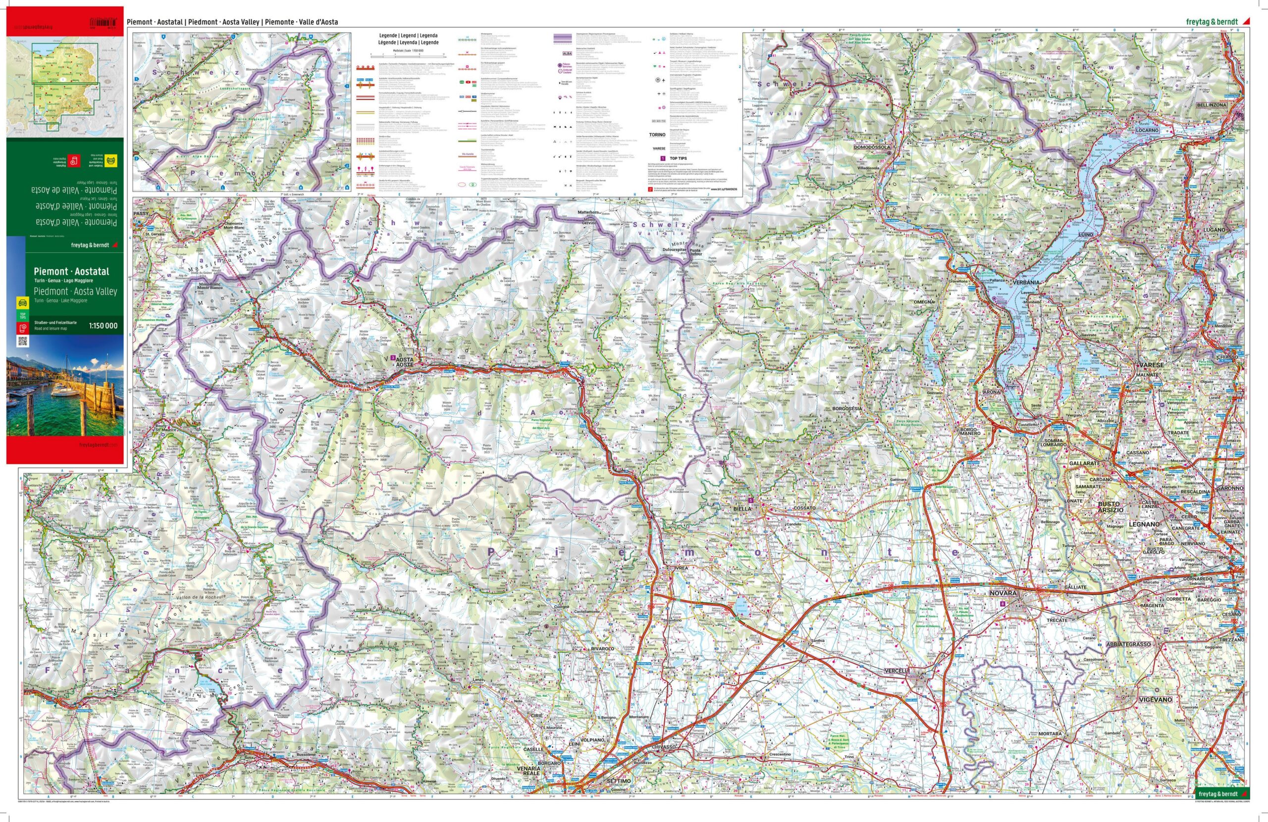
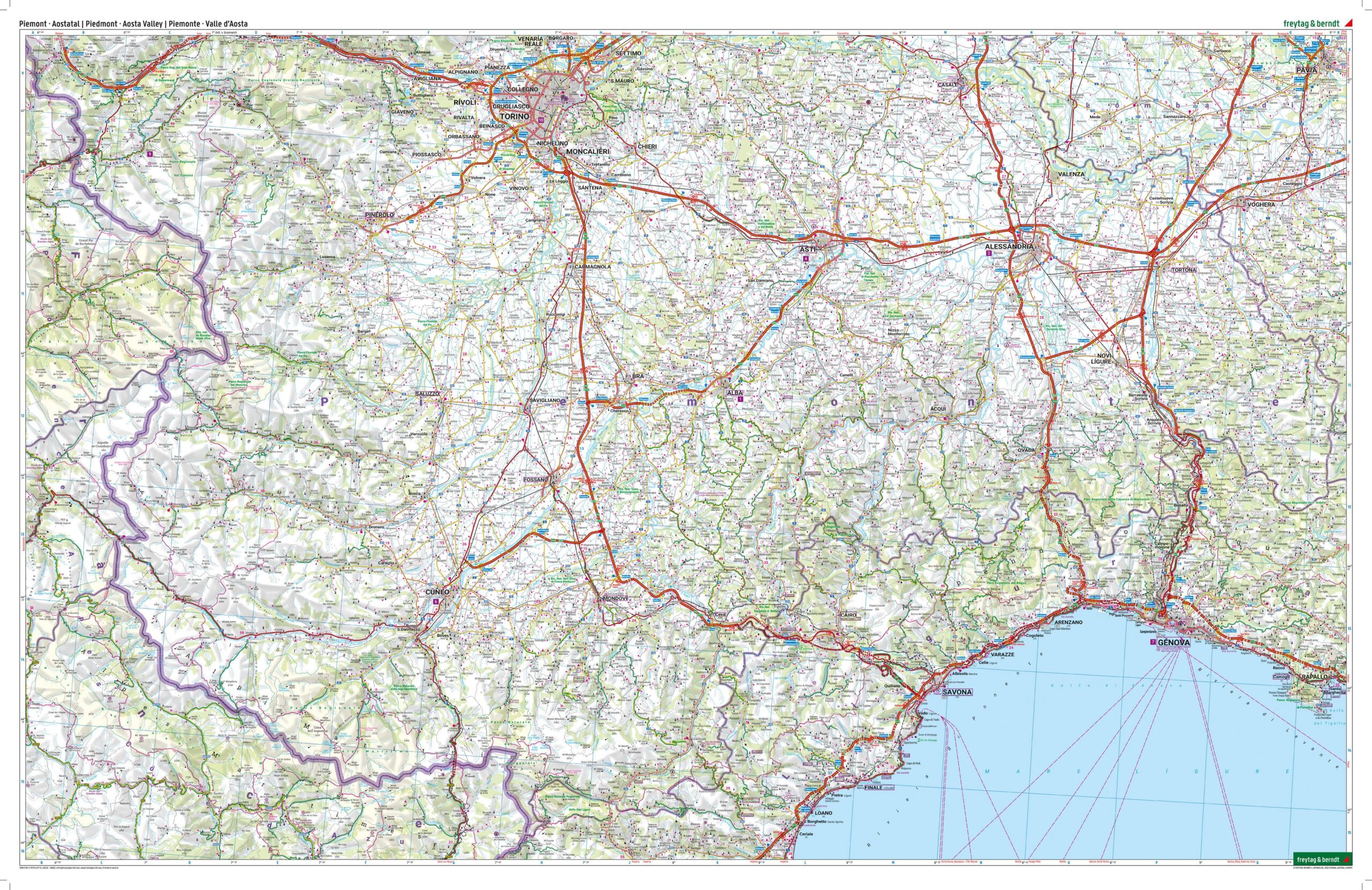
Description
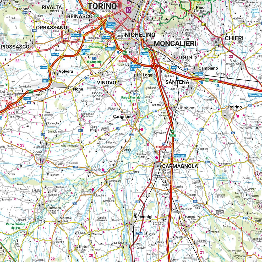
Covering Piedmont and the Valle d’Aosta in northwest Italy, this road map provides a detailed overview of the region’s road network, valleys and mountain areas in the western Alps. The map is well suited for both planning and executing trips, and provides a solid basis for exploring the area by car.
The map shows a fine-meshed network of main roads and smaller connections, making it possible to plan both efficient routes and more scenic drives through alpine landscapes and valleys. Information about road conditions, tourist destinations and sights is integrated into the map, providing good support for planning a varied journey. Campsites are also highlighted, making the map convenient for travelers looking for flexible accommodation options.
The map includes city maps of Turin and Aosta, as well as an accompanying information booklet with selected recommendations for the region. The clear cartography provides a good balance between detail and overview, making the map suitable for both planning and use along the way.
Release year: 2024.