Svalbard maps from the Norwegian Polar Institute – research-based maps with high precision
The Norwegian Polar Institute has published topographic maps of Svalbard since the 1930s and is a leading producer of detailed and research-based maps for Arctic regions. The maps are developed for fieldwork, expeditions, and hiking – and are known for their accuracy and informative content.
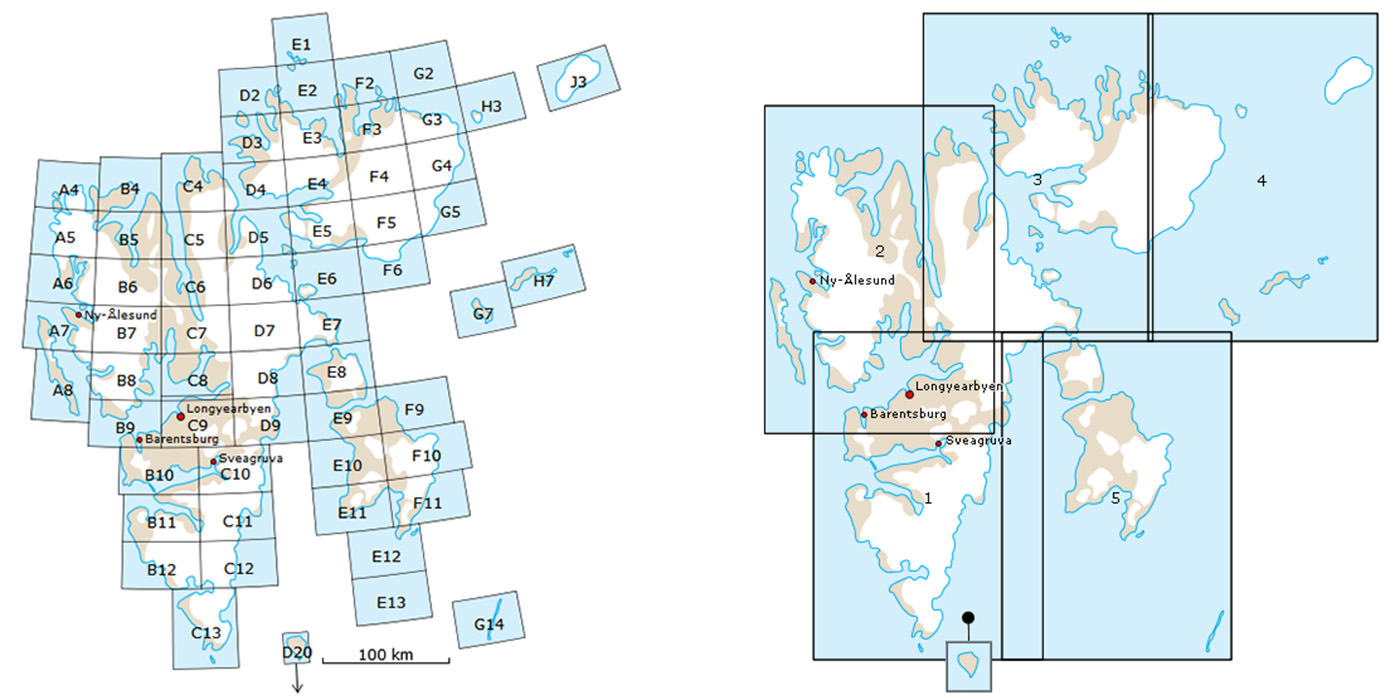
The series covers large parts of Spitsbergen and surrounding areas, with both hiking maps at a scale of 1:100,000 and overview maps at 1:250,000. The maps show glaciers, mountains, contour lines, rivers, and other important terrain information – and provide a good overview of Svalbard’s challenging landscape.
We are authorized dealers of the Polar Institute’s printed maps. The maps are delivered in standard print and are suitable both for field use and as decorative wall maps.
No results found
You can try clearing any filters or head to our store’s home