

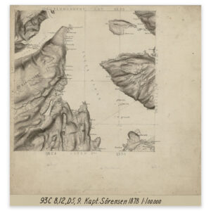
 Alta 1878
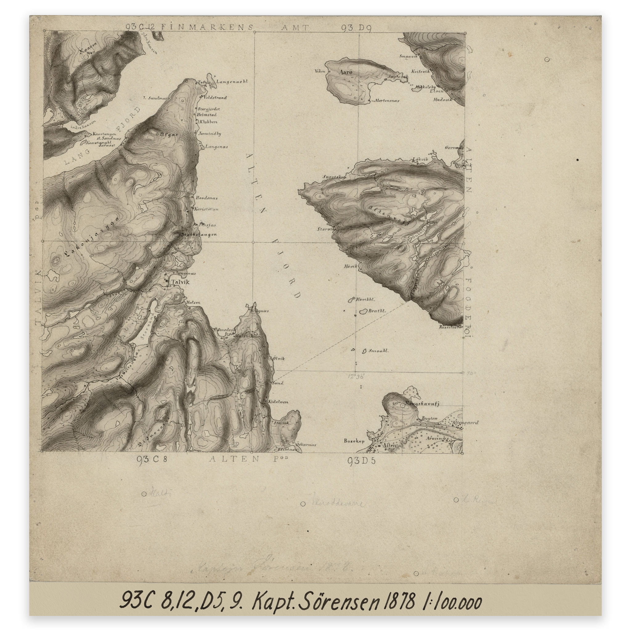
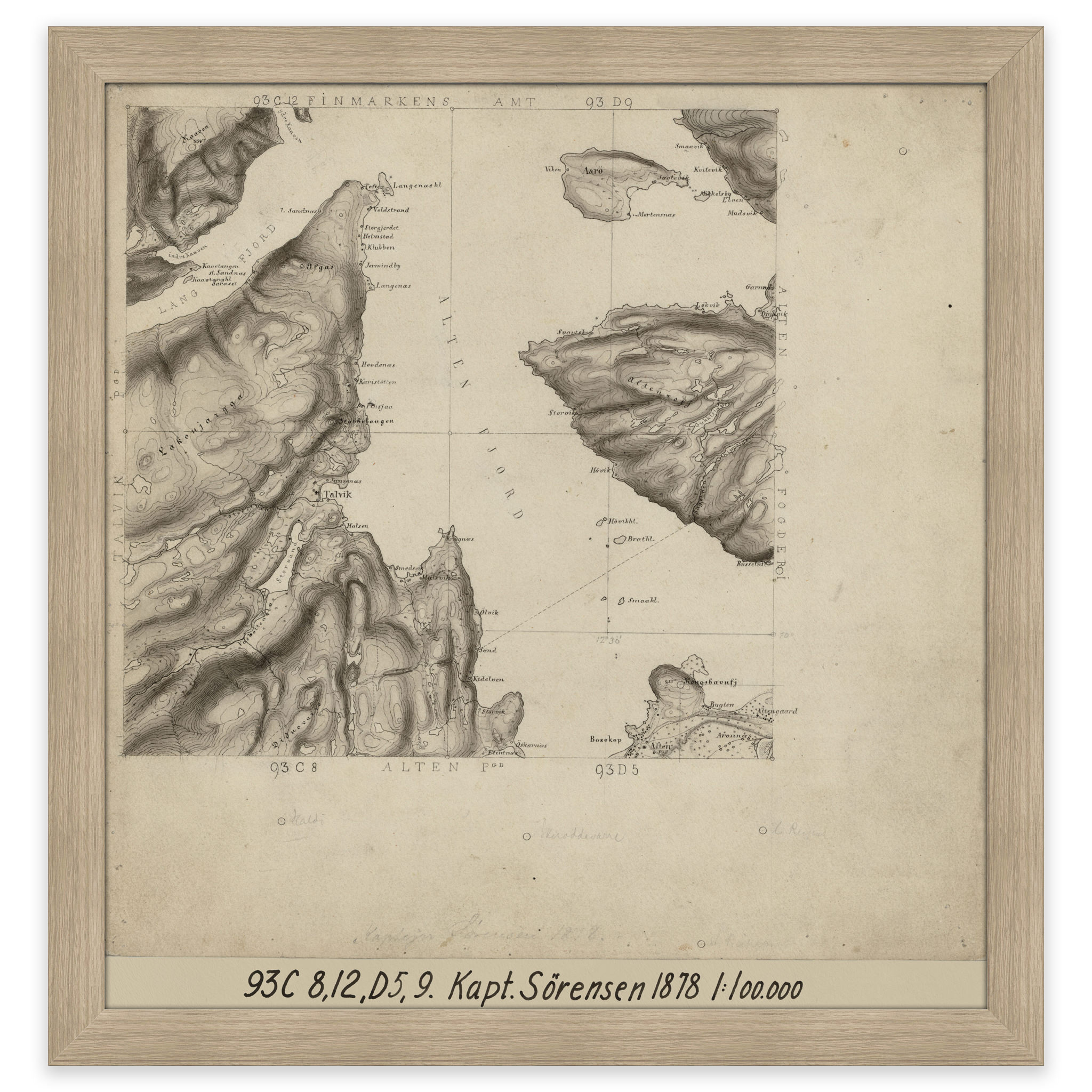
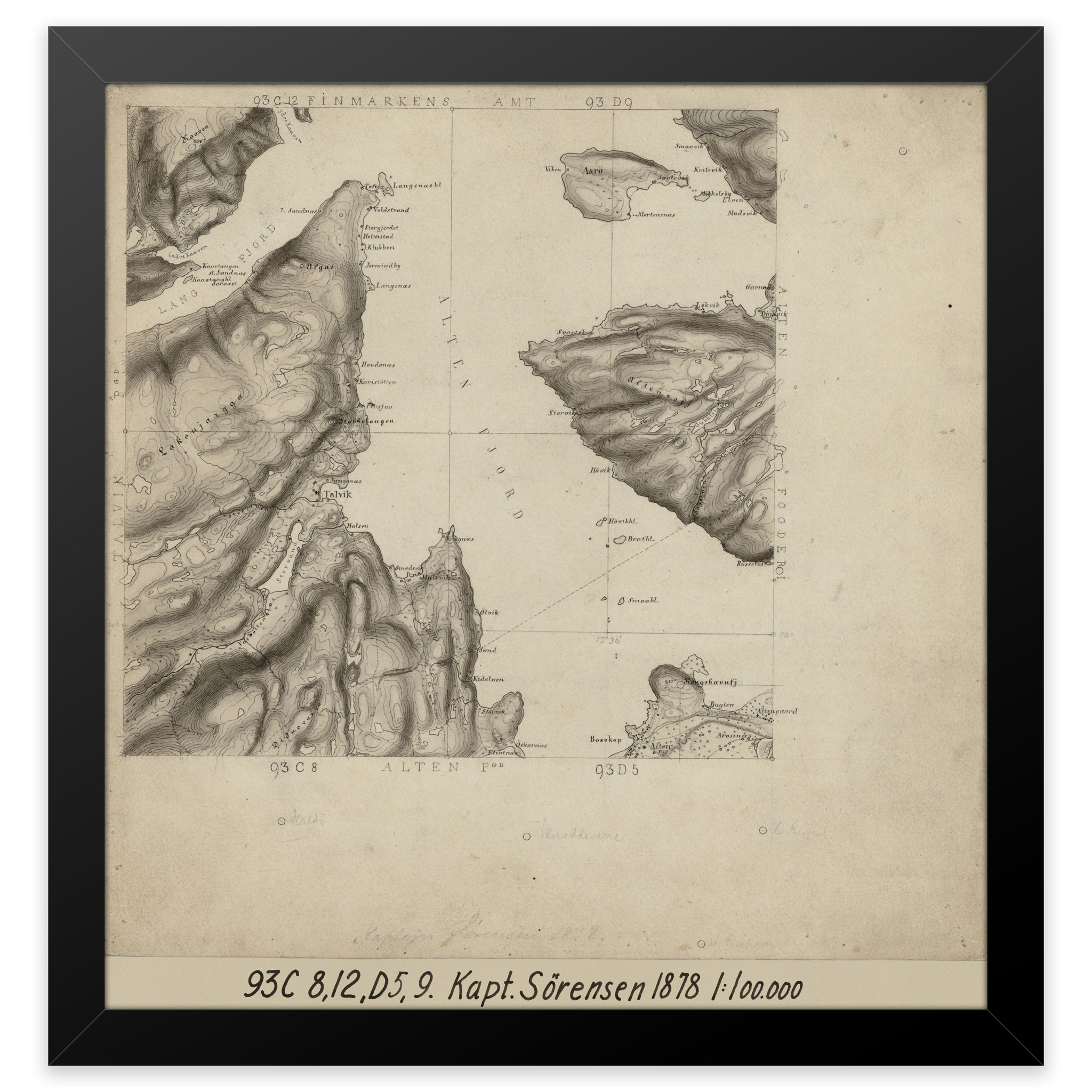
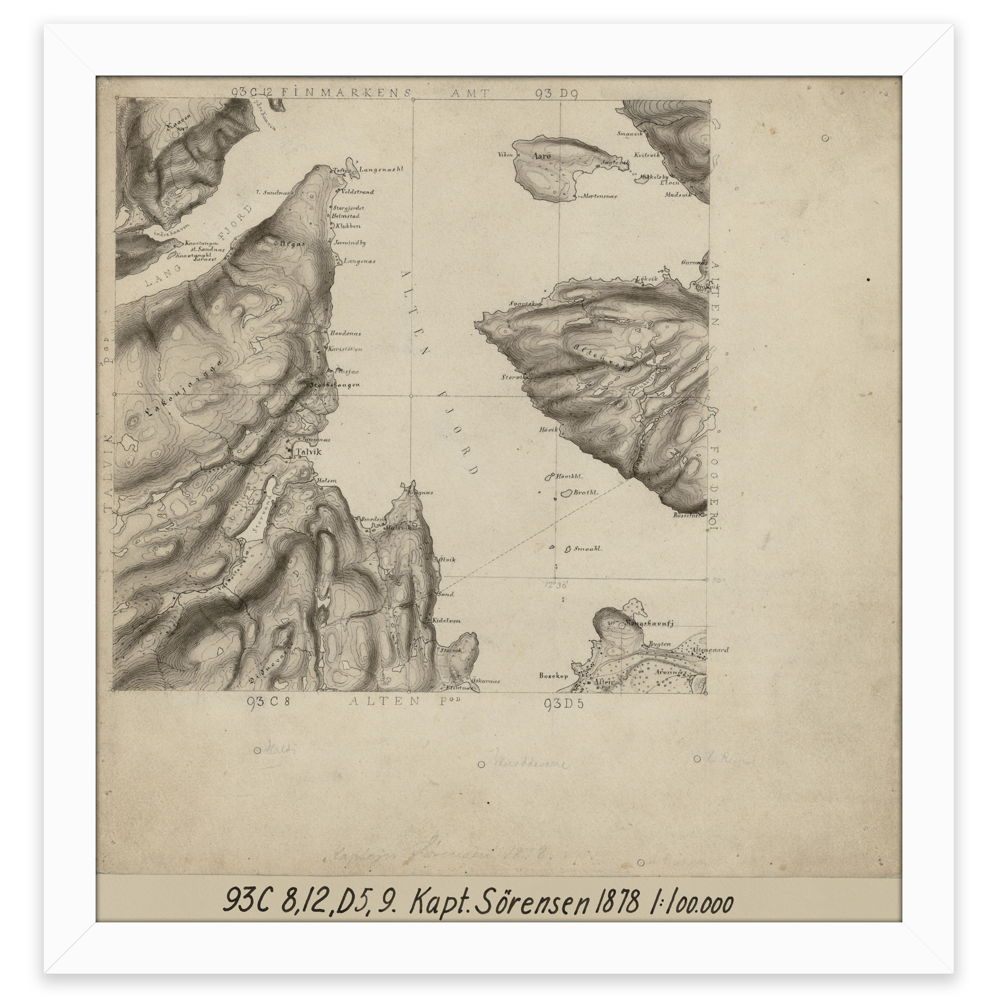
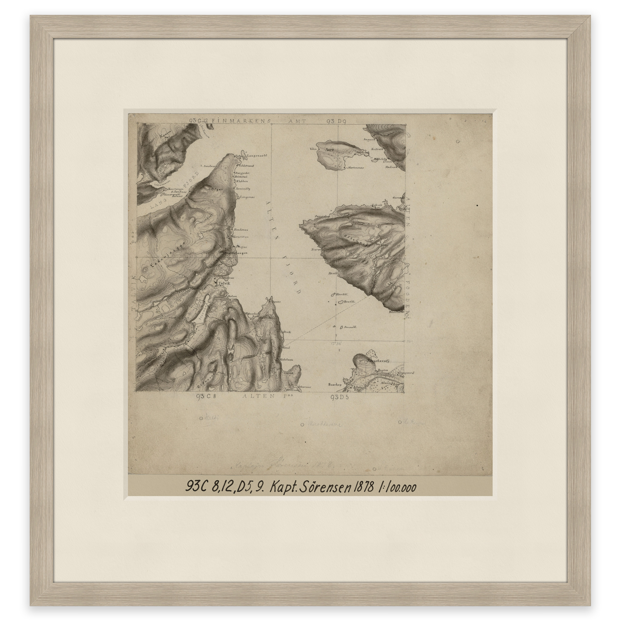
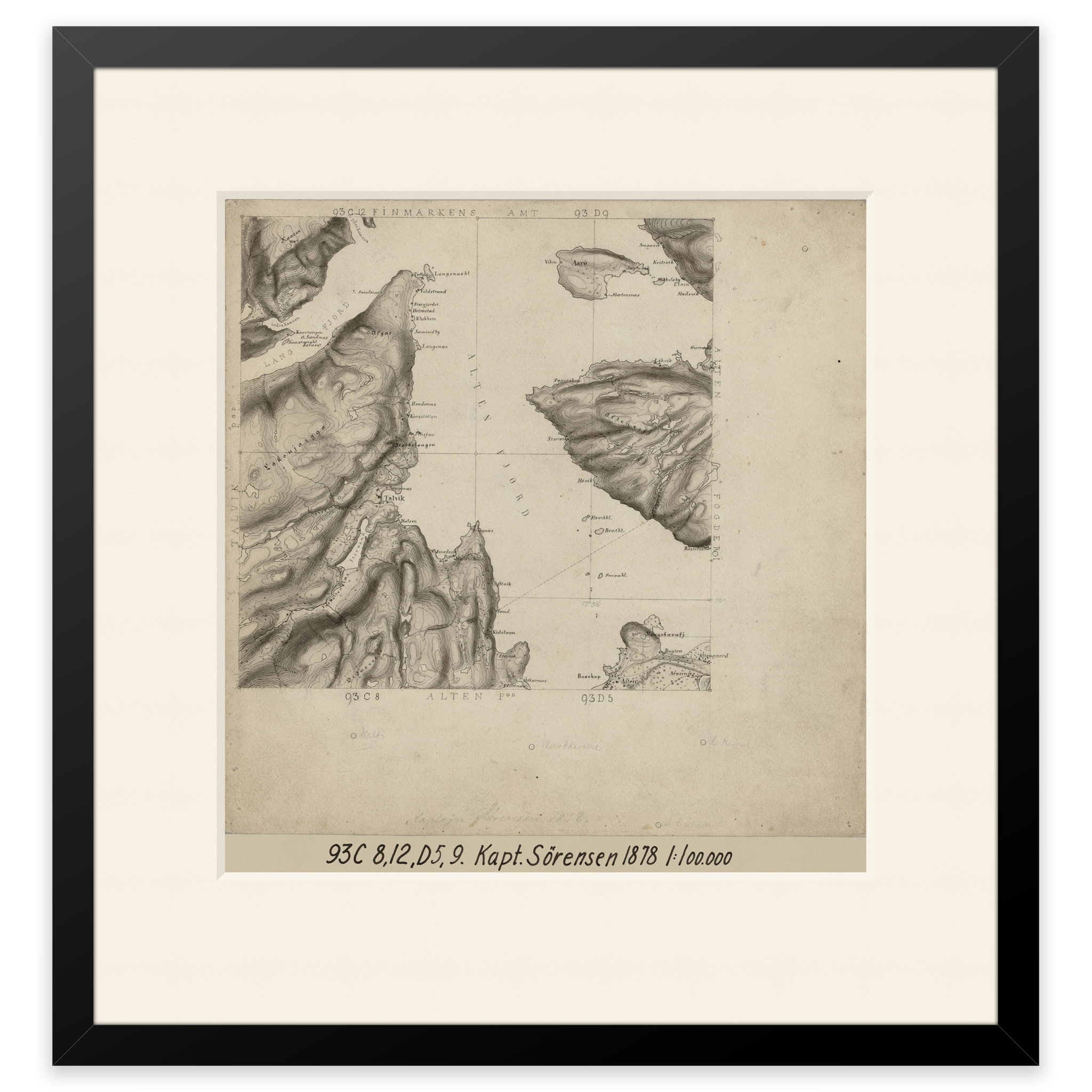
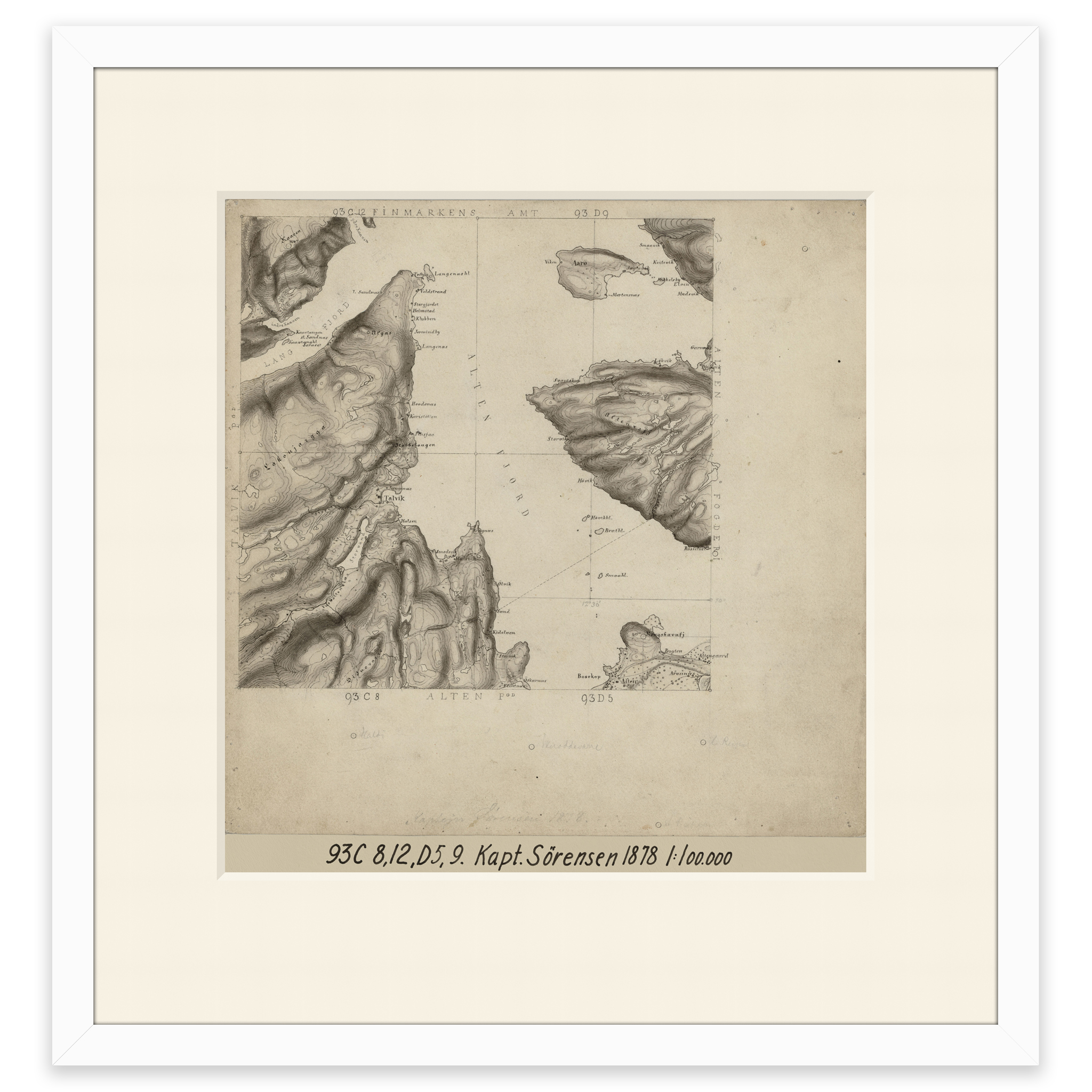
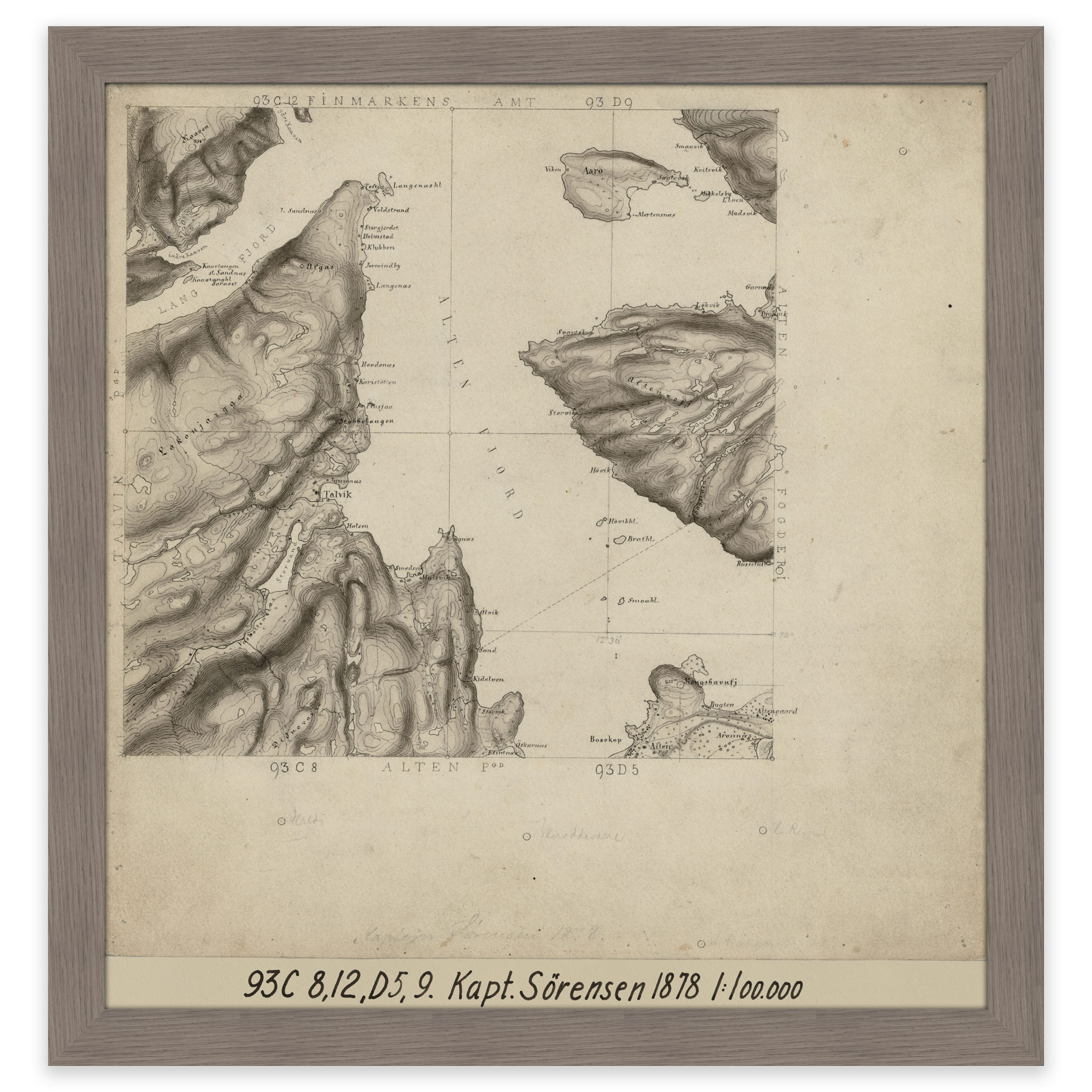
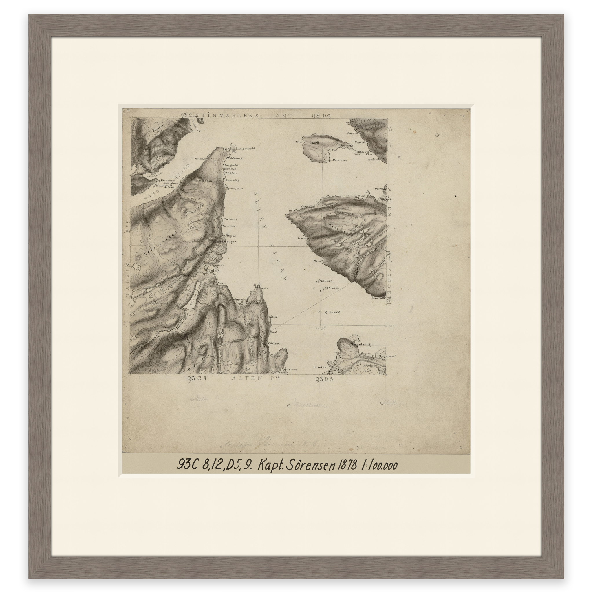
Alta 1878
Map from 1878 of Alta and the Altafjord up to and including Årøya. The map is delivered in its original size of 31.1 x 32.7 cm. The size with frame and passe-partout is 47.1 x 49.7 cm. Would you like the map in a different size? Just get in touch – we’ll be happy to give you a quote for customization.