


 Bergen 1873


Bergen 1873
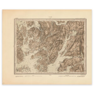
Map of an area around Bergen. Korsfjorden, Bergen and Ådlandsfjorden. The map is from 1873 and was made by E. Heiberg, Einar Sigurd Ween and H. Bergh. The map comes in its original size of 59.8 x 50 cm. The size with frame and passepartout is 77.8 x 69 cm. Would you like the map in a different size? Just get in touch – we’ll be happy to give you a quote for customization.