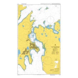
Description
British Admiralty Chart 3271 covers Lerwick Harbour and associated approaches in Shetland. The chart is an official British nautical chart and shows port areas, leads, depths, beacons and navigational details necessary for safe entry, exit and local navigation in the area.
Lerwick is the main port in Shetland and an important port of call for leisure boats, fishing vessels and commercial traffic. The map is suitable for both planning calls and navigating the port area and nearby waters.
British Admiralty charts are renowned for their high cartographic quality and are used internationally by both professional and private navigators.