Description
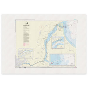
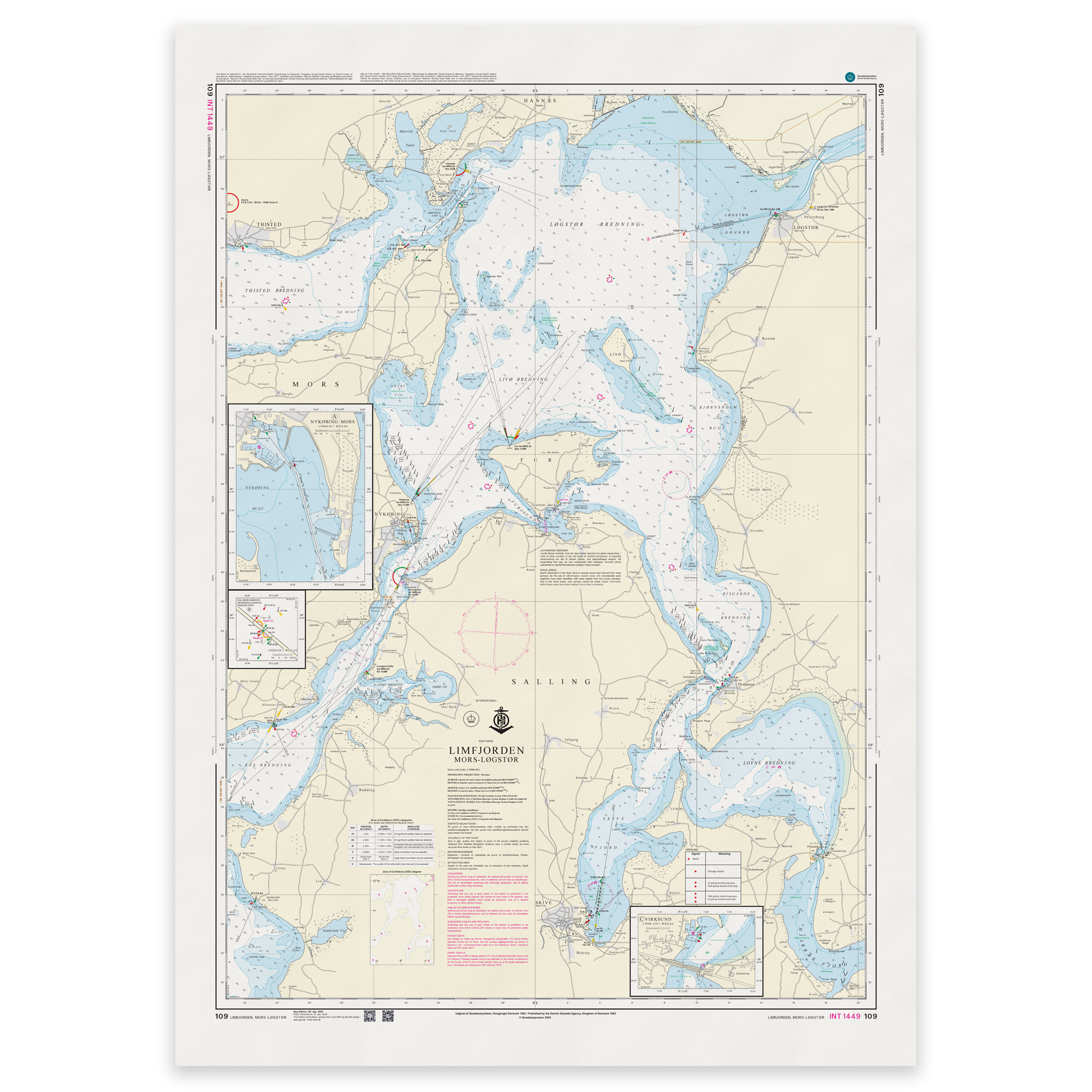
Denmark Chart 109 – Limfjorden, Mors-Løgstør (INT 1449) is an official Danish nautical chart published by Geodatastyrelsen at a scale of 1:65 000.
The map covers the central part of the Limfjord between Mors and Løgstør. The area includes important leads, shoals, banks, depth contours, beacons and other navigation installations that are crucial for safe navigation in the fjord.
This is a navigational chart, developed for navigation in fjord and coastal waters where a good level of detail is required. The scale of 1:65,000 provides a balanced representation of both general waters and local navigation conditions, and is well suited for both planning and practical sailing through the Limfjord.
The chart is also published as INT 1449 and is part of the International Chart Series coordinated by IHO (International Hydrographic Organization). The INT number means that the chart follows international standards and is harmonized for use in international shipping.
The map is delivered as Print-on-Demand (POD) under license from Geodatastyrelsen. It is printed when ordered and updated to the latest available Notices to Mariners at the time of production.
You’ll receive a fresh and updated reprint based on current official map data.
The chart is produced on durable, matte 125 g paper approved for official nautical charts.
Corrections are published continuously and new updates may occur after printing. Print-on-Demand ensures that you get the most up-to-date paper edition available when ordering.