Description
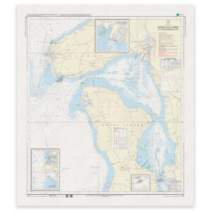
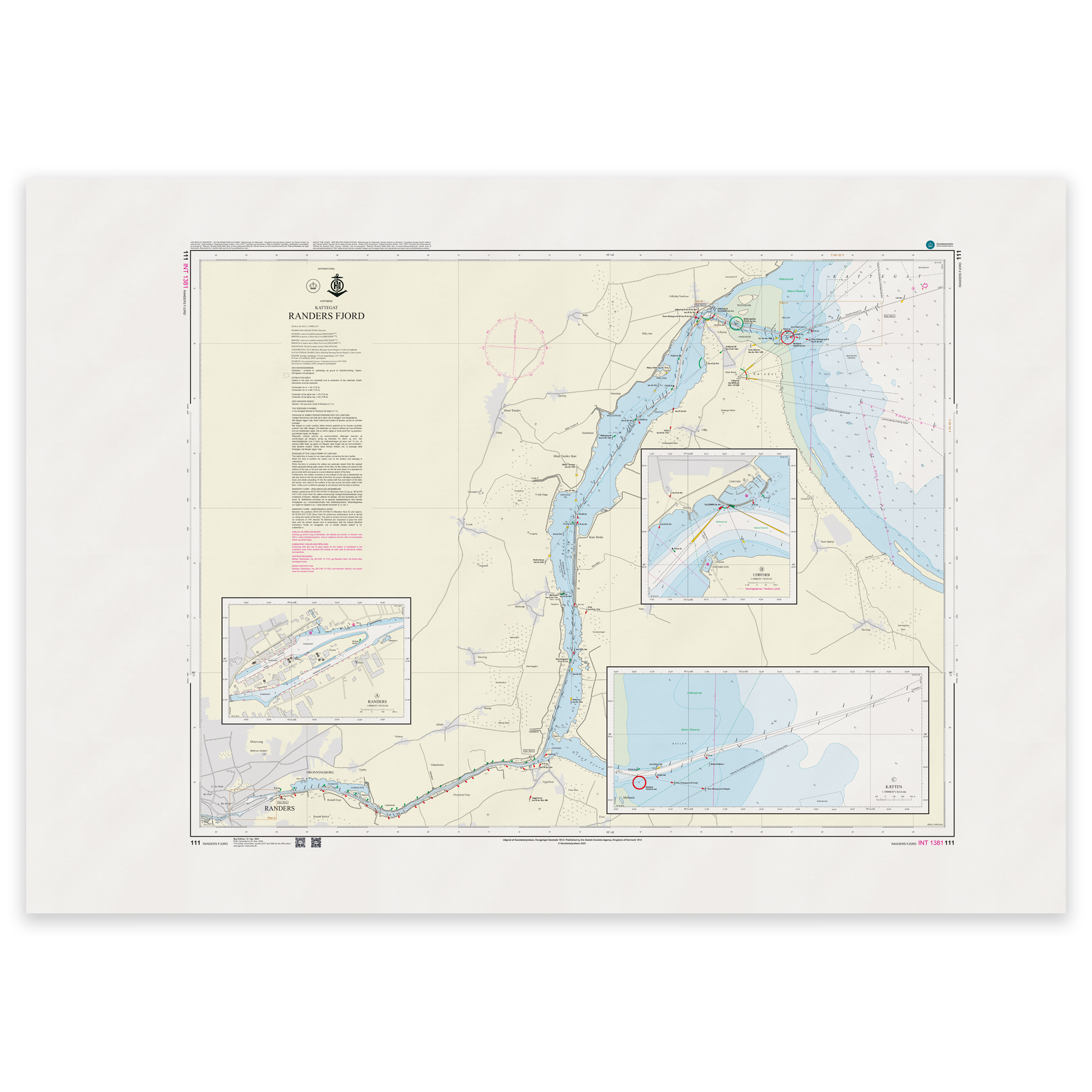
Denmark Chart 111 – Kattegat, Randers Fjord (INT 1381) is an official Danish nautical chart published by Geodatastyrelsen at a scale of 1:30 000.
The map covers the approach from the Kattegat and further through Randers Fjord towards Randers harbor area. It provides a detailed presentation of the leads, shoals, depth contours, beacons, bridges and other navigational installations that are essential for safe navigation in the fjord.
This is a navigational chart, developed for precise navigation in coastal and fjord waters. The detailed scale (1:30 000) makes the map particularly suitable for:
Approach from open water
Navigation in narrower fjord channels
Port calls
Planning a local voyage
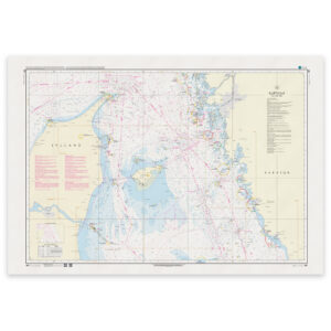
The chart is also published as INT 1381 and is part of the International Chart Series coordinated by IHO (International Hydrographic Organization). The INT number means that the chart follows international standards and is harmonized for use in international shipping.
The map is delivered as Print-on-Demand (POD) under license from Geodatastyrelsen. It is printed when ordered and updated to the latest available Notices to Mariners at the time of production.
You’ll receive a fresh and updated reprint based on current official map data.
The chart is produced on durable, matte 125 g paper approved for official nautical charts.
Corrections are published continuously and new updates may occur after printing. Print-on-Demand ensures that you get the most up-to-date paper edition available when ordering.