Description
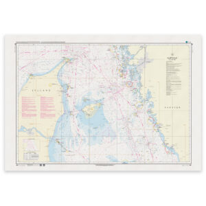
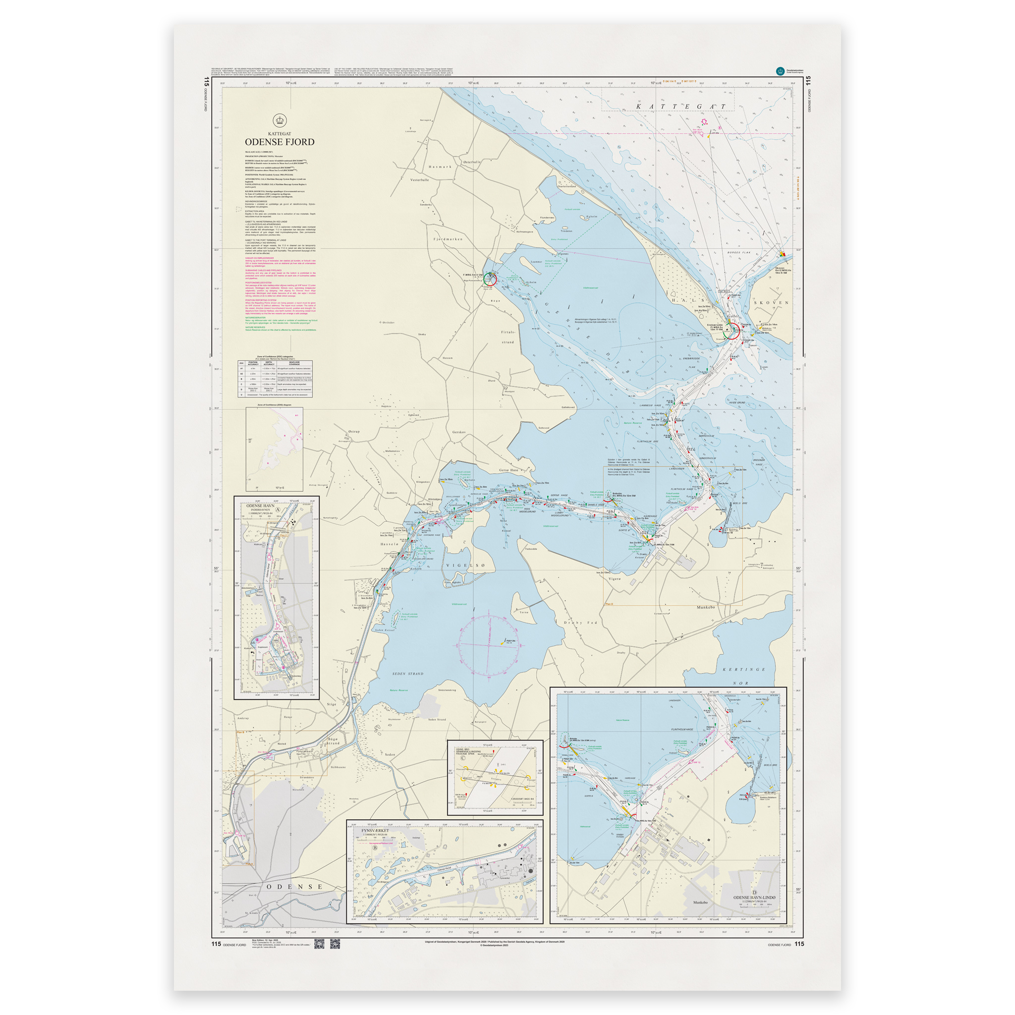
Denmark Chart 115 – Kattegat, Odense Fjord is an official Danish nautical chart published by Geodatastyrelsen at a scale of 1:20 000.
The map covers the approach from the Kattegat into Odense Fjord, including leads, shoals, depth contours, beacons, harbor areas and anchorages. The high level of detail makes the map particularly suitable for navigation in narrow and demanding fjord waters.
This is a special large-scale map, developed for precise maneuvering and safe travel in areas where an accurate map base is essential. The map is particularly suitable for:
Entrance to Odense Fjord
Navigation in tight spaces
Port calls and mooring
Anchorage planning
The detailed presentation provides good control of local navigation conditions and is suitable for both leisure boats and professional traffic.
The map is delivered as Print-on-Demand (POD) under license from Geodatastyrelsen. It is printed when ordered and updated to the latest available Notices to Mariners at the time of production.
You’ll receive a fresh and updated reprint based on current official map data.
The chart is produced on durable, matte 125 g paper approved for official nautical charts.
Corrections are published continuously and new updates may occur after printing. Print-on-Demand ensures that you get the most up-to-date paper edition available when ordering.