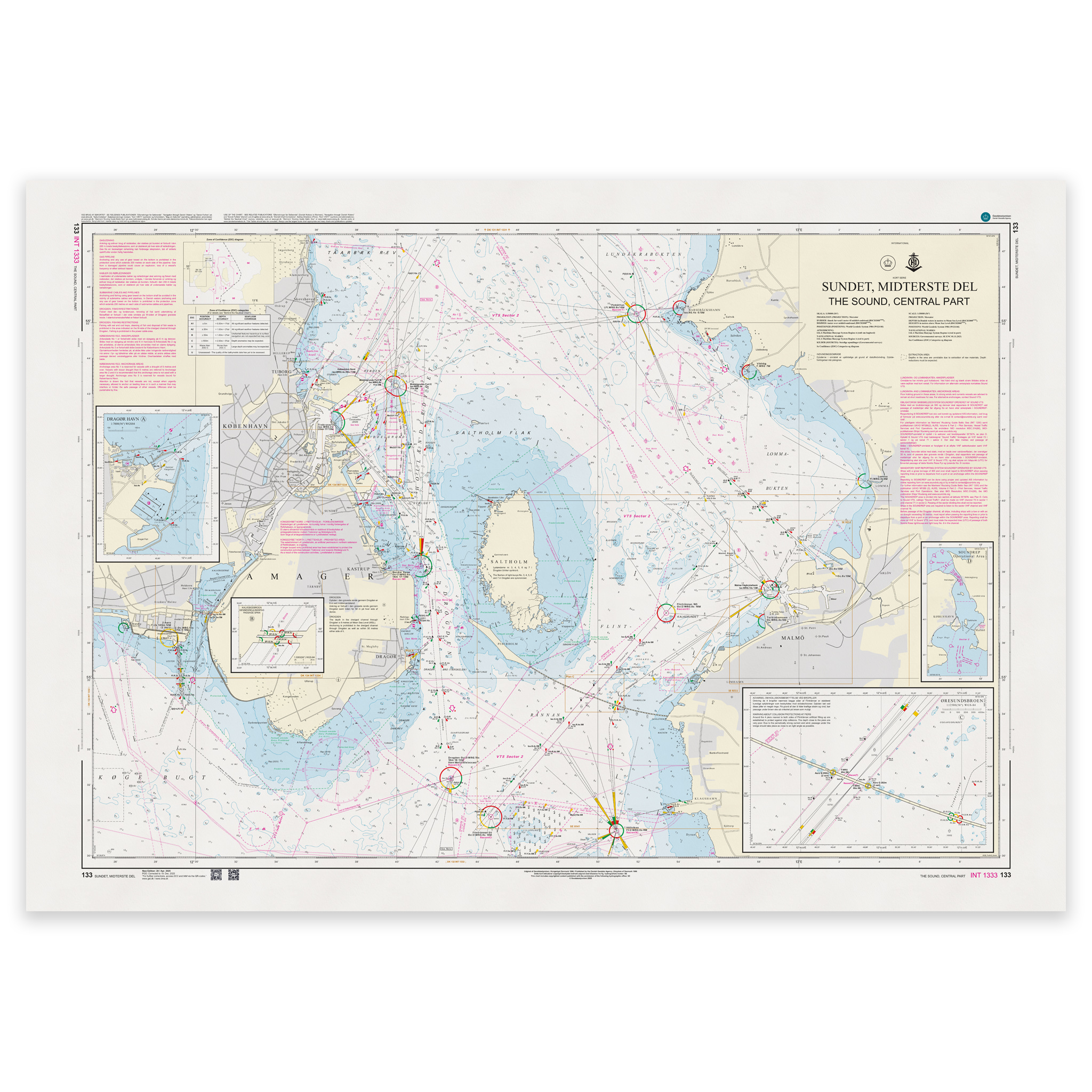
Description
Denmark Chart 133 – Sundet, midterste del (INT 1333) is an official Danish nautical chart published by Geodatastyrelsen at a scale of 1:50 000.
The map covers the central part of the Øresund (Sound), the waterway between Denmark and Sweden that constitutes one of the Nordic region’s most important and busiest sea routes. The area includes key passages, routes, traffic separation zones, lighthouses, beacons and detailed depth information.
This is a navigation map with a higher level of detail than the general navigation maps. The scale of 1:50,000 provides a very good balance between overview and precision, and is particularly suitable for:
Operational navigation in the Sound
Sailing in busy main roads
Planning of calls to nearby ports
Navigation in areas with heavy ship traffic
The chart is also published as INT 1333 and is part of the International Chart Series coordinated by IHO. The INT number means that the chart follows international standards and is harmonized for use in international shipping.
The map is delivered as Print-on-Demand (POD) under license from Geodatastyrelsen. It is printed when ordered and updated to the latest available Notices to Mariners at the time of production.
You’ll receive a fresh and updated reprint based on current official map data.
The chart is produced on durable, matte 125 g paper approved for official nautical charts.
Corrections are published continuously and new updates may occur after printing. Print-on-Demand ensures that you get the most up-to-date paper edition available when ordering.