Description
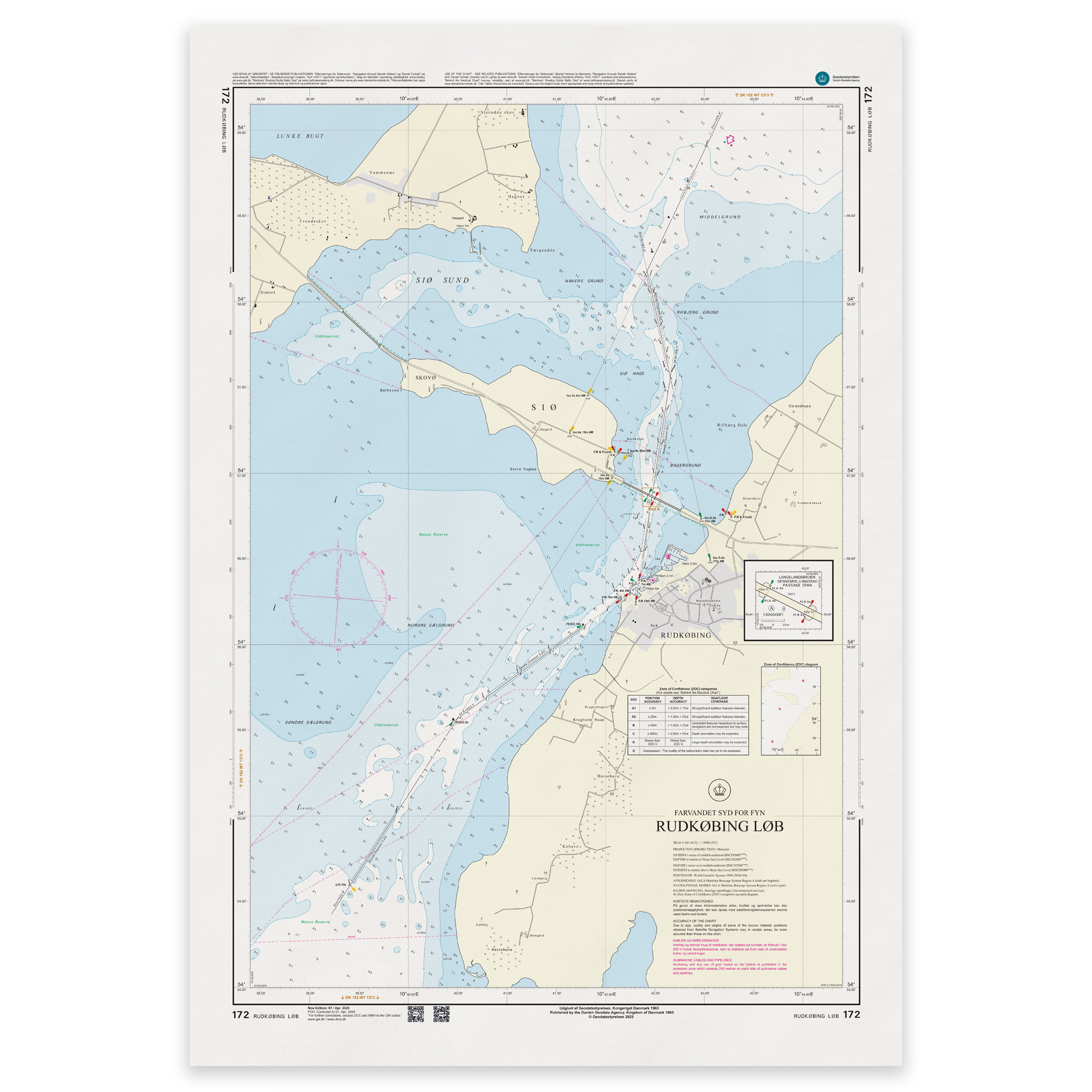
Denmark Chart 172 – Rudkøbing Løb is an official Danish nautical chart published by Geodatastyrelsen at a scale of 1:15 000.
The map covers Rudkøbing Løb, the narrow and demanding waters between Langeland and Strynø. The area is characterized by shallow sections, marked leads and dense recreational boat traffic, and requires accurate navigation.
This is a special large-scale map, developed for detailed navigation in narrow channels and harbor areas. The 1:15,000 scale provides high precision and makes the map particularly suitable for:
Sail through Rudkøbing Løb
Navigation in narrow and shallow areas
Port calls in Rudkøbing
Maneuvering in island waters
The map shows detailed depth conditions, beacons, lighthouses, cables and other navigation installations that are essential for safe navigation.
Due to its high level of detail, this chart is particularly suitable for operational use when calling at ports and navigating in complex waters.
The map is delivered as Print-on-Demand (POD) under license from Geodatastyrelsen. It is printed when ordered and updated to the latest available Notices to Mariners at the time of production.
You’ll receive a fresh and updated reprint based on current official map data.
The chart is produced on durable, matte 125 g paper approved for official nautical charts.
Corrections are published continuously and new updates may occur after printing. Print-on-Demand ensures that you get the most up-to-date paper edition available when ordering.