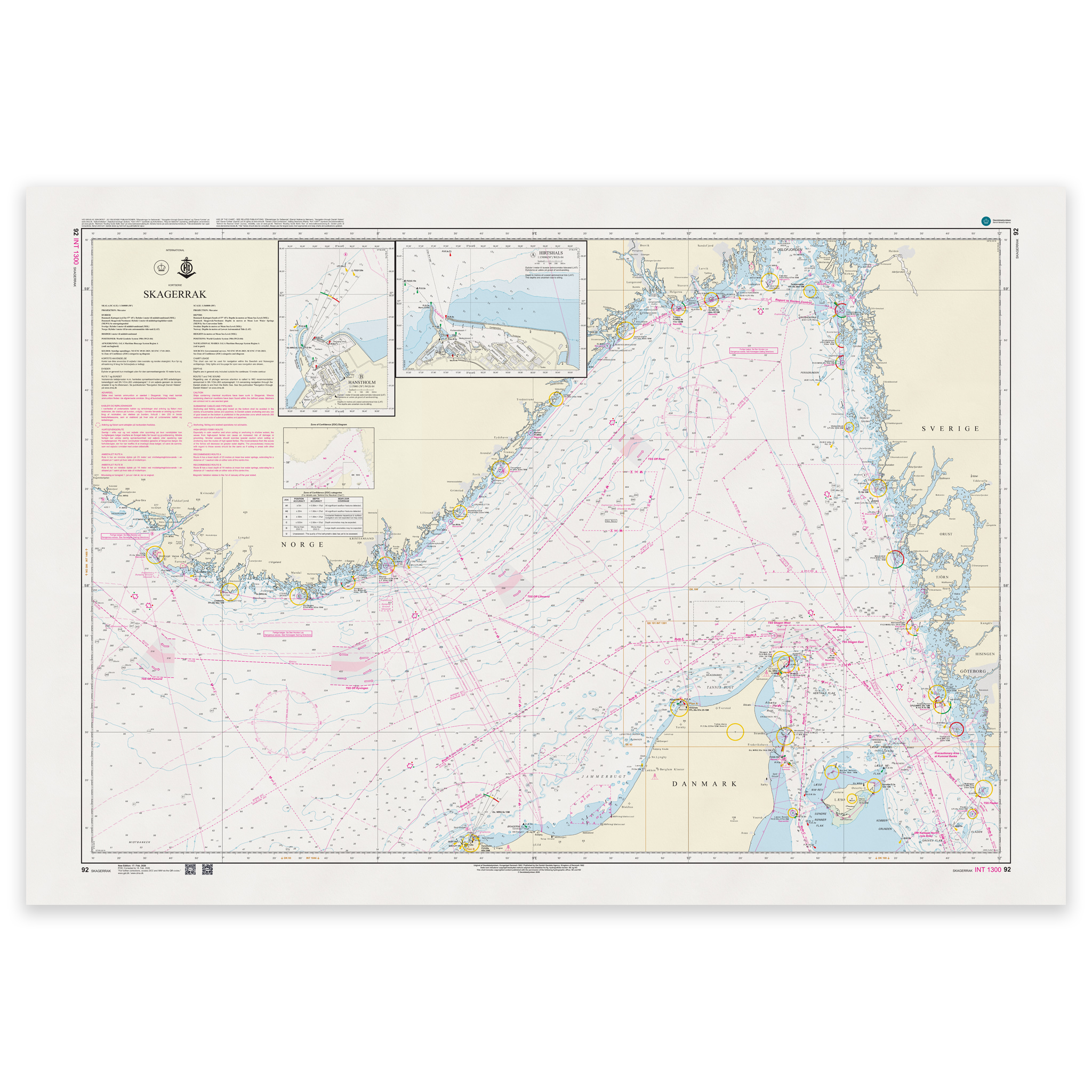
Description
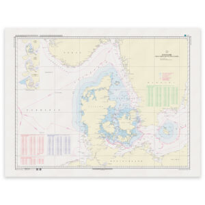
Denmark Chart 92 – Skagerrak (INT 1300) is an official international nautical chart published by Geodatastyrelsen at a scale of 1:360 000.
The map covers the Skagerrak – the sea area between Denmark, Norway and Sweden – and shows the main waters between the North Sea and the Kattegat. This is a key transit area for international shipping and leisure boats in Northern Europe.
As an INT chart (INT 1300) it is part of the international chart series coordinated by the International Hydrographic Organization (IHO). The chart follows international standards and can be used by seafarers across national borders.
The scale of 1:360,000 makes this an overview and planning map, suitable for:
Route planning over longer distances
Overview of main routes and traffic patterns
Sailing between Denmark, southern Norway and western Sweden
Transition between the North Sea and Kattegat
The map shows main depths, lighthouses, navigation installations, traffic separation zones and key sea traffic routes in Skagerrak.
For detailed coastal navigation, larger scale maps are recommended.
The map is delivered as Print-on-Demand (POD) under license from Geodatastyrelsen. It is printed when ordered and updated to the latest available Notices to Mariners at the time of production.
You’ll receive a fresh and updated reprint based on current official map data.
The chart is produced on durable, matte 125 g paper approved for official nautical charts.
Corrections are published continuously and new updates may occur after printing. Print-on-Demand ensures that you get the most up-to-date paper edition available when ordering.