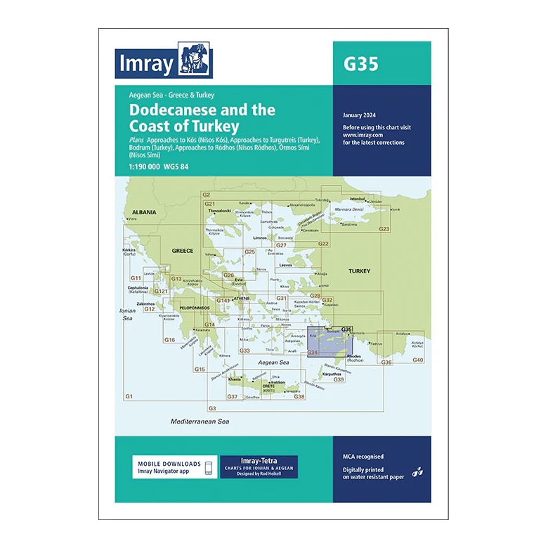
Description
This overview map from Imray covers the Dodecanese and the adjacent Turkish coast in the eastern Aegean. The map provides a comprehensive regional overview of one of the Mediterranean’s most popular sailing areas, with short distances between Greek islands and Turkish ports.
The map includes plan views and approaches to Kos, Bodrum, Turgutreis, Ródhos, Sími, among others, as well as key sailing routes between the islands and the mainland. Designed for passage and route planning, it is particularly useful for sailors who combine sailing in Greece and Turkey within the same trip.
Printed on water-resistant paper and manufactured to MCA approved standards, with support for digital updates via the Imray Navigator app.