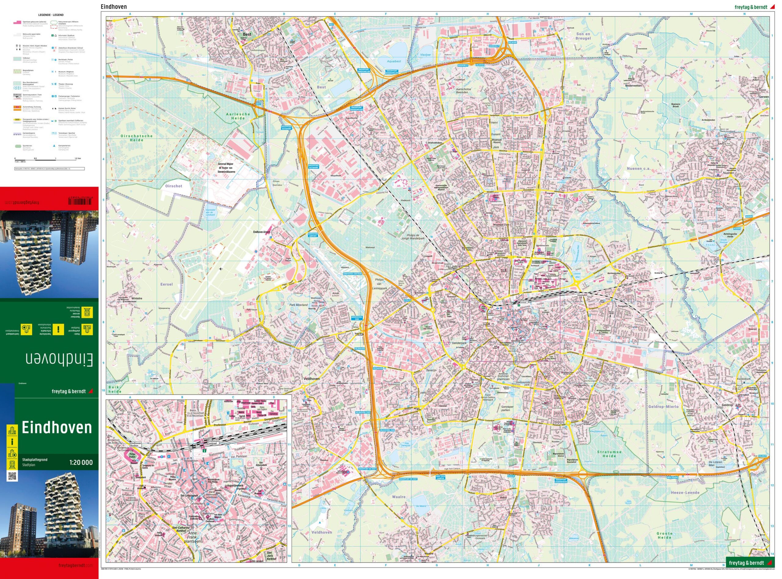
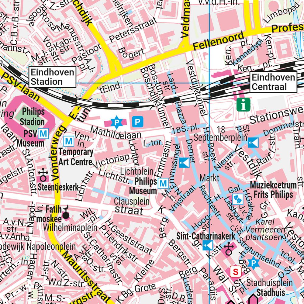

Description
This city map covers Eindhoven and provides a clear and detailed representation of the city’s streets, districts and central areas. The map is well suited for city walking, short stays and planning transportation and visits in the city. The city center is depicted at an extra detailed scale, making it easy to navigate on foot and find sights, public transport hubs and important addresses. The cartography is clear and easy to read, with symbols that provide a quick overview of public services and city functions. On the back is a street and address index that makes it easy to look up specific addresses. Release year: 2025.