Description
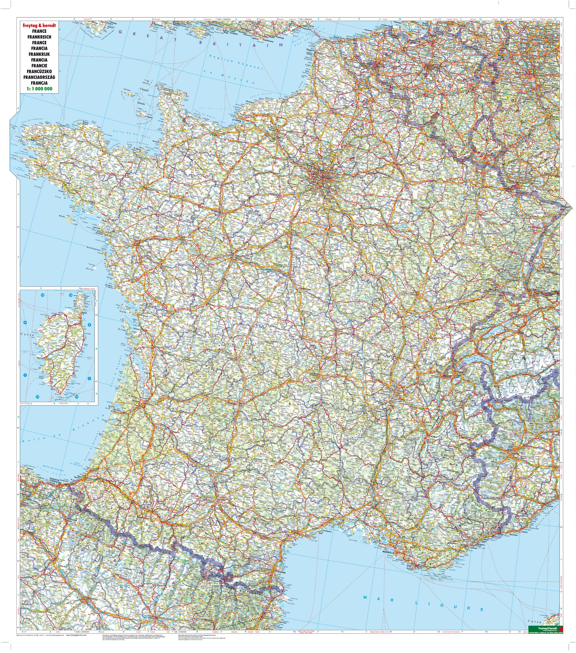
This is a detailed and easy-to-read road map of France, designed for travelers who want a good overview of the entire country in one comprehensive map. The map covers the whole of France at a scale of 1:1,000,000 and shows main roads, highways, cities, rivers, lakes and mountain areas in a clear and concise cartography.
The map contains a comprehensive place index with postcodes, making it easy to find both larger cities and smaller towns. In addition, distances in kilometers between central cities and tourist destinations are indicated, which provides a good basis for efficient route planning. This makes the map particularly useful for car drivers, motorcyclists and campers who want flexibility when traveling.
The clear map presentation provides a quick overview while retaining important details. The map works well both as a planning tool at home and as a navigation aid on the road, and is a reliable choice for anyone traveling through France with their own car.
The map is in German, but can easily be used by travelers with no knowledge of German. Road maps are mainly based on symbols, road numbers and place names and provide quick and intuitive orientation regardless of language.
Published in 2019 by freytag & berndt, the map is delivered as a foldable road map in a practical format.