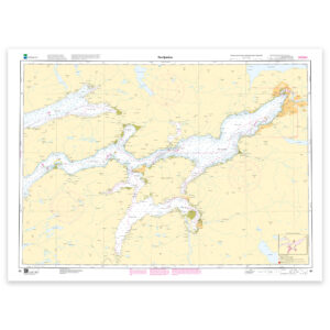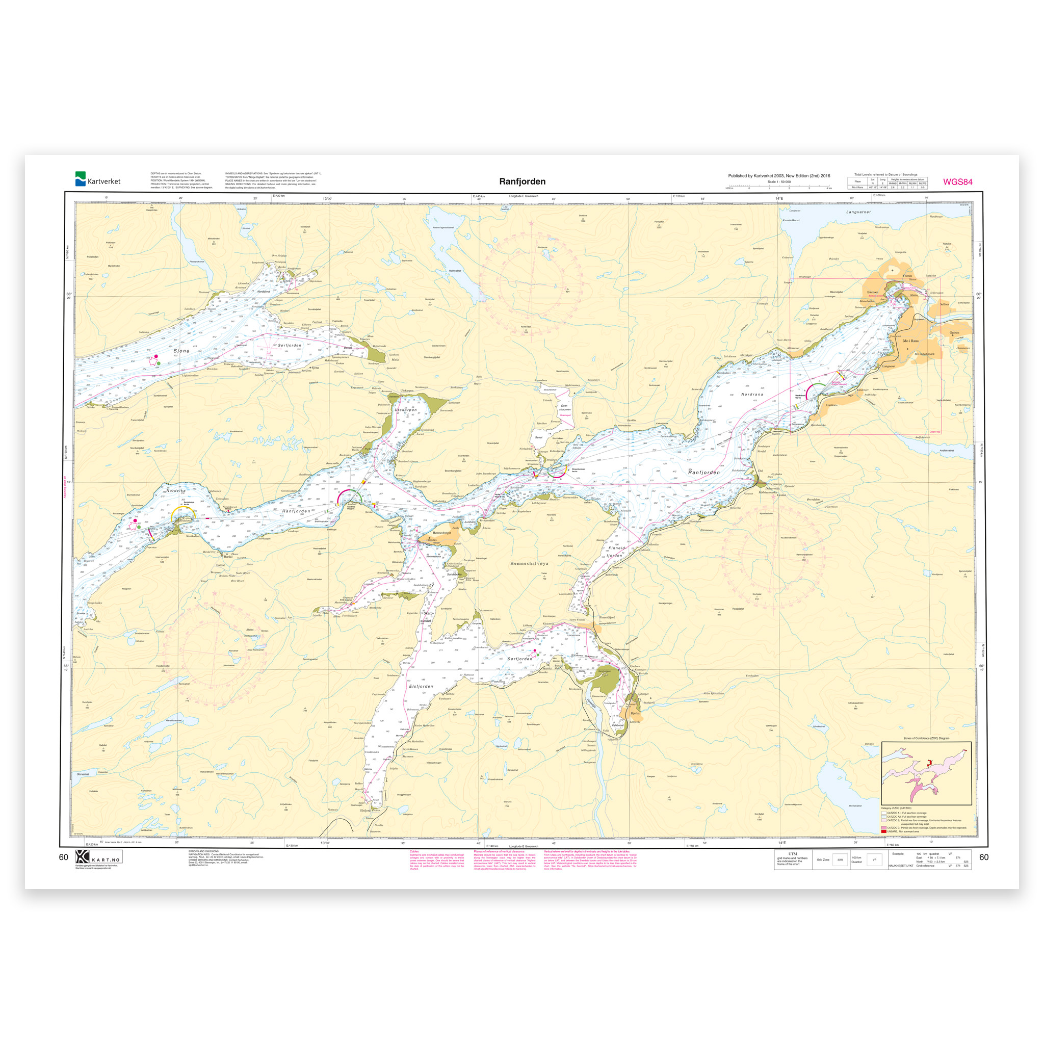
Description
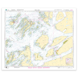
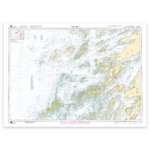
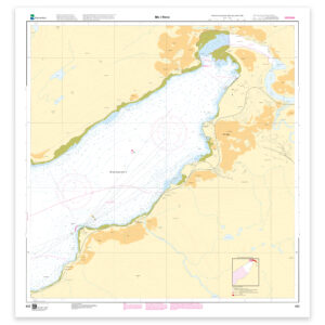
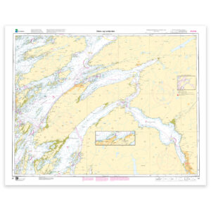
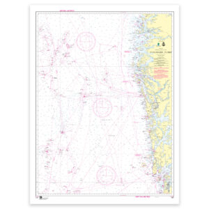
Nautical chart covering the waters of Ranfjorden. Map sheet 60 in the Norwegian Mapping Authority’s main map series. The map is 74 x 102 cm and has a scale of 1:50,000. Can also be delivered on a plate or framed. Size with passepartout and frame is 95 x 122 cm.
The map covers Ranfjorden and is designed for those who need an up-to-date nautical chart for active use along the coast. The coverage is particularly useful if you are looking for nautical charts for this particular area and want a clear overview of local waters and nearby coastlines.
Map sheet 60 in the Norwegian Mapping Authority’s main map series. The scale of 1:50,000 provides a good balance between level of detail and overview, and the size of 74 x 102 cm makes the map practical to use. This nautical chart is produced when ordered, so you get a fresh edition with updated information from the Mapping Authority.
The map base is based on official data from the Swedish Mapping Authority, making this a reliable choice for those who want up-to-date nautical charts.
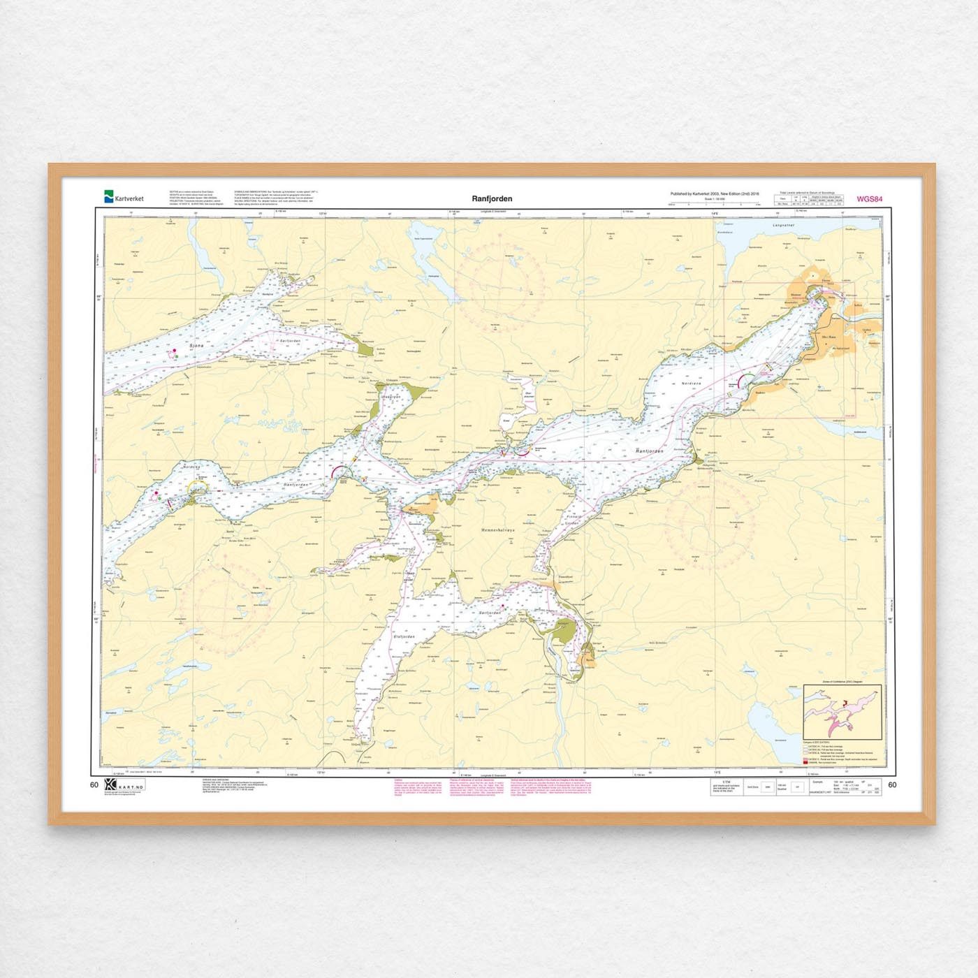
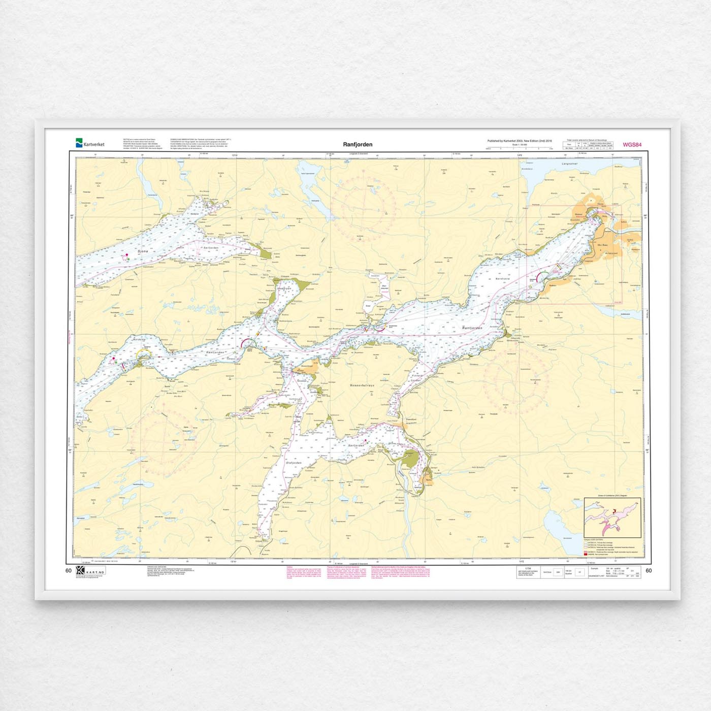
The choice of material can be adapted to the application. 125 gram map paper is thin, matt and space-saving, and is ideal as a spare map. 180-gram chart paper is a carefully selected, matt and sturdy paper that is ideal for active use of the chart on board. If the map is to be used in harsh environments, Tyvek is a very durable alternative. For framing and decoration, art paper is an exclusive choice with a clear structure and high quality.
In addition, the map can be delivered with a frame or on an aluminum plate, ready to hang up as a practical and decorative map. Size with passepartout and frame is 95 x 122 cm.