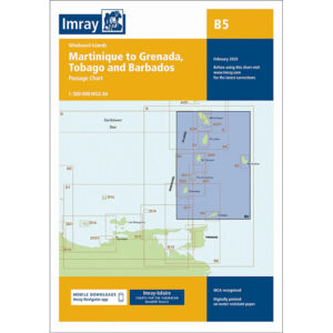
Description
This chart covers the Windward Islands in the eastern Caribbean and provides an overview of the sailing area between Martinique, St. Lucia, St. Vincent & the Grenadines, Grenada, Tobago and Barbados. The chart is designed as a passage chart and is intended for planning longer ocean voyages and island-to-island sailing in the region.
The chart provides a good overview of open sea areas, island groups and the most important geographical relationships in an area characterized by stable trade winds and clear currents. It is particularly suitable for long-distance sailing and route planning between islands, and is often used in combination with more detailed coastal and harbor charts for arrival and local navigation.
Imray is a recognized British chart manufacturer with extensive experience in nautical cartography for leisure and long-distance sailing. Their passage charts are developed with a focus on high legibility and strategic overview when navigating in open tropical waters.