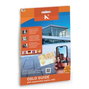
Description
Osloguiden is a practical and inspiring city guide for those who wish to explore Oslo on foot. The guide combines a clear city map with English text and brief descriptions of 31 central attractions in Oslo city center, and is specifically designed for visitors who want to experience the city in a simple and clear manner.
The map provides an excellent overview of central districts, sights, and walking distances, and each attraction is equipped with QR codes that lead directly to Google Maps walking directions. This makes it easy to navigate between stops along the way, without the need for prior knowledge or extensive planning.
Some of the images in the guide also feature an AR function (augmented reality), which can be activated via mobile phone to display videos and additional information related to the attraction. This provides a more engaging experience and extra context for selected sights.
Although Osloguiden is not a traditional map product for navigation or route planning, it still provides a very good overview of Oslo city center and serves well both as inspiration before your visit and as a practical companion for city walks.
The guide was updated in 2024.