Description
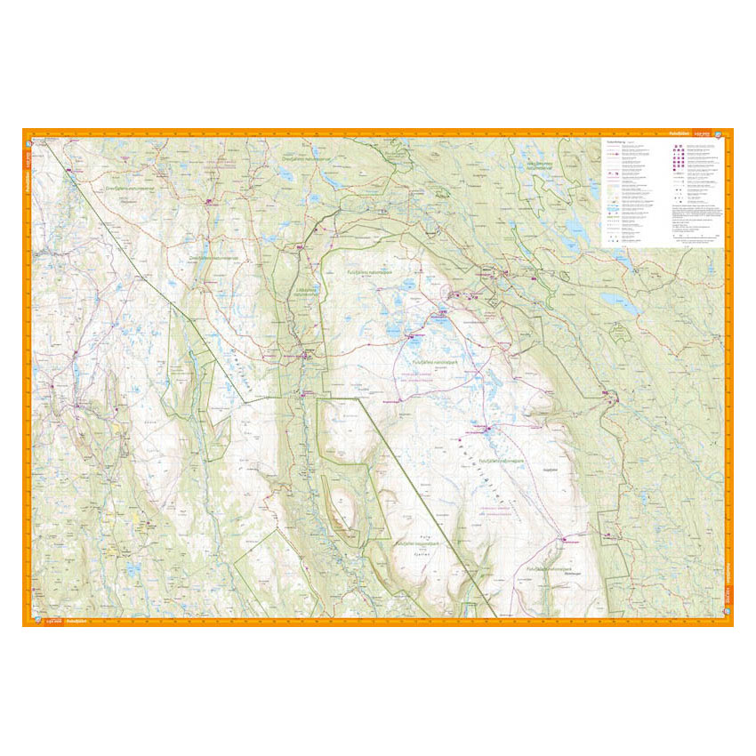
This hiking map covers Sälenfjällen and Fulufjället National Park at a scale of 1:50,000. The map provides a detailed overview of the mountain areas around Sälen and Fulufjället, with clear reproduction of terrain shapes and grids.
The terrain information is based on detailed elevation data, and the map shows contour lines with a 10-meter equidistance. Watercourses, steep slopes, marshlands, buildings and vegetation are clearly visible, and paths and trails are precisely marked. The map also shows groomed ski trails and mountain bike trails, including around Rörbäcksnäs, as well as cabins and services in the area.
The map is at a scale of 1:50,000, which is the standard scale for longer hikes in the mountains. At this scale, 2 cm on the map corresponds to 1 km in the terrain, which provides a good balance between overview and level of detail.
The map is printed on durable and water-repellent material (Tyvek), well suited for active use in changing weather conditions.
Calazo Förlag is a Swedish publishing house specializing in maps and books for outdoor life in the Nordic region.
Here you can see the area the map covers:
The map is released in 2020.