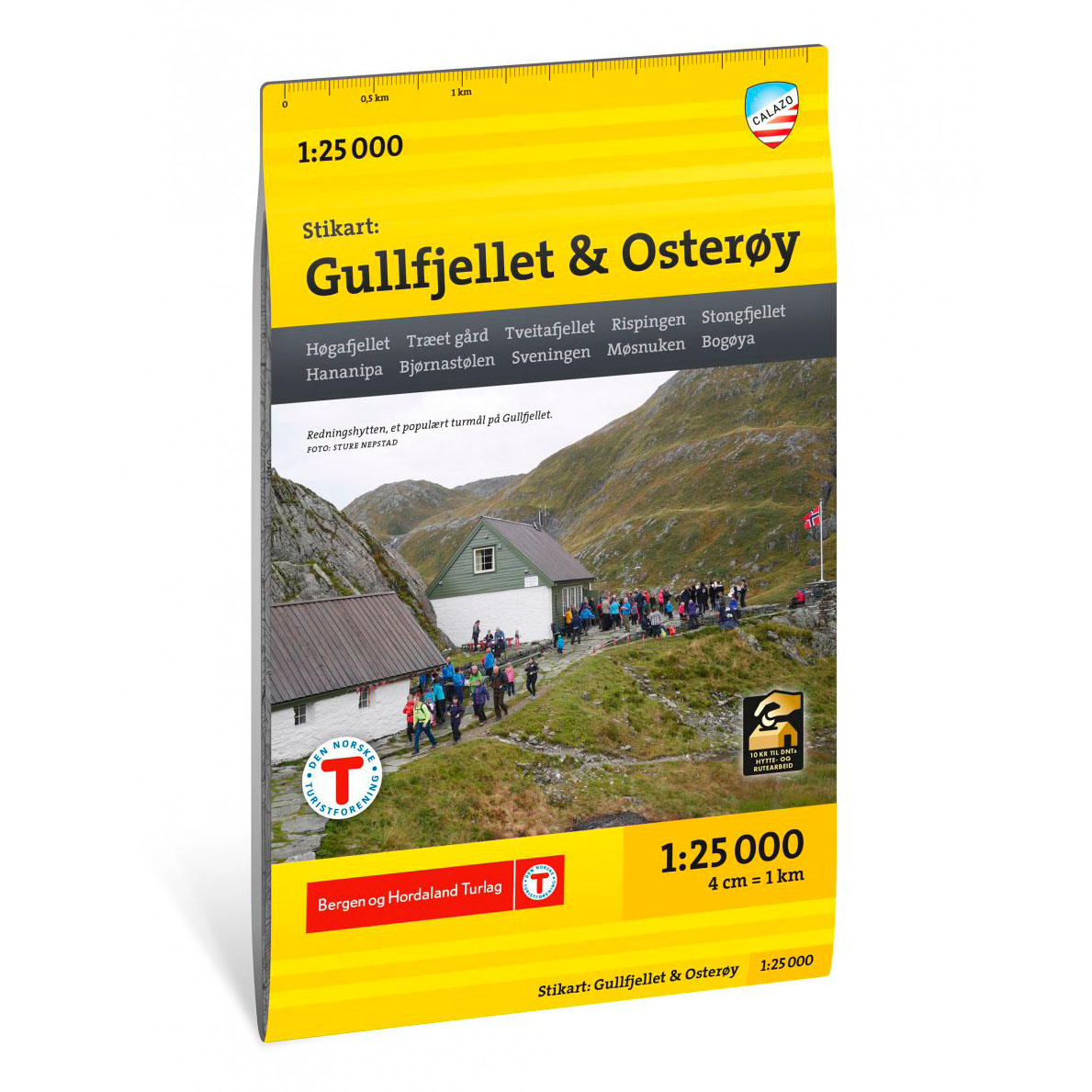

Description
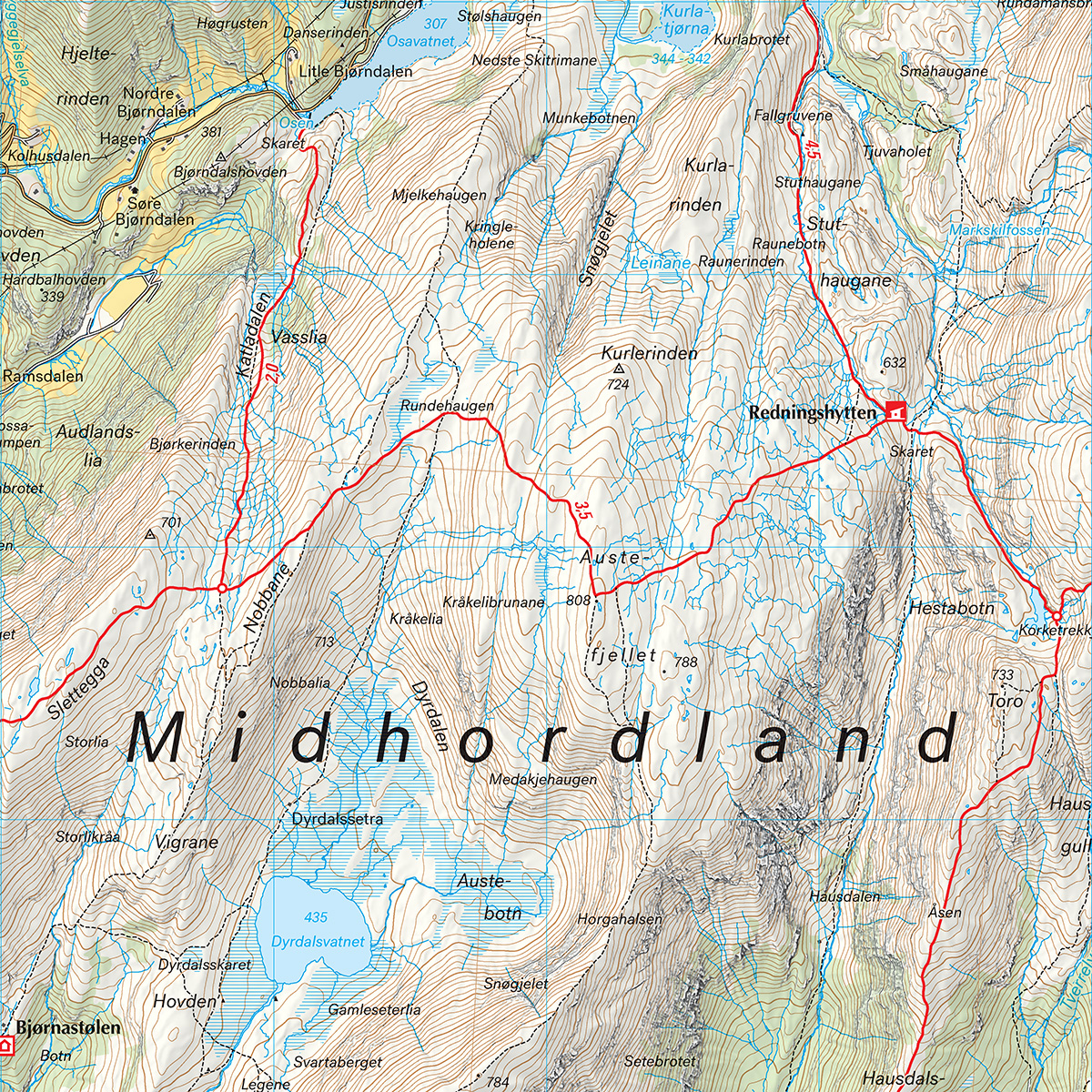
Stikart Gullfjellet & Osterøy covers one of the most used outdoor areas east of Bergen. The map is part of a series at a scale of 1:25,000 that covers nearby hiking areas around the city, and is prepared in collaboration with Bergen and Hordaland Turlag.
The area has a dense network of trails used by hikers, cross-country skiers and mountain bikers. The map provides an updated overview of the trail network, as well as cabins and current marking of summer and winter routes. The terrain information is based on detailed elevation data, which provides a precise and clear representation of the shapes of the landscape.
The map is at a scale of 1:25,000. At this scale, 4 cm on the map corresponds to 1 km in the terrain. This provides a good level of detail and makes it easy to plan both short day trips and longer trips in mountain and forest terrain.
Calazo donates an amount per map sold to DNT’s work on trails and accommodation cabins, which contributes to the further development and maintenance of the infrastructure in the area.
Calazo Förlag is a Swedish publishing house specializing in maps and books for outdoor life in the Nordic region.
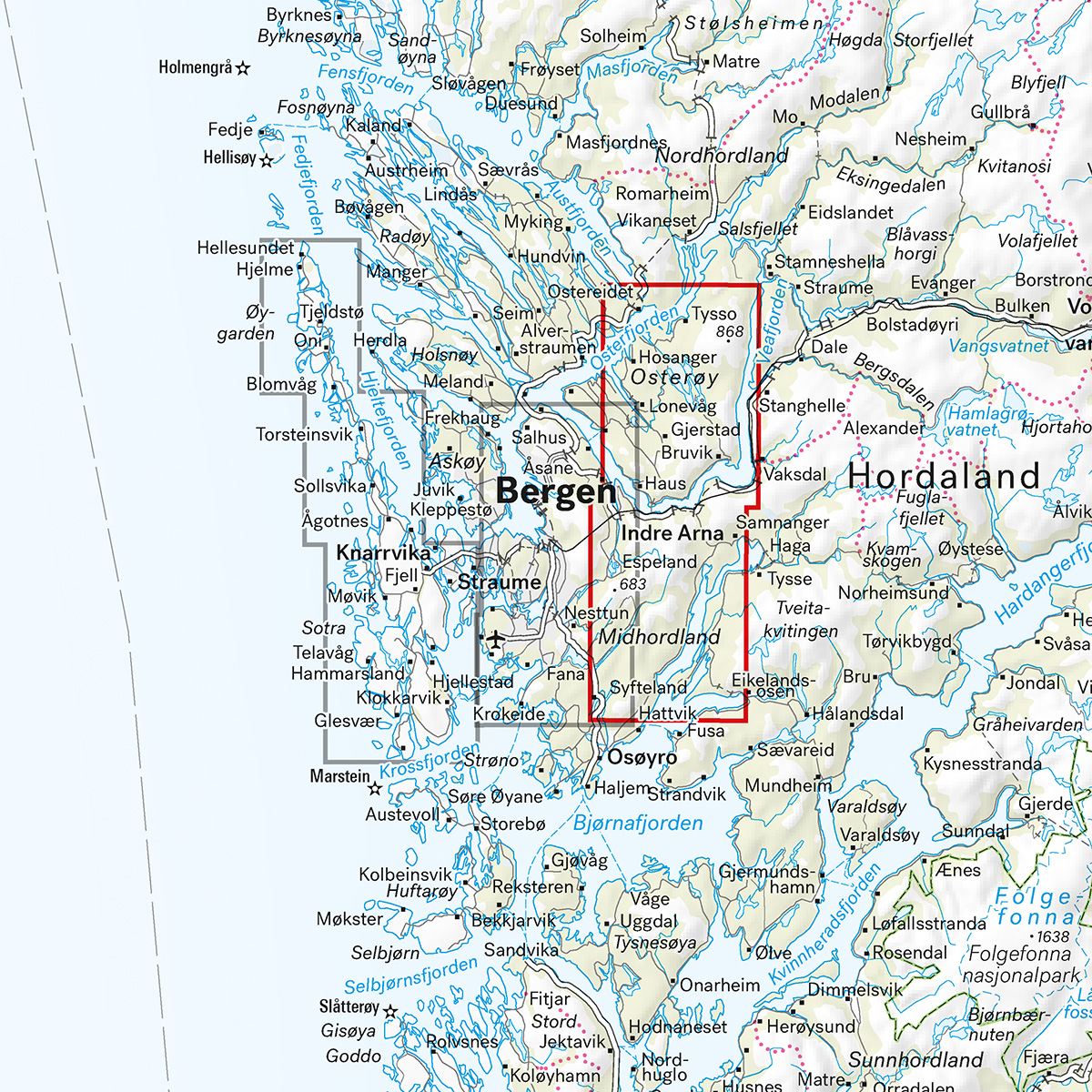
Here you can see the area the map covers:
The map is released in 2025.