
Description
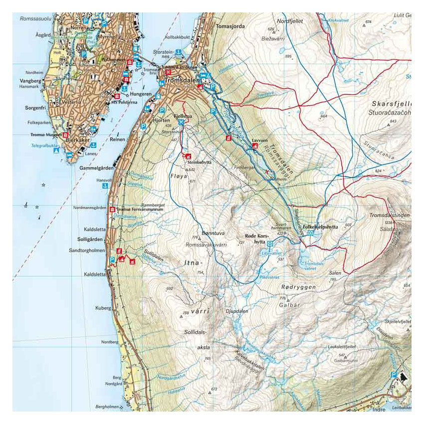
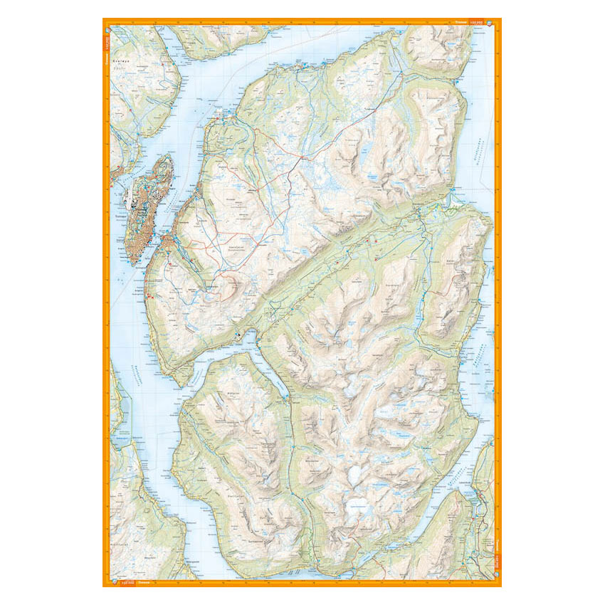
Turkart Tromsø covers large parts of the Tromsø region with map sections on both the front and back. The map covers the mountain areas of mainland Tromsø, Malangen and Kvaløya, and provides an overview of a varied landscape that is ideal for both skiing and hiking.
Classic hiking destinations such as Tromsdalstinden (1238 m), Skittentinden (1042 m) and Buren (802 m) are clearly marked. The map also shows available cabins and marked hiking routes in the area. Trails have been reviewed and corrected using detailed aerial photographs and terrain data, and the map provides a precise representation of contours, water and landforms. It is adapted for use throughout the year, with marked winter routes and groomed ski trails where applicable.
The map is at a scale of 1:50,000, which is the most common scale for longer mountain hikes. At this scale, 2 cm on the map corresponds to 1 km in the terrain.
Calazo Förlag is a Swedish publishing house specializing in maps and books for outdoor life in the Nordic region.
Here you can see the area the map covers:
The map is released in 2023.