


 Valdresflya 1891
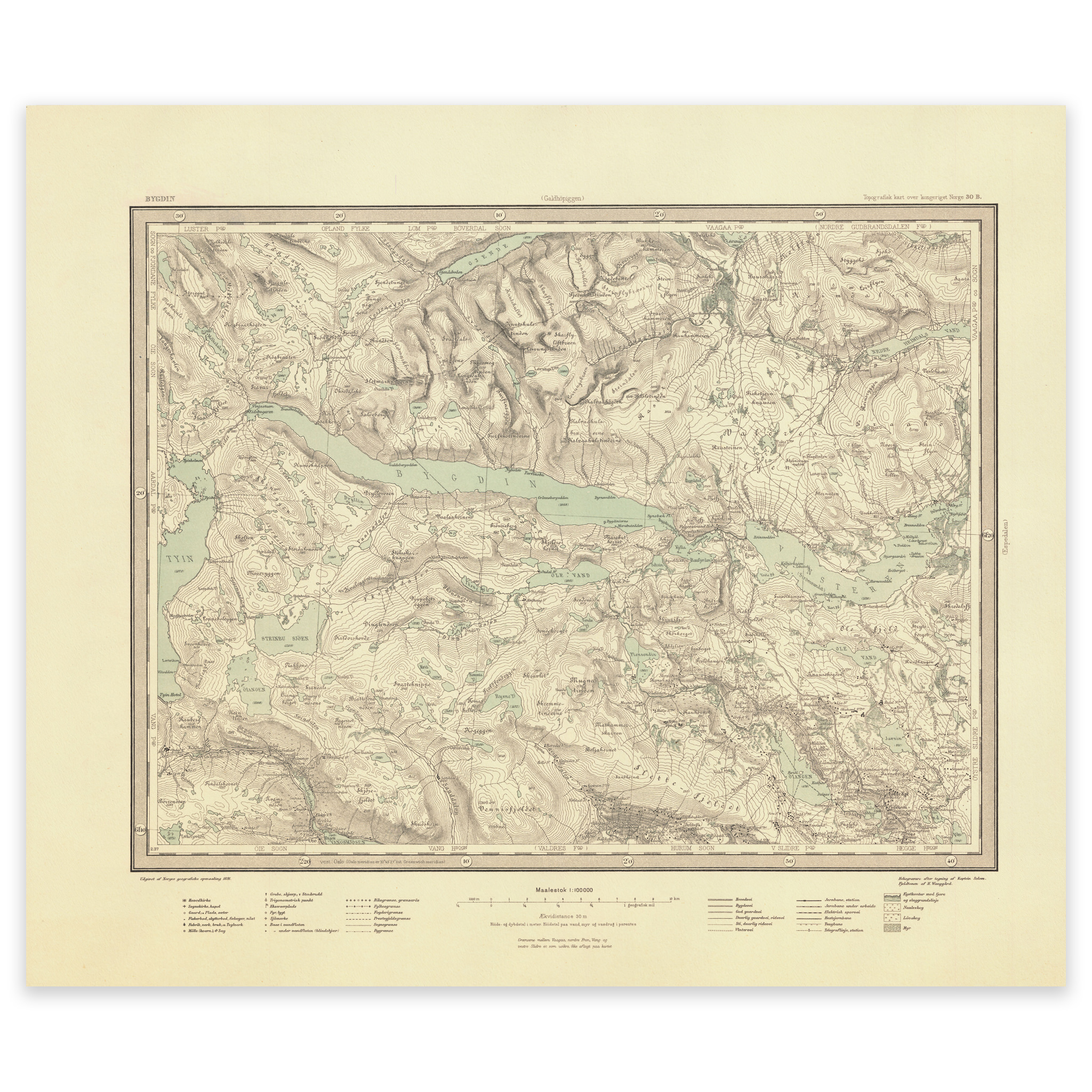
Valdresflya 1891
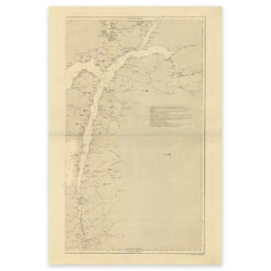
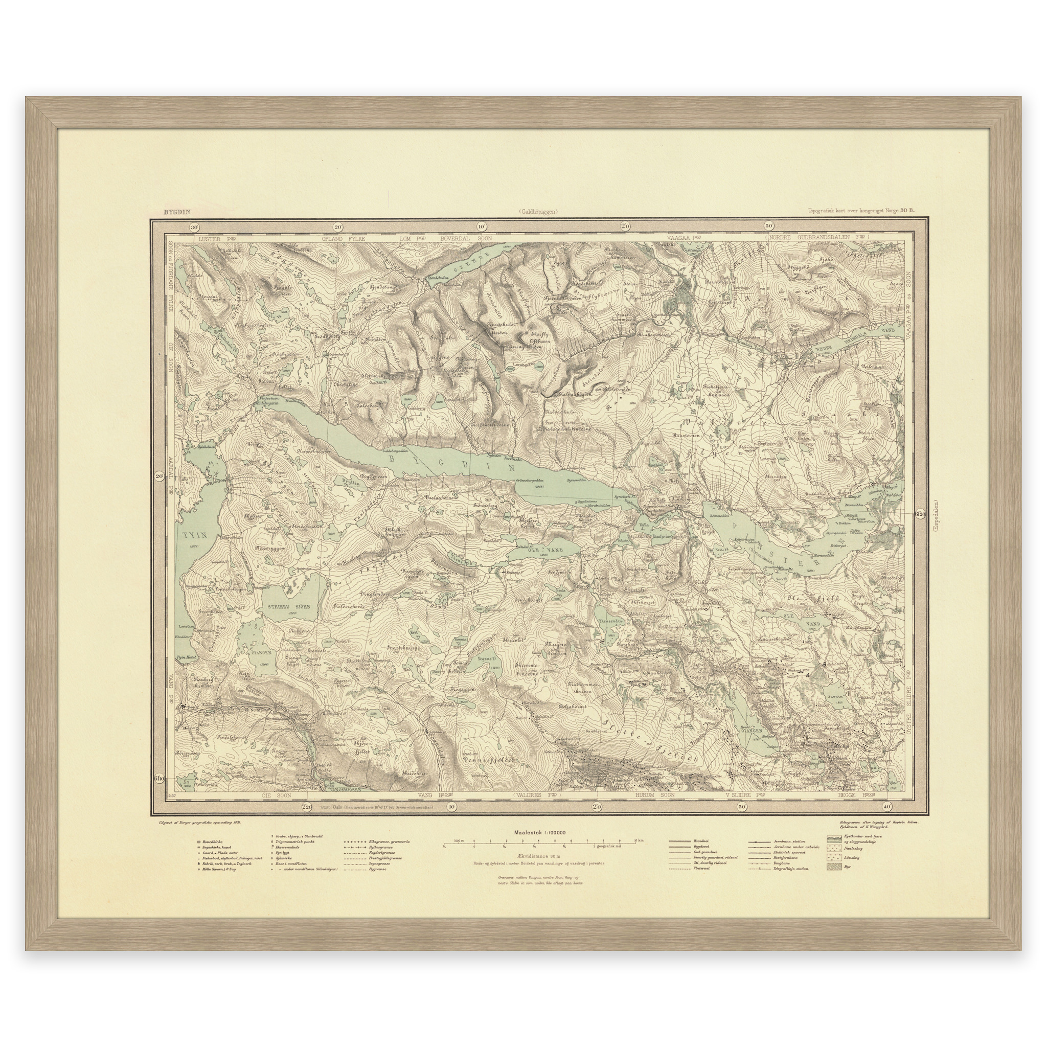
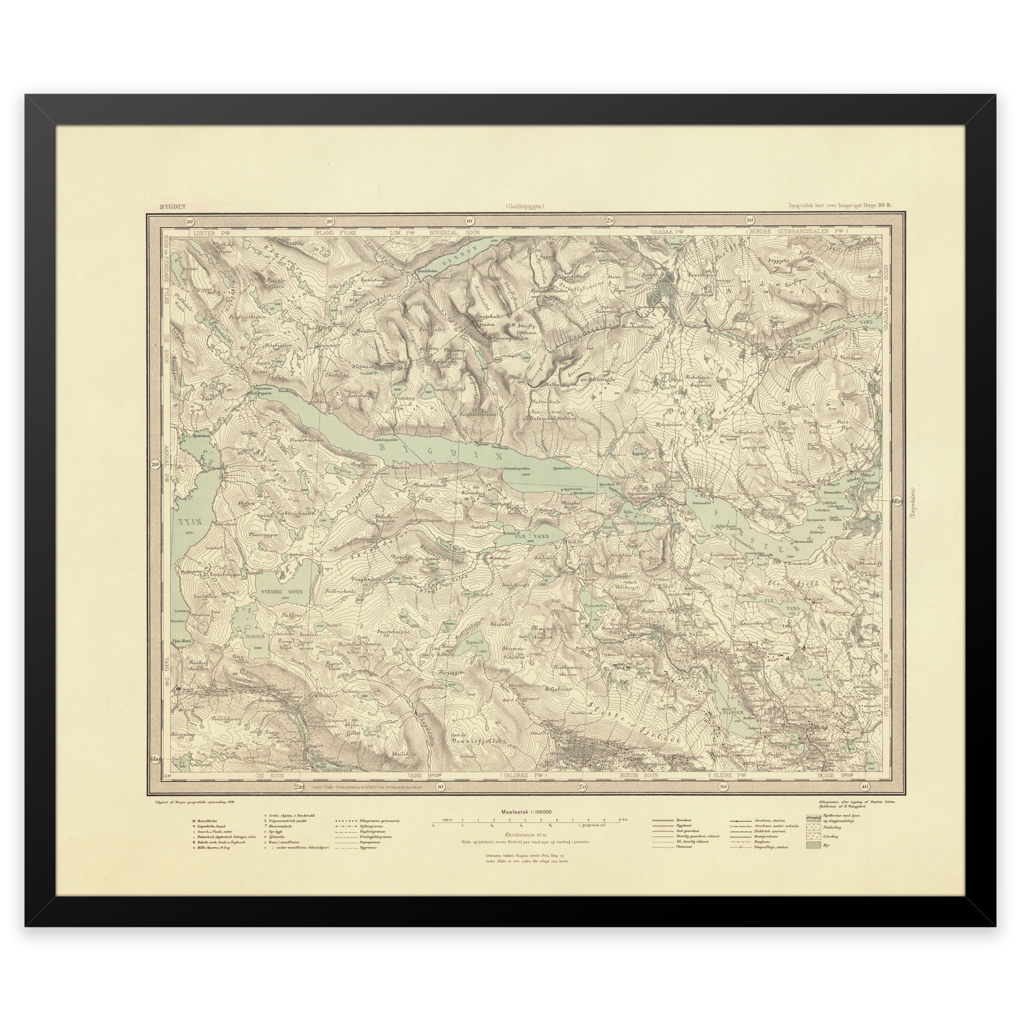
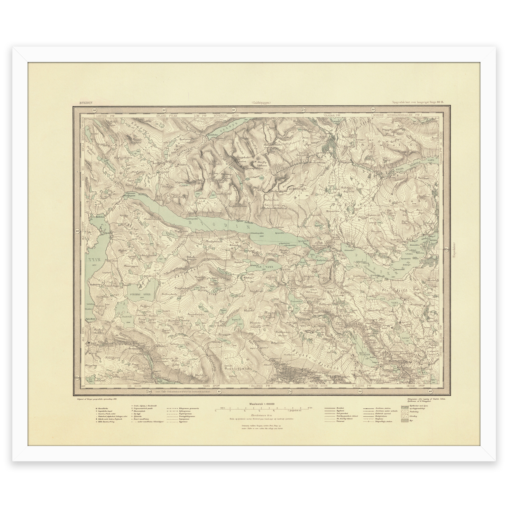
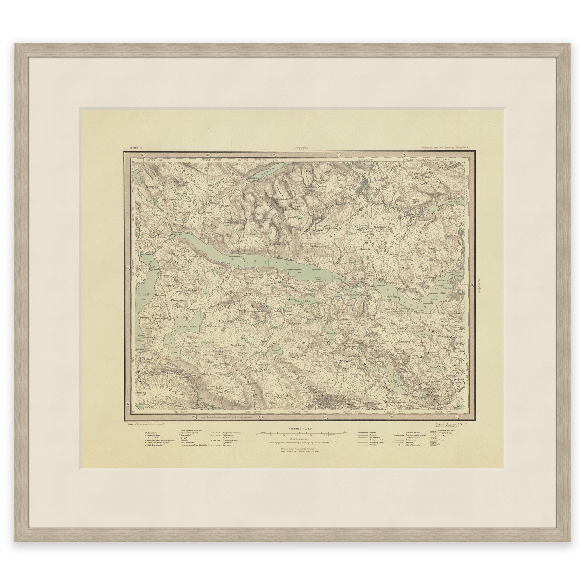
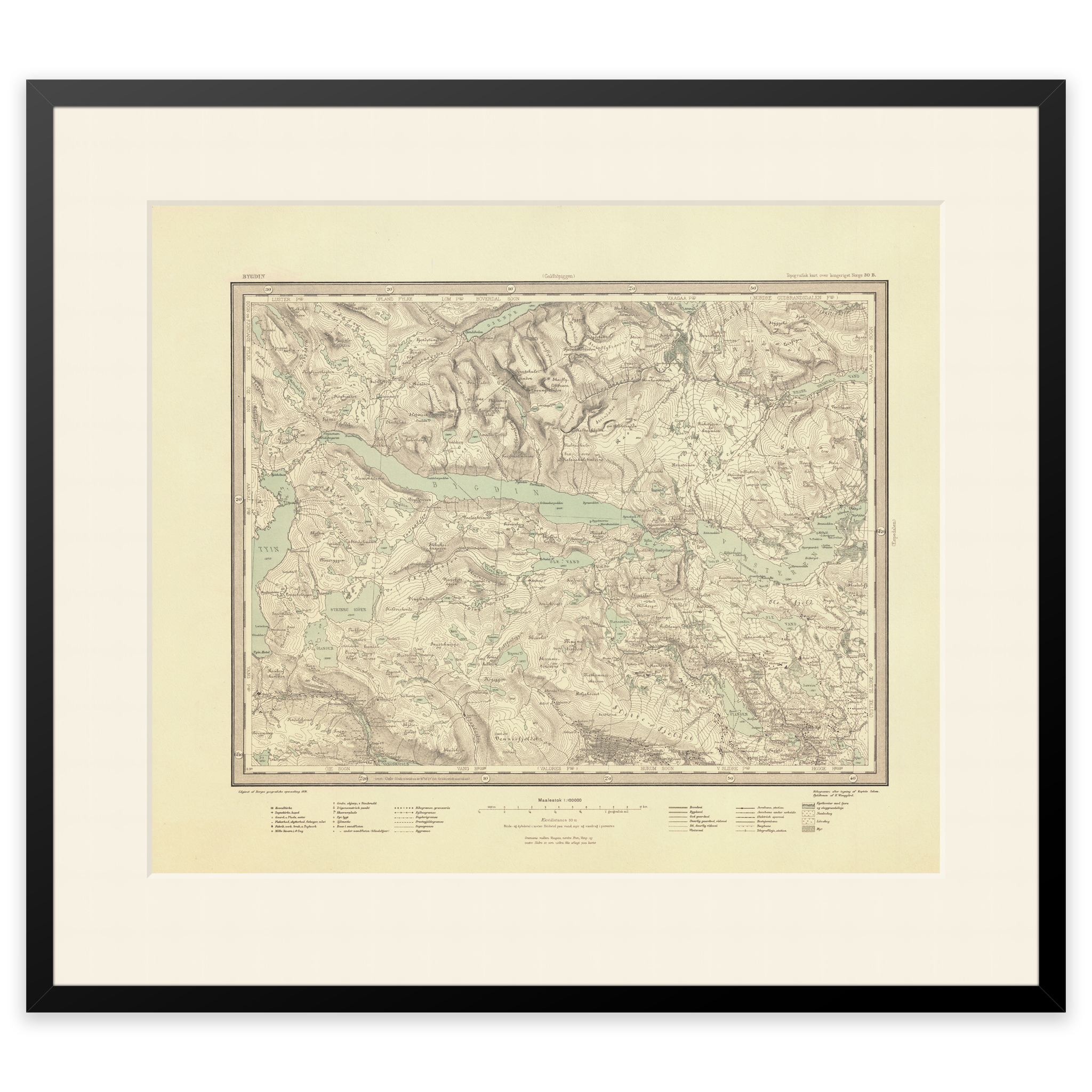
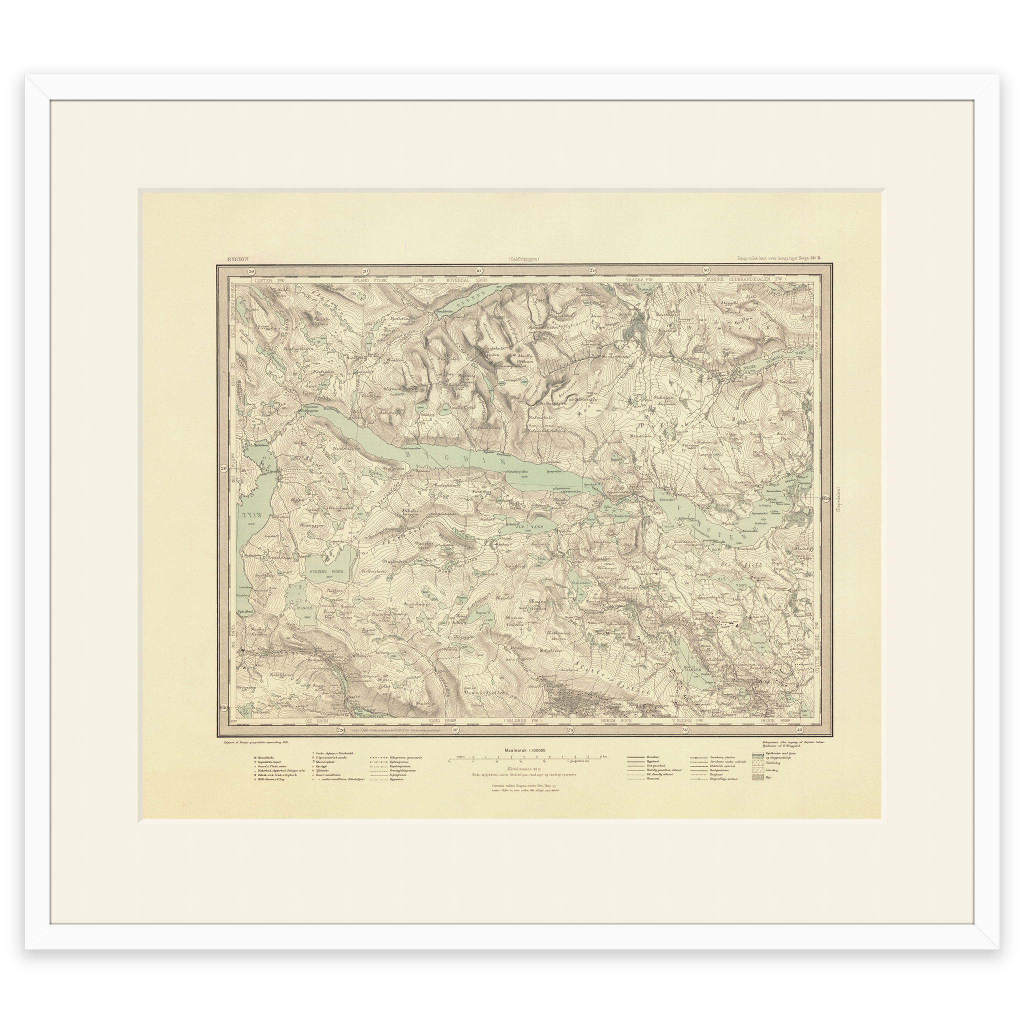
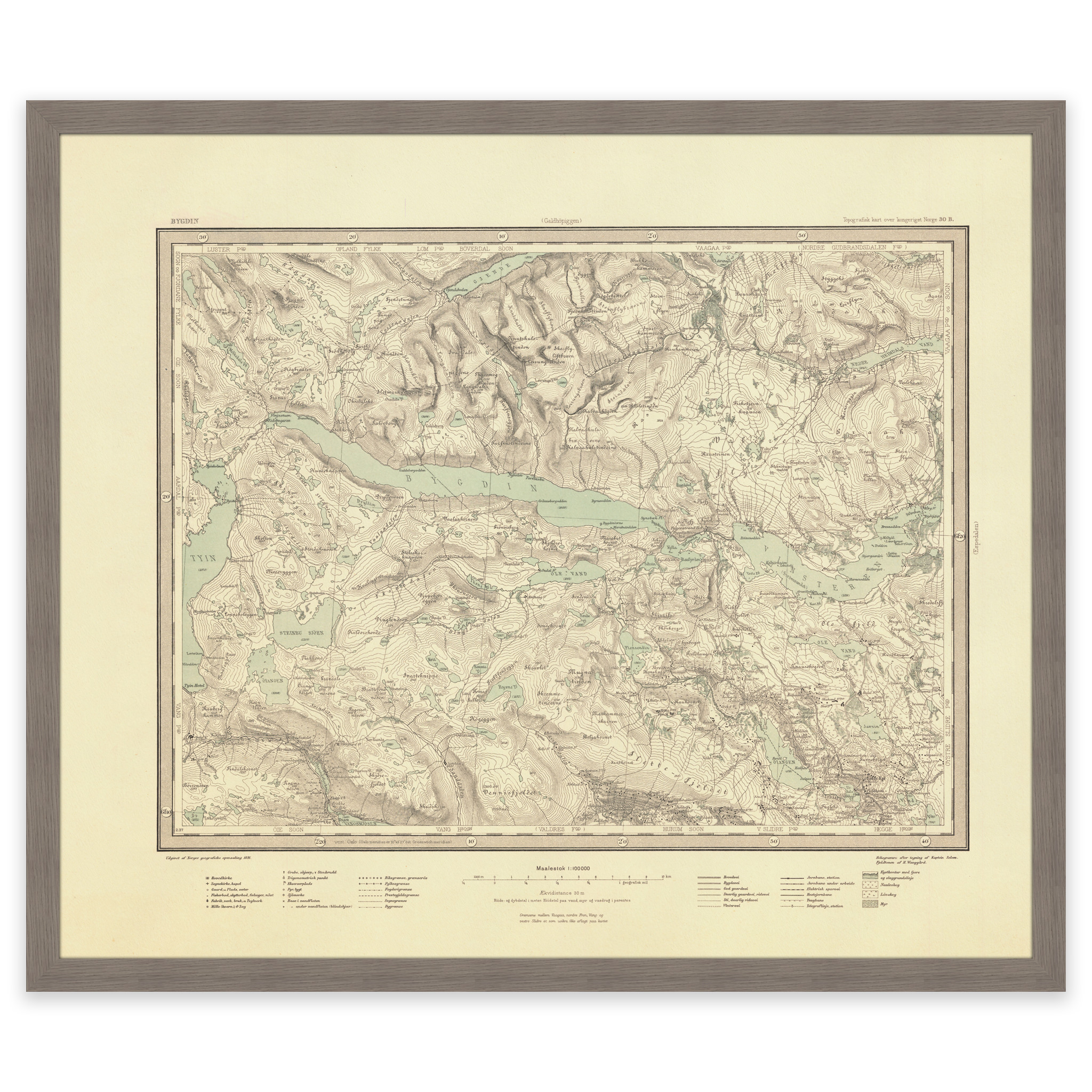
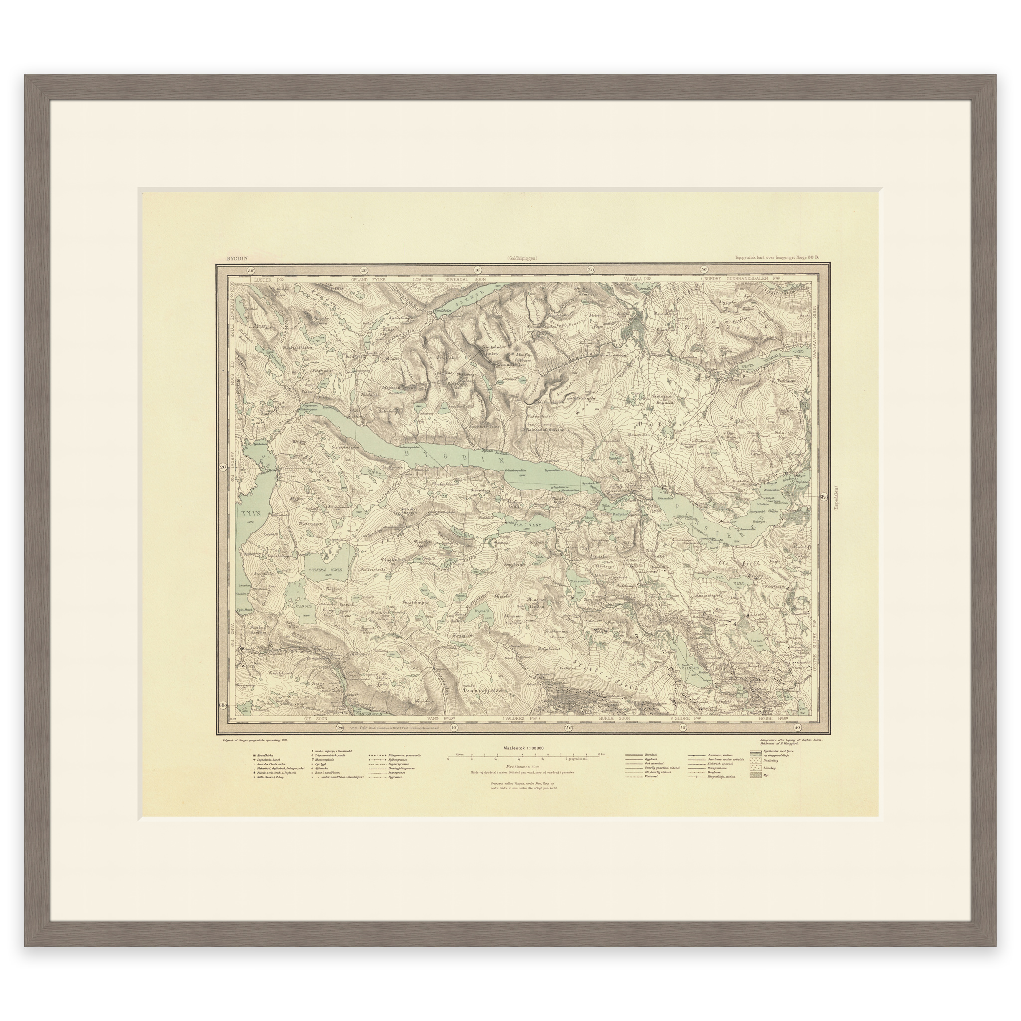
Map of lake Bygdin, Valdresflya and Beitostølen from 1891. The map is made using the heliogravure technique by Solem and H. C. The original size of the map is 58.8 x 49.8 cm. The size with frame and passe-partout is 76.8 x 68.8 cm. Would you like the map in a different size? Just get in touch – we’ll be happy to give you a quote for customization.