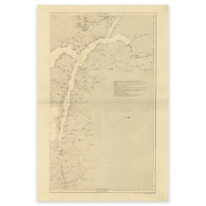


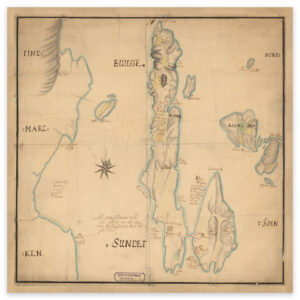
 Vardø 1750
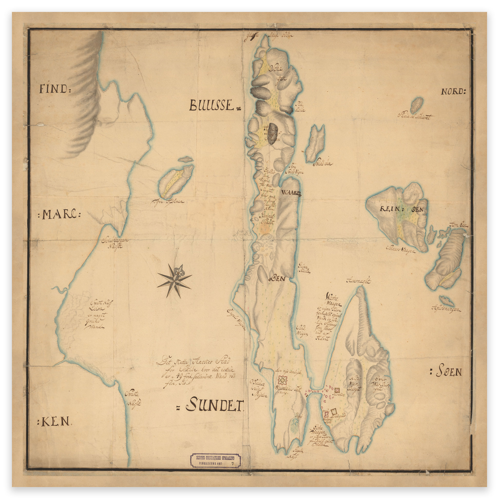

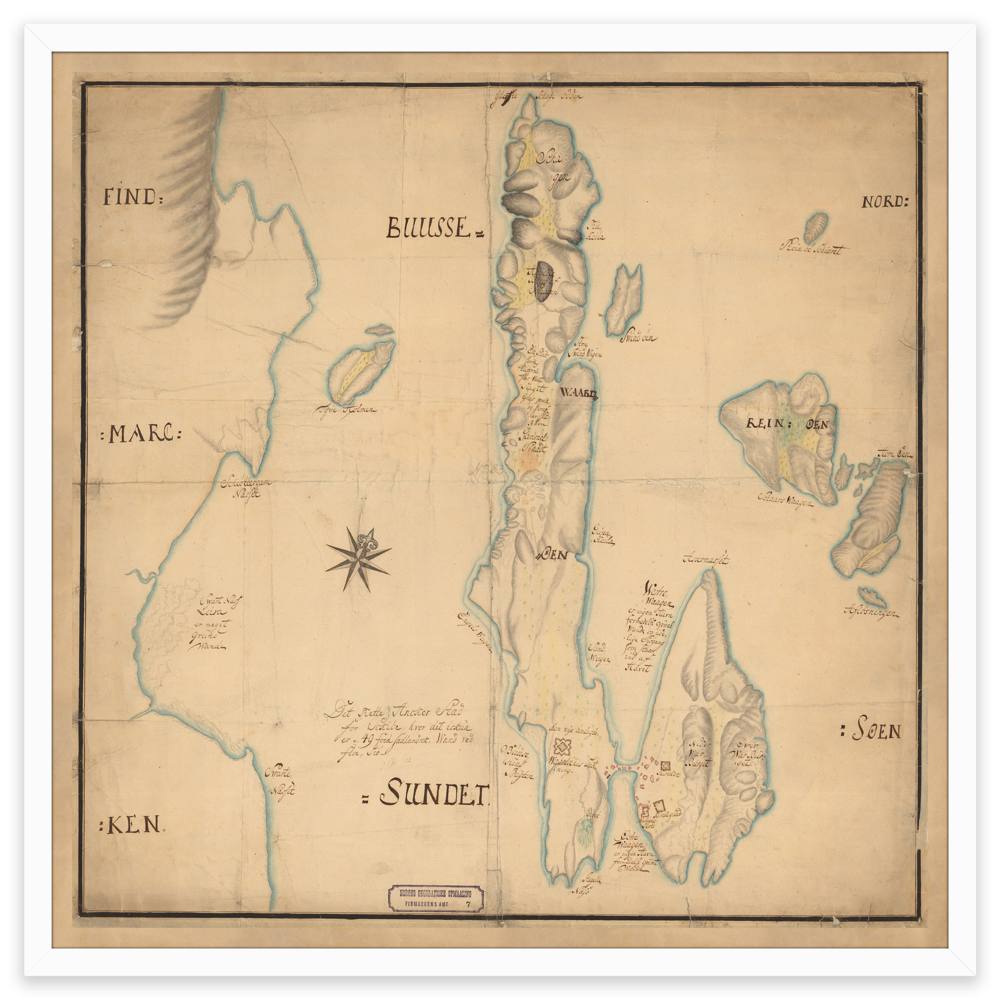


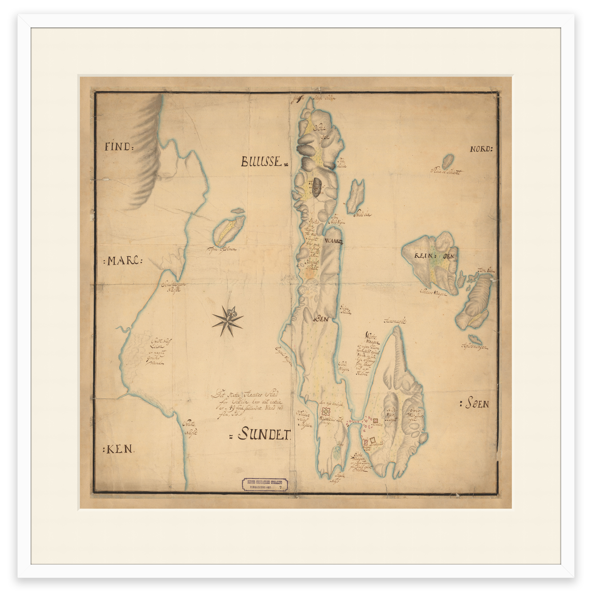


Vardø 1750
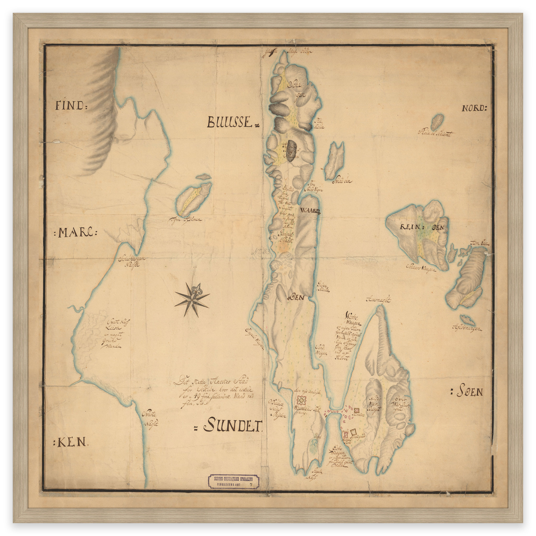
Northern part of Norway, 1795. The map covers south to Leka and Vikna in Trøndelag, as well as the border areas with Sweden, Finland and Russia. The map is delivered in its original size of 64.9 x 64.9 cm. The size with frame and passe-partout is 82.9 x 83.9 cm. Would you like the map in a different size? Just get in touch – we’ll be happy to give you a quote for customization.