


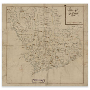
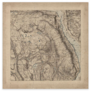
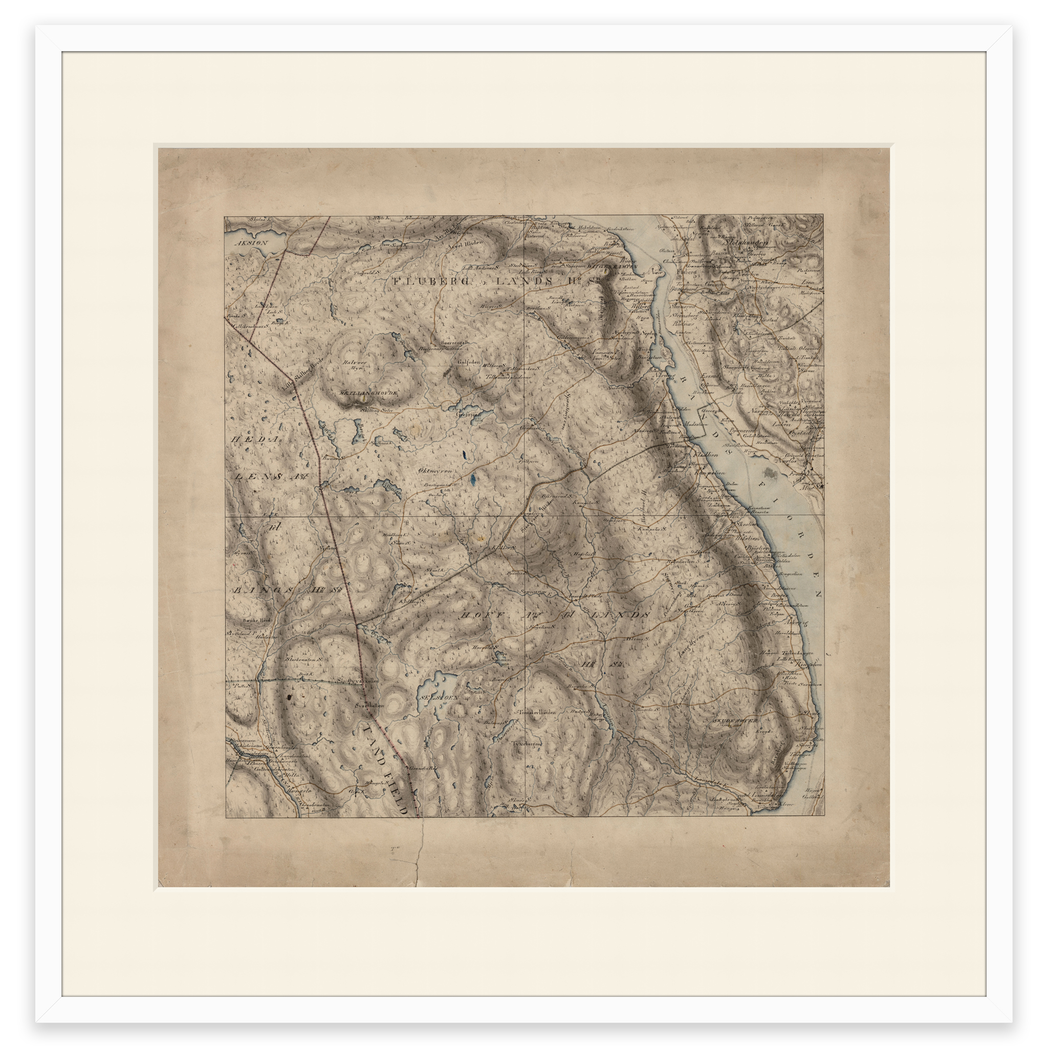
 Søndre Land 1827
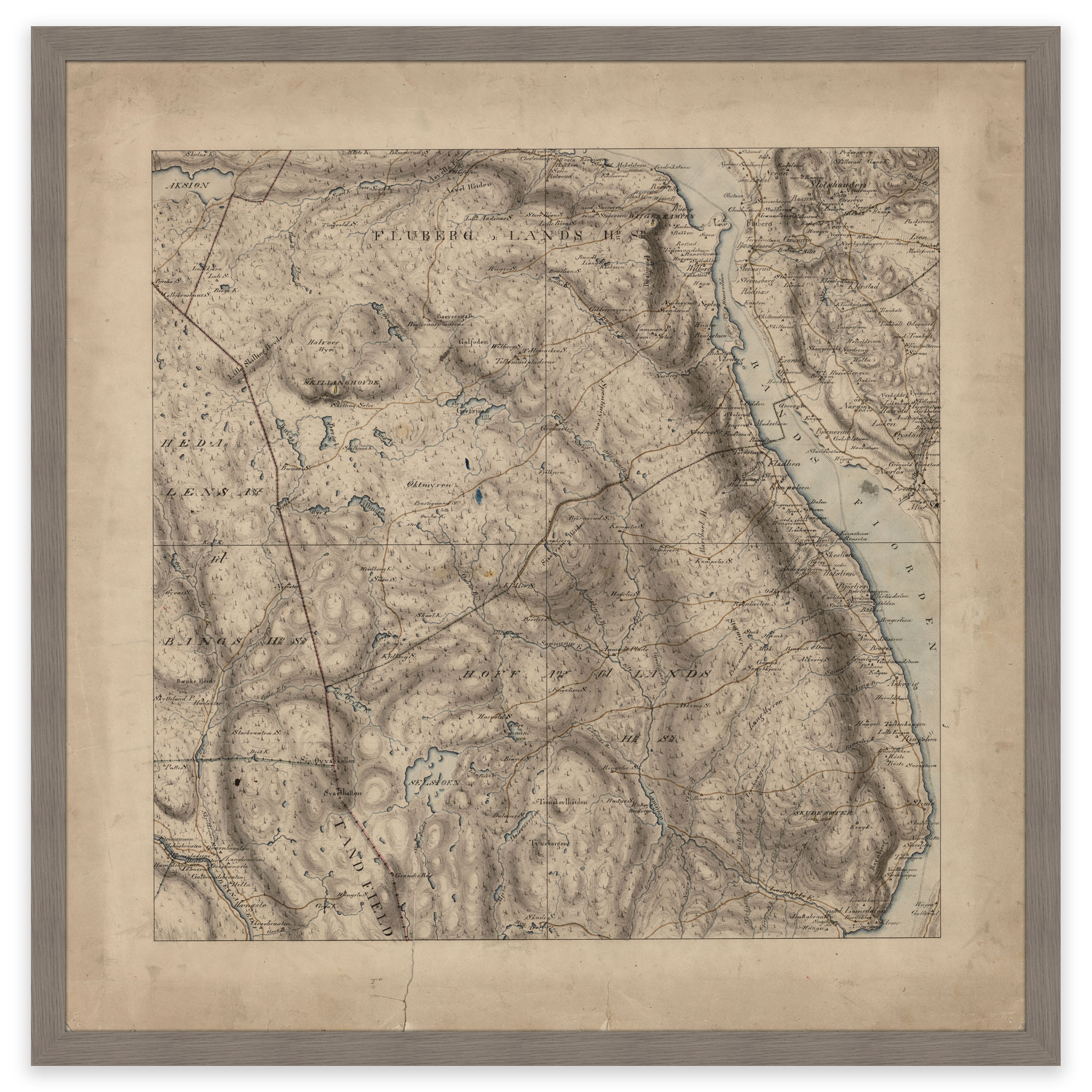
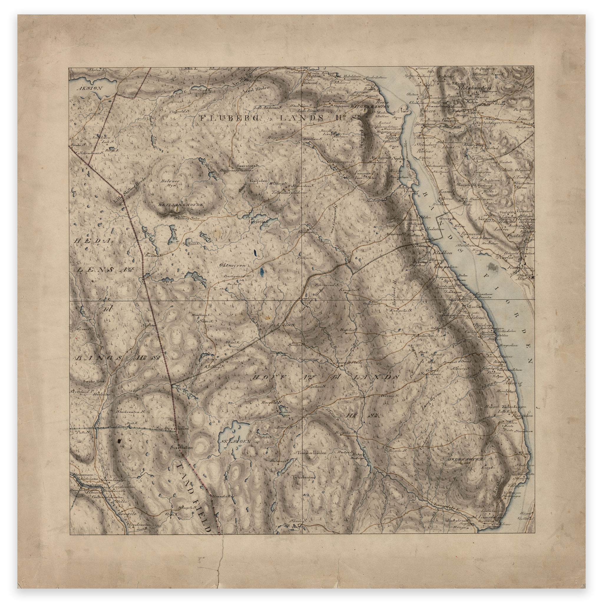
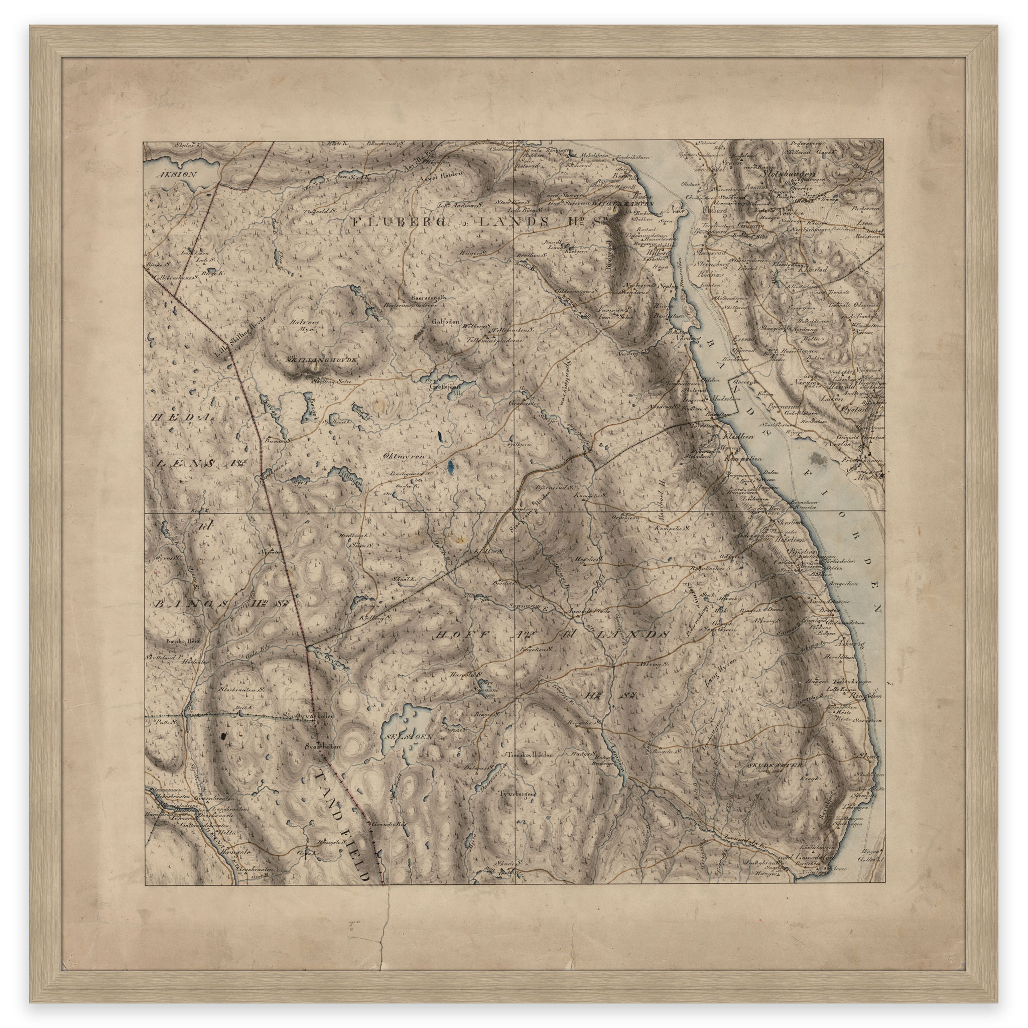
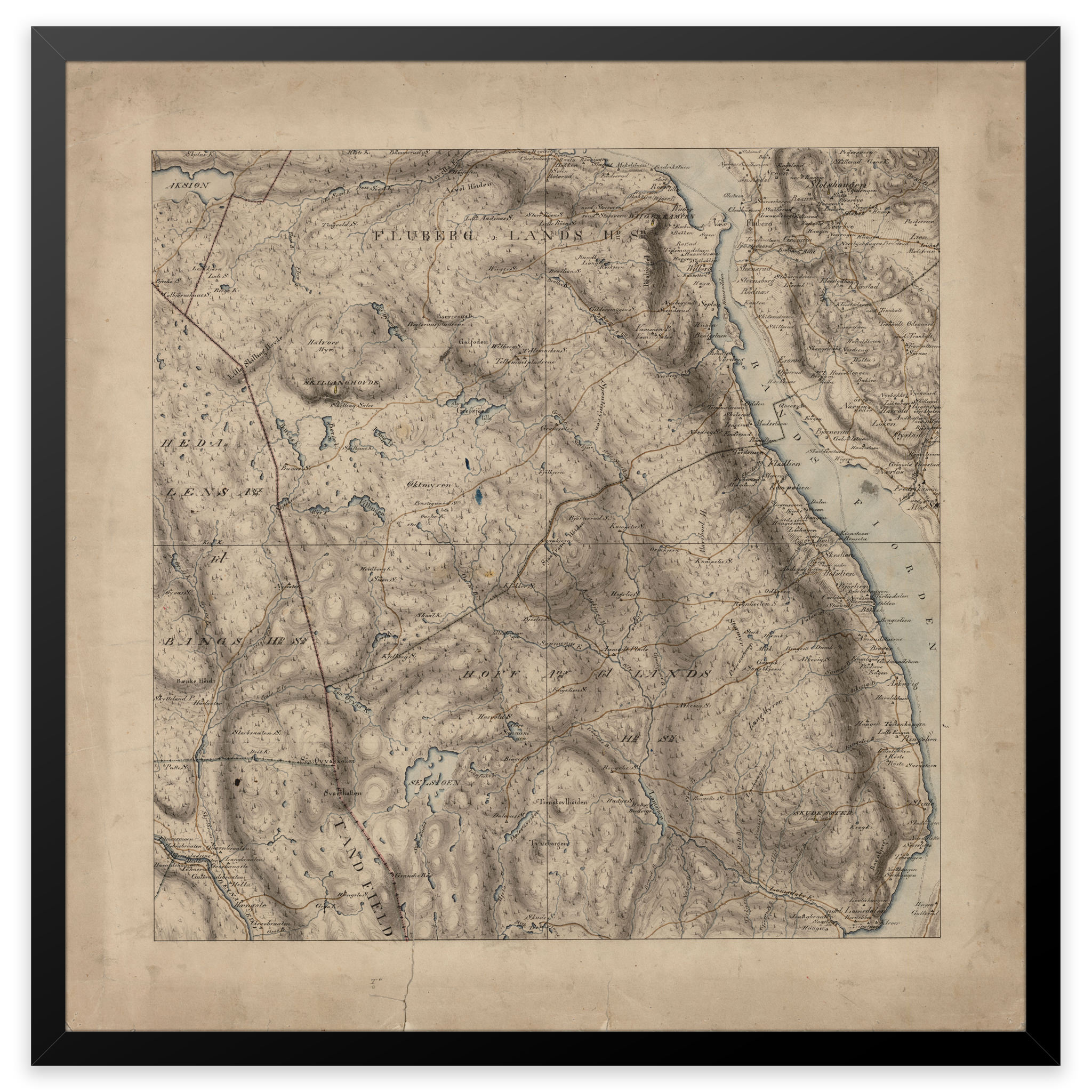
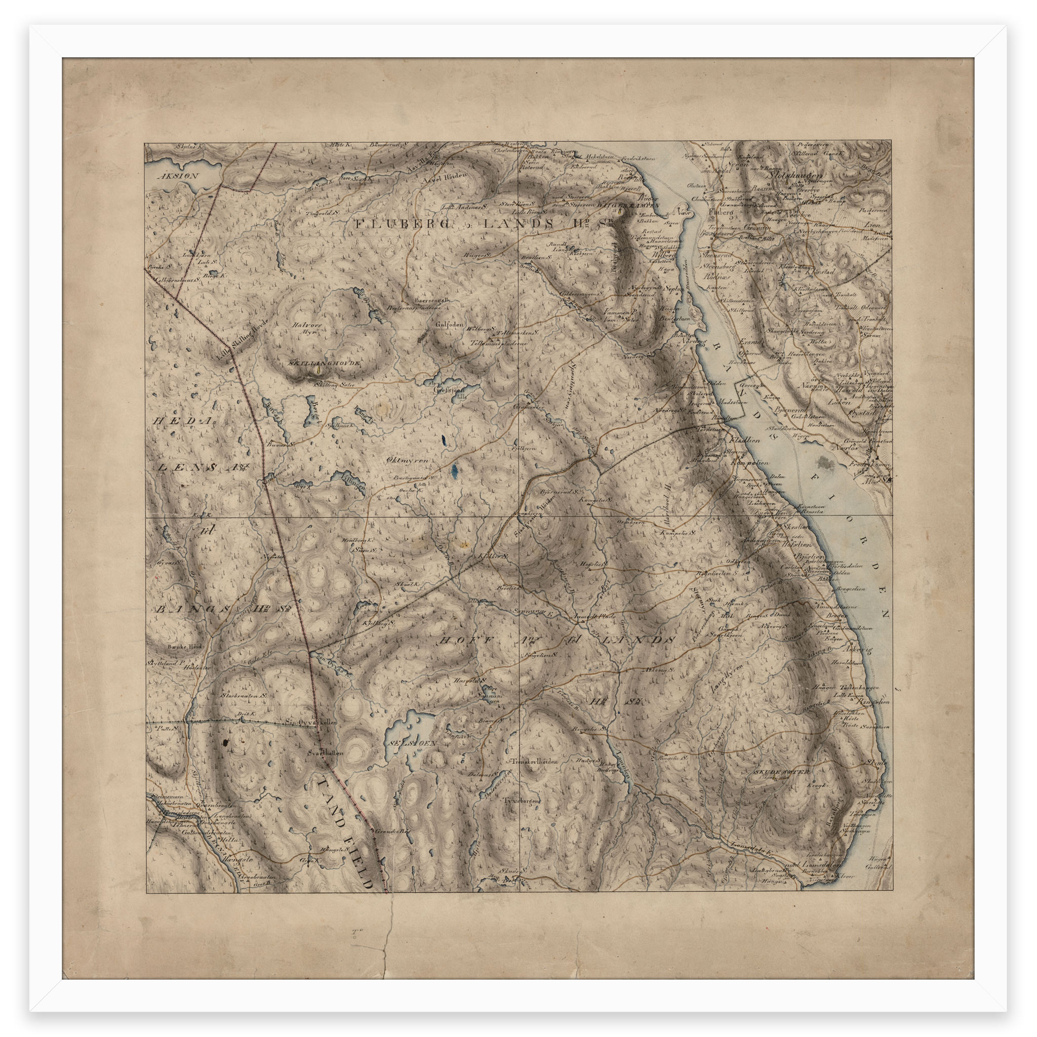
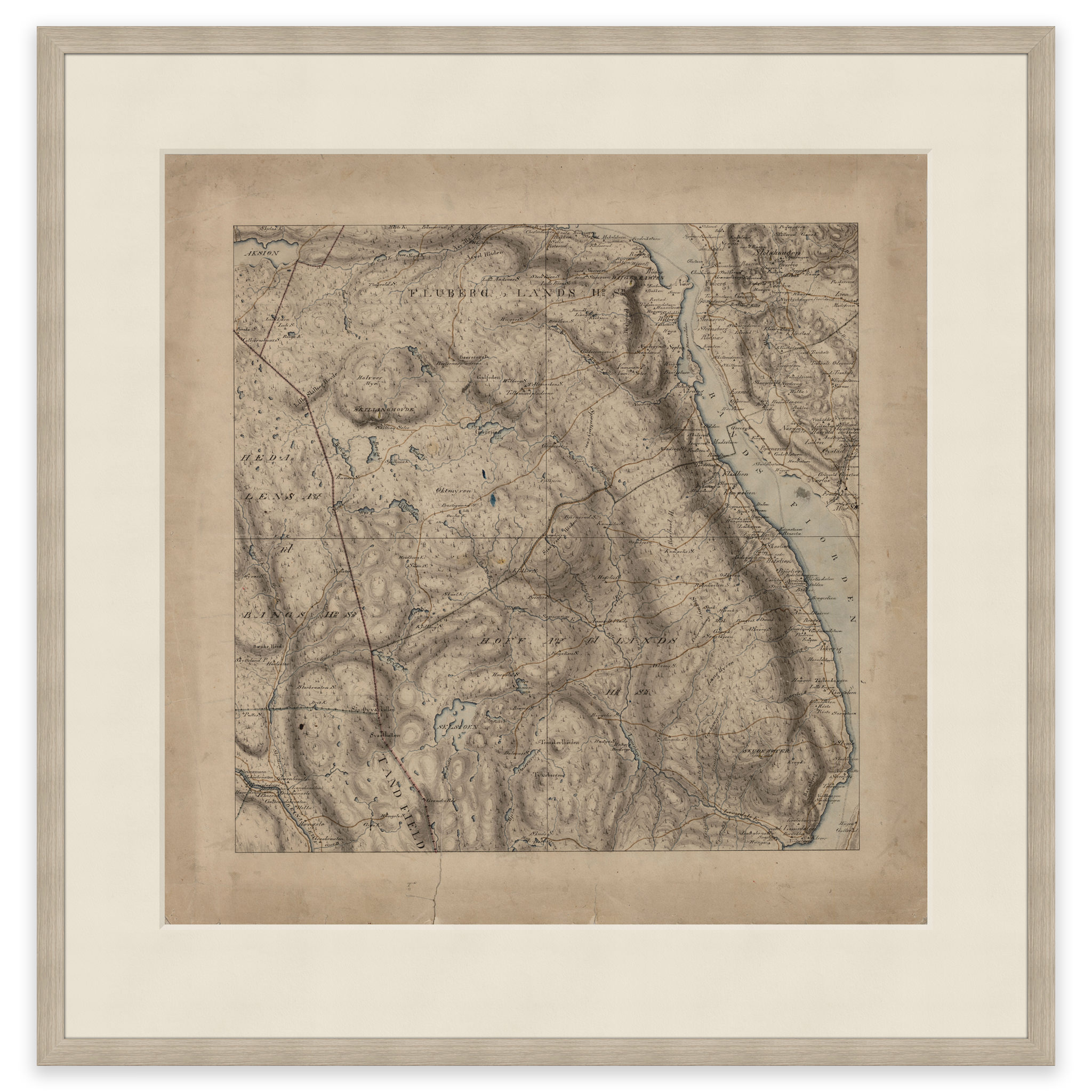
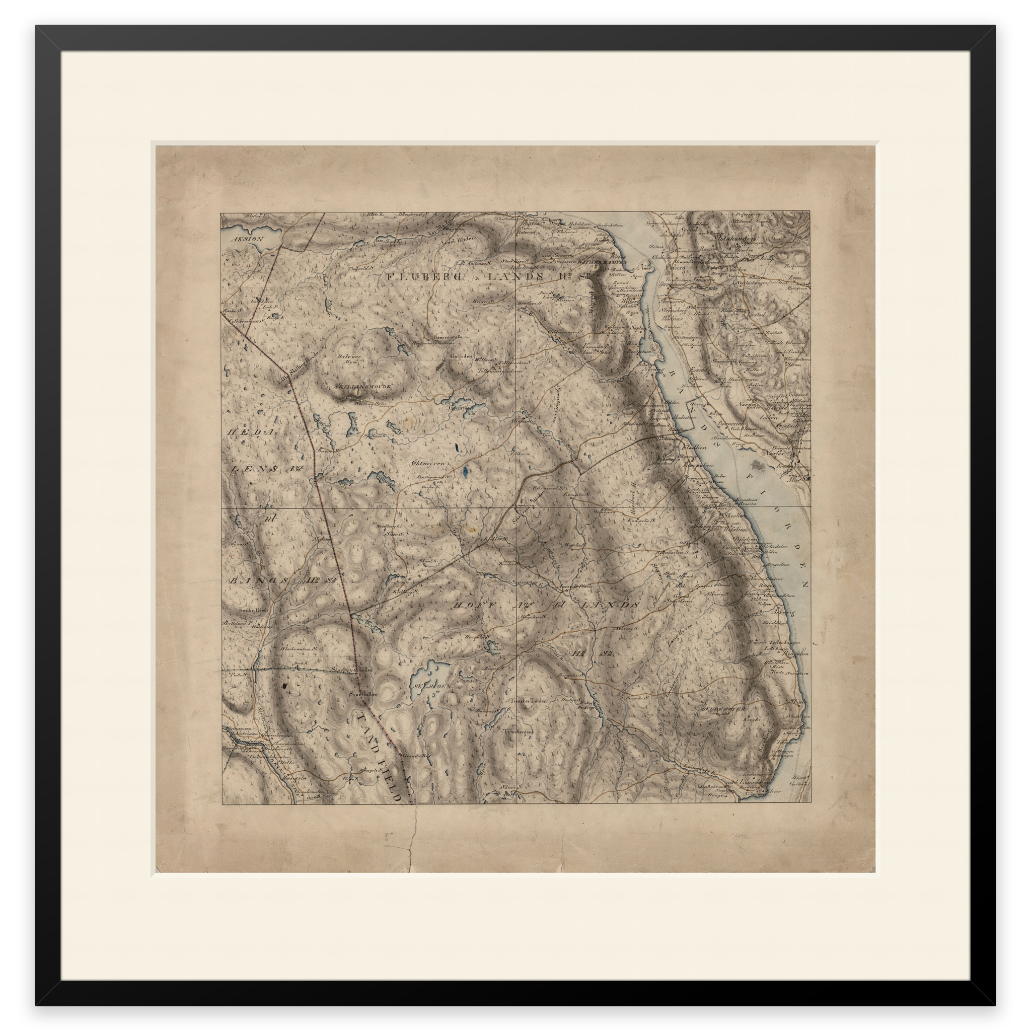
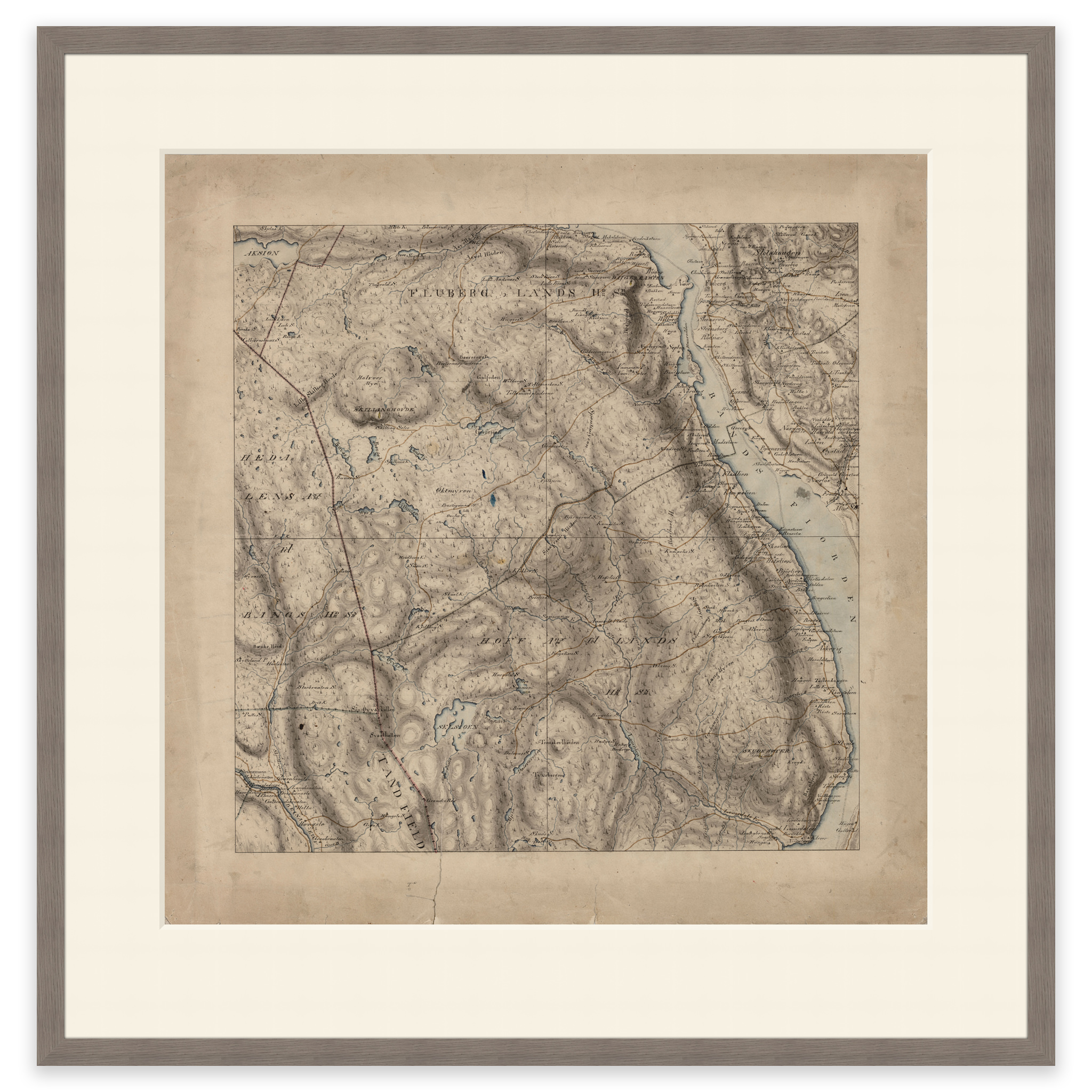
Søndre Land 1827
Hand-drawn map from 1827 of the area Søndre Land and Randsfjorden. The map is delivered in its original size of 56 x 56.6 cm. The size with frame and passepartout is 74 x 75.6 cm. Would you like the map in a different size? Just get in touch – we’ll be happy to give you a quote for customization.