

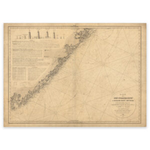
 Historical nautical chart of the stretch Jomruland and Kragerø to Kristiansand


Historical nautical chart of the stretch Jomruland and Kragerø to Kristiansand
Nautical chart from 1856 covering the stretch from Jomfruland and Kragerø to Kristiansand. The map is delivered in its original size of 90.6 x 59.2 cm. The size with frame and passepartout is 110.6 x 81.2 cm. Would you like the map in a different size? Just get in touch – we’ll be happy to give you a quote for customization.