-
Havøysund National Scenic Routes
Map/booklet showing National Scenic Route Havøysund (Rv 889) – a spectacular 67 km drive from Kokelv to Havøysund with viewpoints, rest areas, and nature experiences in one of Norway’s most dramatic coastal landscapes.
-
Hedmarksvidda Topo 3000 Turkart
Detailed topographic hiking map of Hedmarksvidda Topo 3000 Turkart, from Nordic Maps (formerly Nordeca). Topo 3000 is a popular map series for mountain hikes and longer hikes in varied terrain.
-

Helgelandskysten National Tourist Routes
Road guide for a road trip along the Helgeland Coast, with an overview of the route, sights, and experiences along the way.
-
Helleas – roadmap (multilingual)
Detailed and clear road map of Greece at a scale of 1:700,000, designed for road trips and travel planning. The map covers the entire country and provides a quick overview of the road network, cities, ferry routes and important tourist destinations. The map is suitable for travelers who want a reliable and user-friendly road map…
-
Hemsedal Norway Series Hiking Map
Detailed hiking map of Hemsedal in the Norway Series – the classic red hiking maps that have been a trusted companion in Norwegian backpacks for generations. The maps are systematically divided with overlaps to adjacent maps, ensuring good continuity as you traverse the terrain.
-
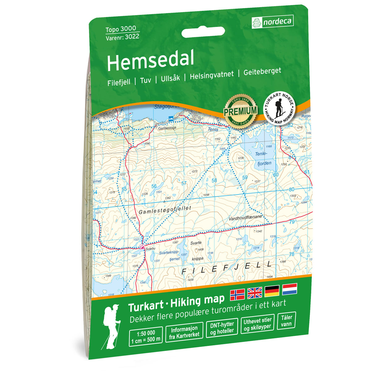
Hemsedal Topo 3000 Hiking Map
Detailed topographic hiking map of Hemsedal Topo 3000 Hiking Map, from Nordic Maps (formerly Nordeca). Topo 3000 is a popular map series for mountain trips and longer trips in varied terrain.
-
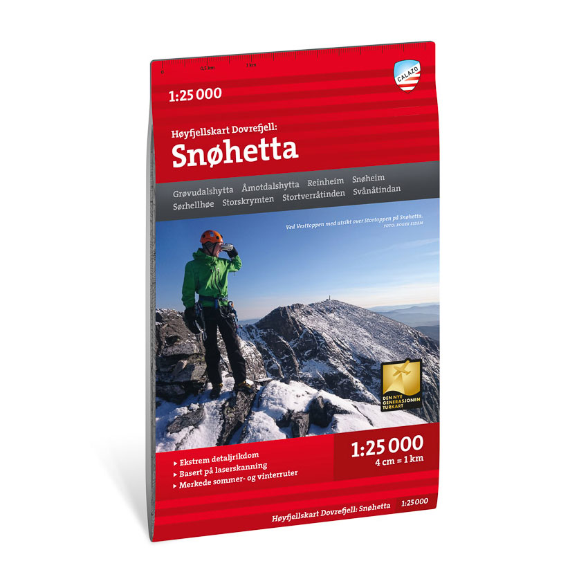
High mountain map Dovrefjell: Snøhetta 1:25,000
Detailed mountain map of Snøhetta and Dovrefjell at a scale of 1:25,000. The map is particularly suitable for summit tours and demanding hikes in the high mountains.
-
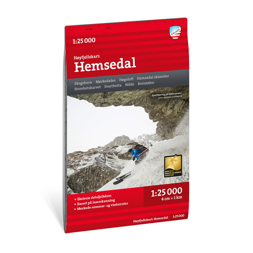
High mountain map Hemsedal 1:25.000
Detailed mountain map of Hemsedal at a scale of 1:25,000. The map is particularly suitable for summit tours and hikes in the high mountains.
-
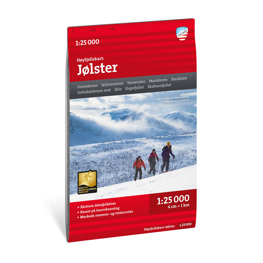
High mountain map Jølster 1:25.000
Detailed mountain map of Jølster at a scale of 1:25 000. The map is particularly suitable for hiking and trekking in the high mountains.
-
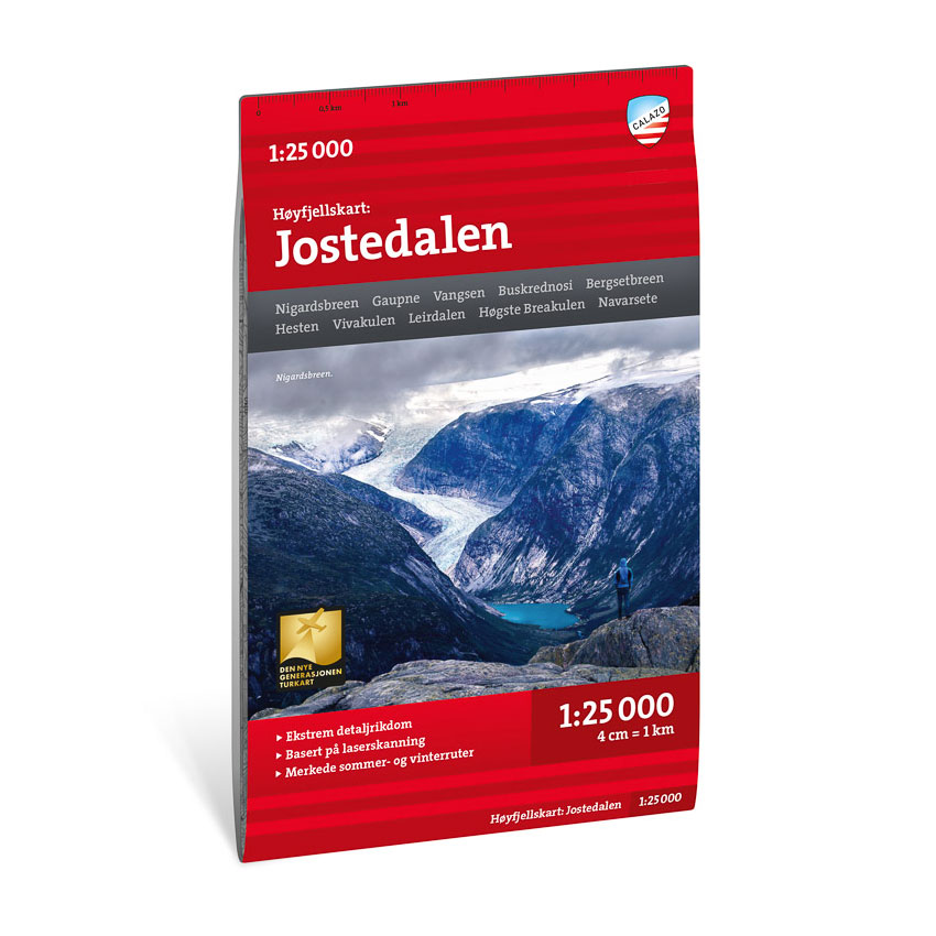
High mountain map Jostedalen 1:25.000
Detailed mountain map of Jostedalen at a scale of 1:25,000. The map is particularly suitable for summit tours and hikes in the high mountains.
-
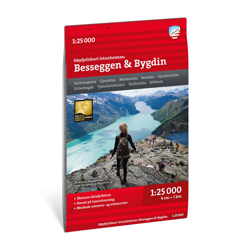
High mountain map Jotunheimen: Besseggen & Bygdin 1:25,000
Detailed high-mountain map of Besseggen and Bygdin at a scale of 1:25,000. The map is particularly suitable for the Besseggen tour and summit tours in Jotunheimen.
-

High mountain map Jotunheimen: Galdhøpiggen & Glittertinden 1:25.000
Detailed mountain map of Galdhøpiggen and Glittertinden at a scale of 1:25 000. The map is particularly suitable for summit tours in Jotunheimen.
-
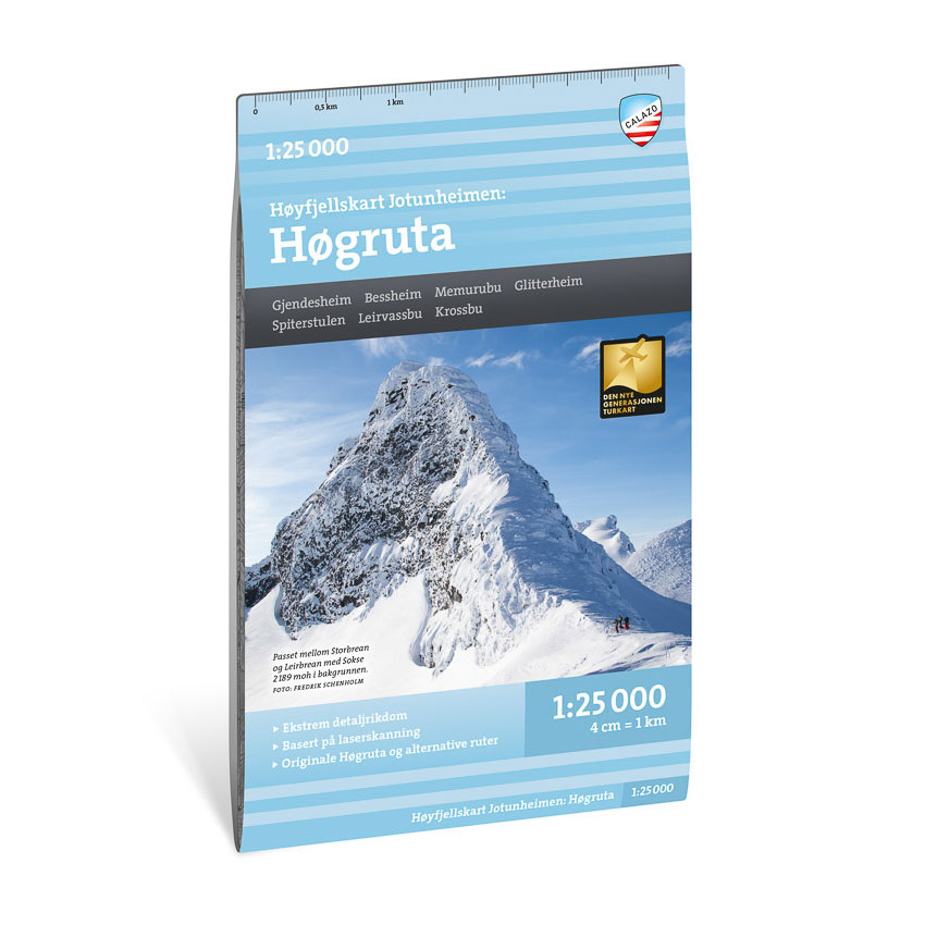
High mountain map Jotunheimen: Høgruta 1:25,000
Detailed mountain map of Høgruta in Jotunheimen at a scale of 1:25,000. The map is particularly suitable for alpine skiing and hiking in the high mountains.
-
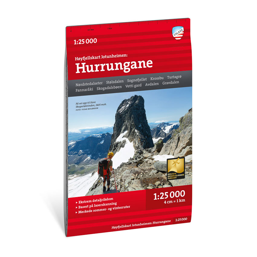
High mountain map Jotunheimen: Hurrungane 1:25,000
Detailed mountain map of Hurrungane at a scale of 1:25 000. The map is particularly suitable for alpine summit tours in Jotunheimen.
-
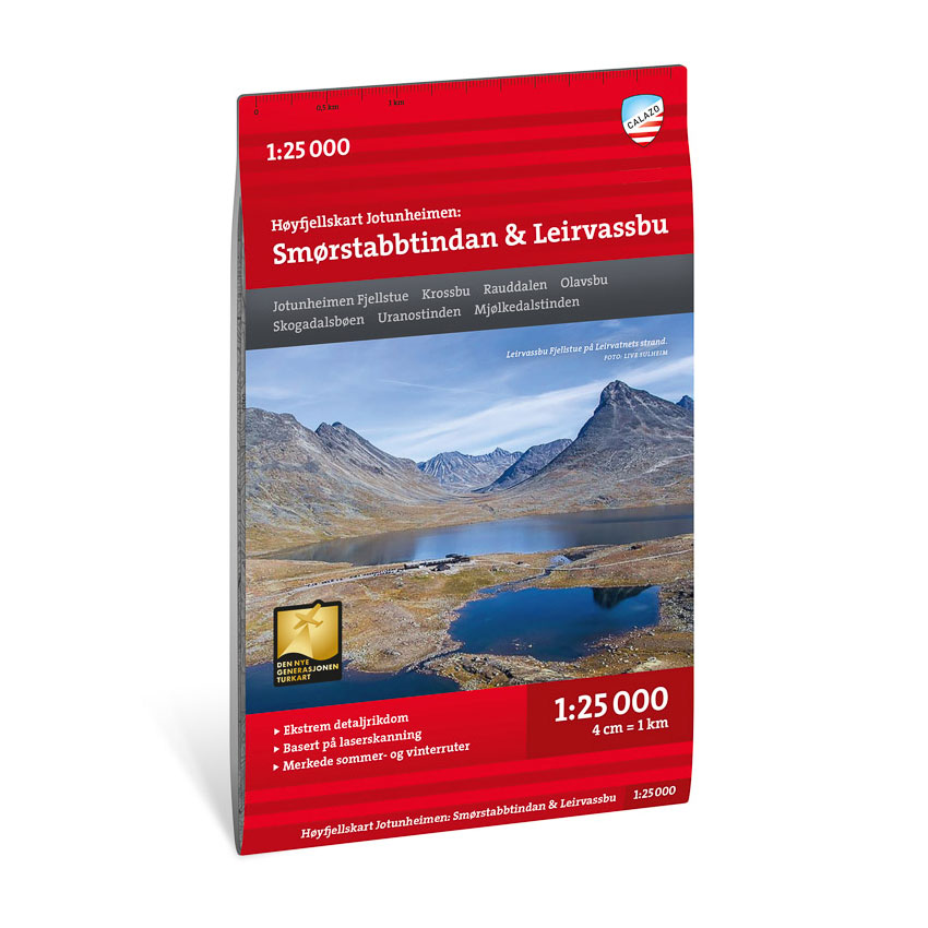
High mountain map Jotunheimen: Smørstabbtindan & Leirvassbu 1:25,000
Detailed mountain map of Smørstabbtindan and Leirvassbu at a scale of 1:25 000. The map is particularly suitable for summit tours in Jotunheimen.
-
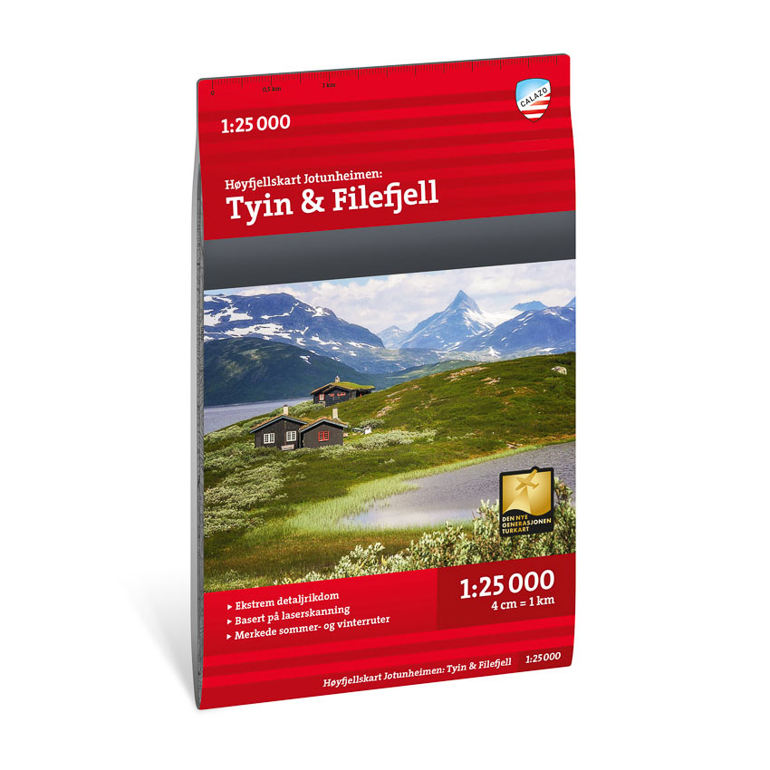
High mountain map Jotunheimen: Tyin & Filefjell 1:25,000
Detailed mountain map of Tyin and Filefjell at a scale of 1:25 000. The map is particularly suitable for hiking in the high mountains.
-
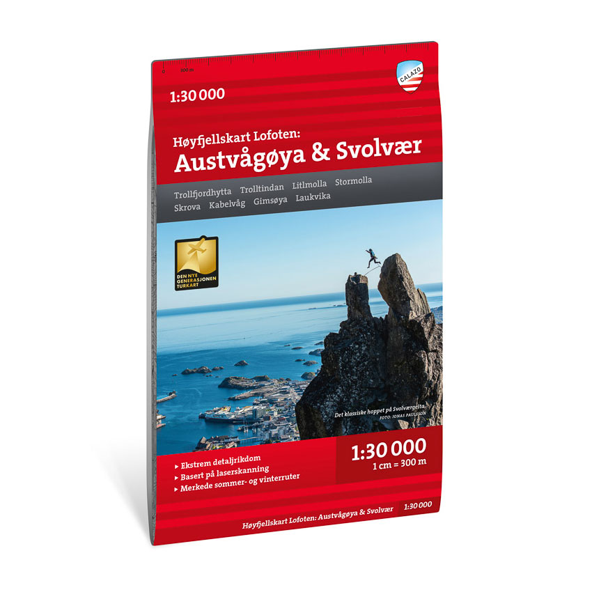
High mountain map Lofoten: Austvågøya – Svolvær 1:30.000
Detailed high mountain map of Austvågøya and Svolvær at a scale of 1:30 000. The map is particularly suitable for hiking and climbing in Lofoten.
-
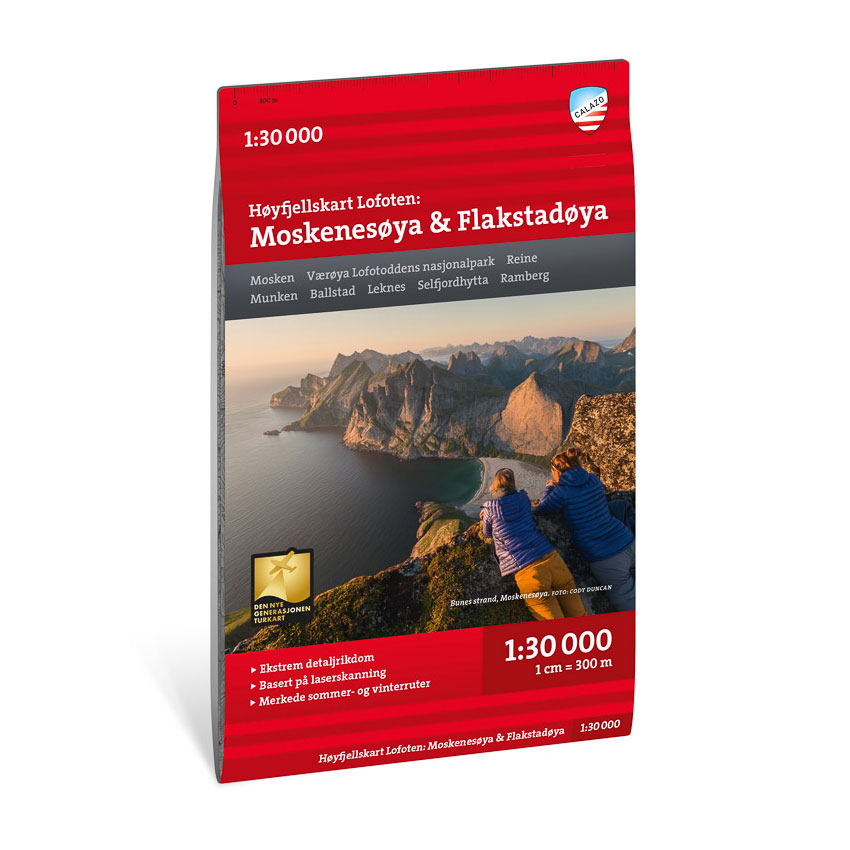
High mountain map Lofoten: Moskenesøya & Flakstadøya 1:30.000
Detailed mountain map of Moskenesøya and Flakstadøya at a scale of 1:30 000. The map is particularly suitable for hiking and climbing in Lofoten.
-
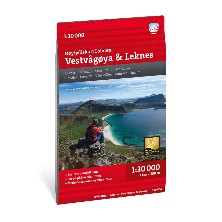
High mountain map Lofoten: Vestvågøya – Leknes 1:30.000
Detailed high-mountain map of Vestvågøya and Leknes at a scale of 1:30 000. The map is particularly suitable for hiking and outdoor activities in Lofoten.
-
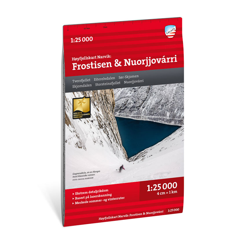
High mountain map Narvik: Frostisen & Nuorjjovárri 1:25,000
Detailed mountain map of Frostisen and Nuorjjovárri near Narvik in scale 1:25 000. The map is particularly suitable for summit hikes and glacier hiking.