-
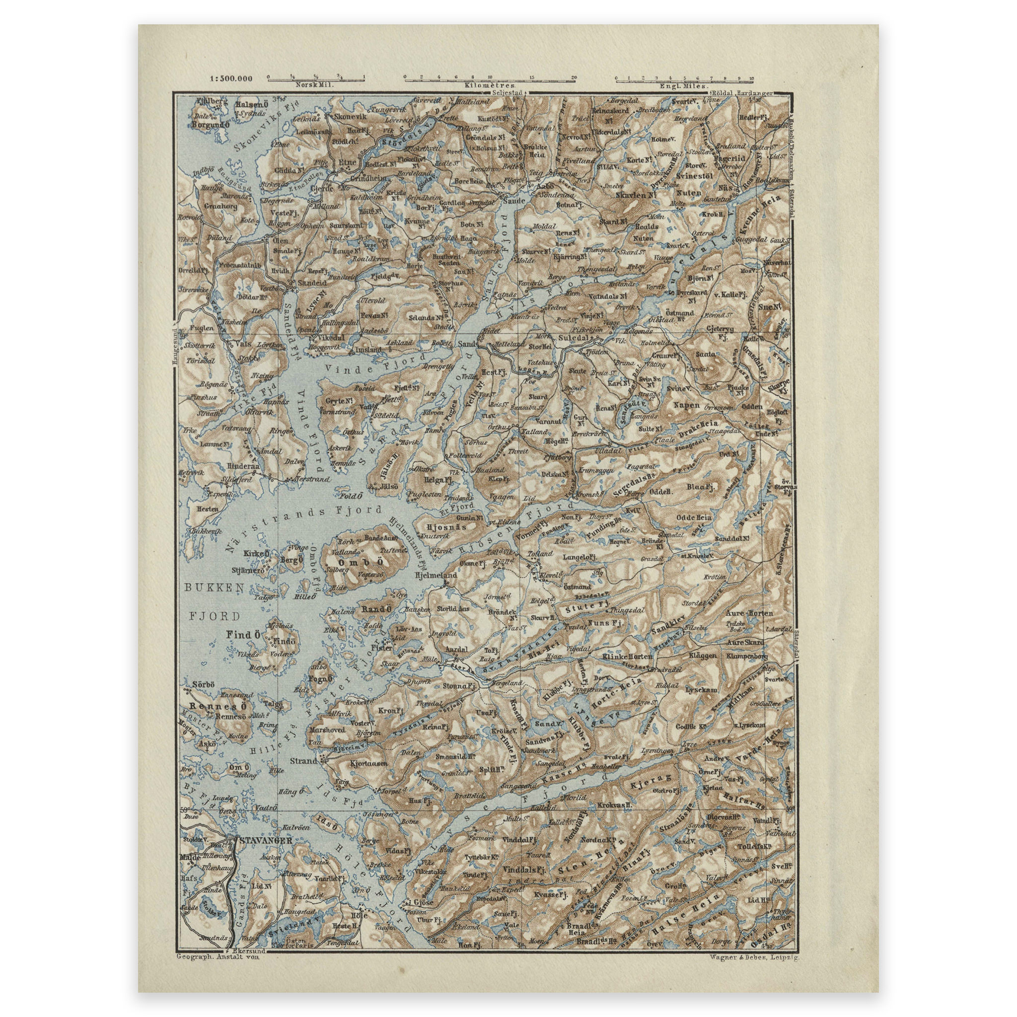
Ryfylke 1879
Map from the travel guide “Norwegen” published in 1879 by Baedecker. The map is delivered in its original size of 17.4 x 22.7 cm. The size with frame and passe-partout is 41.4 x 48.7 cm. Do you want the map in a different size? Just get in touch – we’ll be happy to give you…
-

Sandnes 1899
Hand-drawn map of Sandnes city center, Vibemyr and Smeaheia, made by Nicolai Solner Krum in 1899. The map is delivered in its original size of 115.7 x 101.2 cm. Do you want the map in a different size? Just get in touch – we’ll be happy to give you a quote for customization.
-
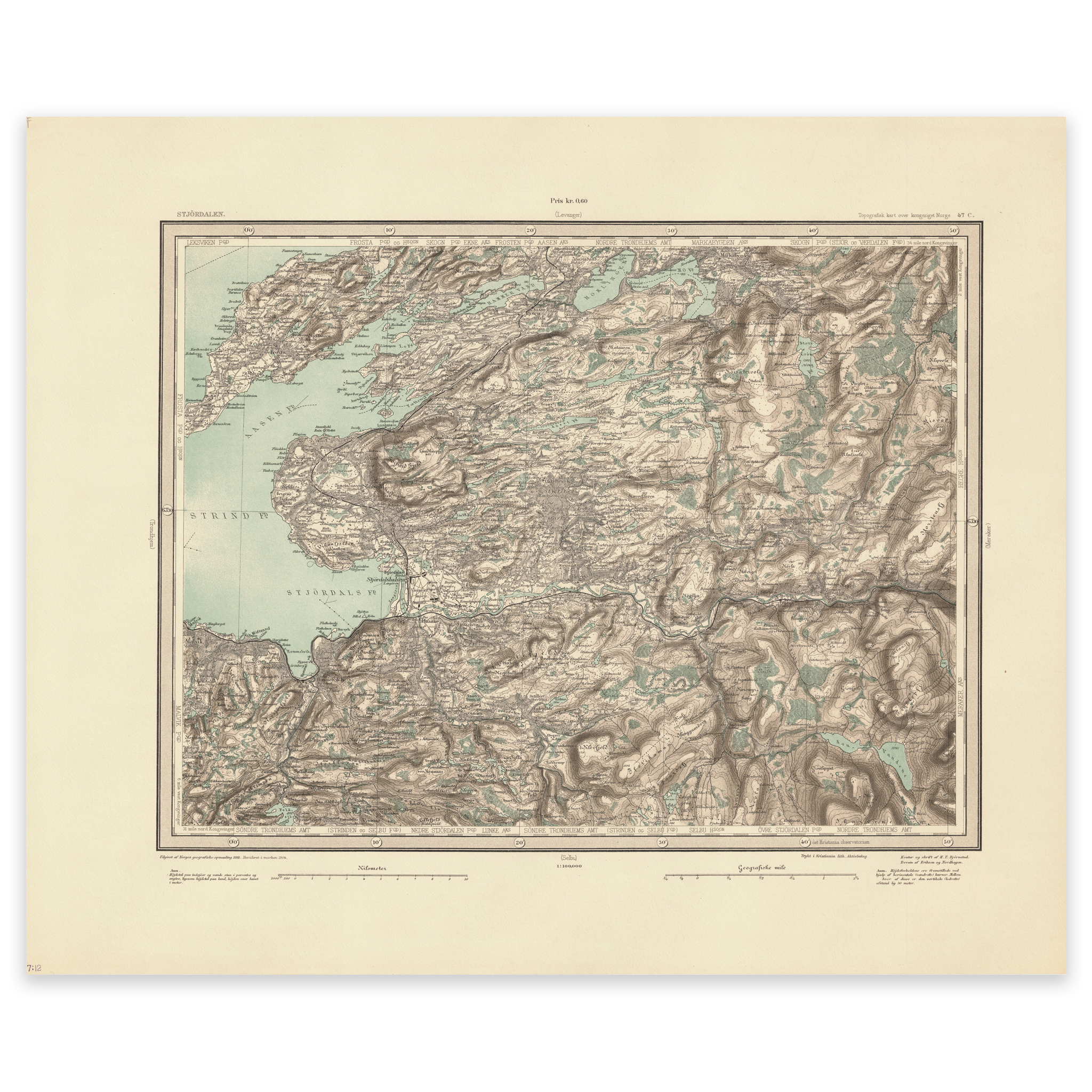
Stjørdalen 1904
Map of Stjørdalen and the area north towards Markabygda, Åsen and Frosta in Trøndelag. The map was made using the heliogravure technique by F. Eriksen, H. T. Bjørnstad and Johan Nordhagen in 1904. The map is delivered in its original size of 60.8 x 50.2 cm. The size with frame and passe-partout is 78.8 x…
-
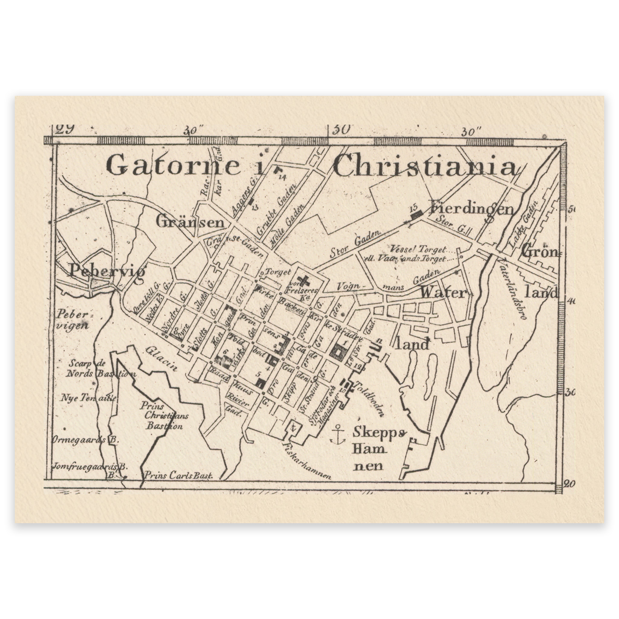
The streets of Christiania 1816
A small pocket map showing the streets of Kvadraturen in Christiania. The map comes in its original size of 9.2 x 6.4 cm. Total size for the map with frame and passe-partout is 33.2 x 32.4 cm. Do you want the map in a different size? Just get in touch – we’ll be happy to…
-
Uten innramming
-
Uten innramming
-

Vestfold, unknown year
Hand-drawn map of Vestfold, the area between Sandefjord and Larviksfjorden. The map is delivered in its original size of 29.5 x 35.7 cm. The size with frame and passepartout is 45.5 x 52.7 cm. Do you want the map in a different size? Just get in touch – we’ll be happy to give you a…