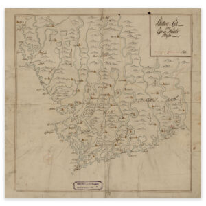

 Akershus 1720
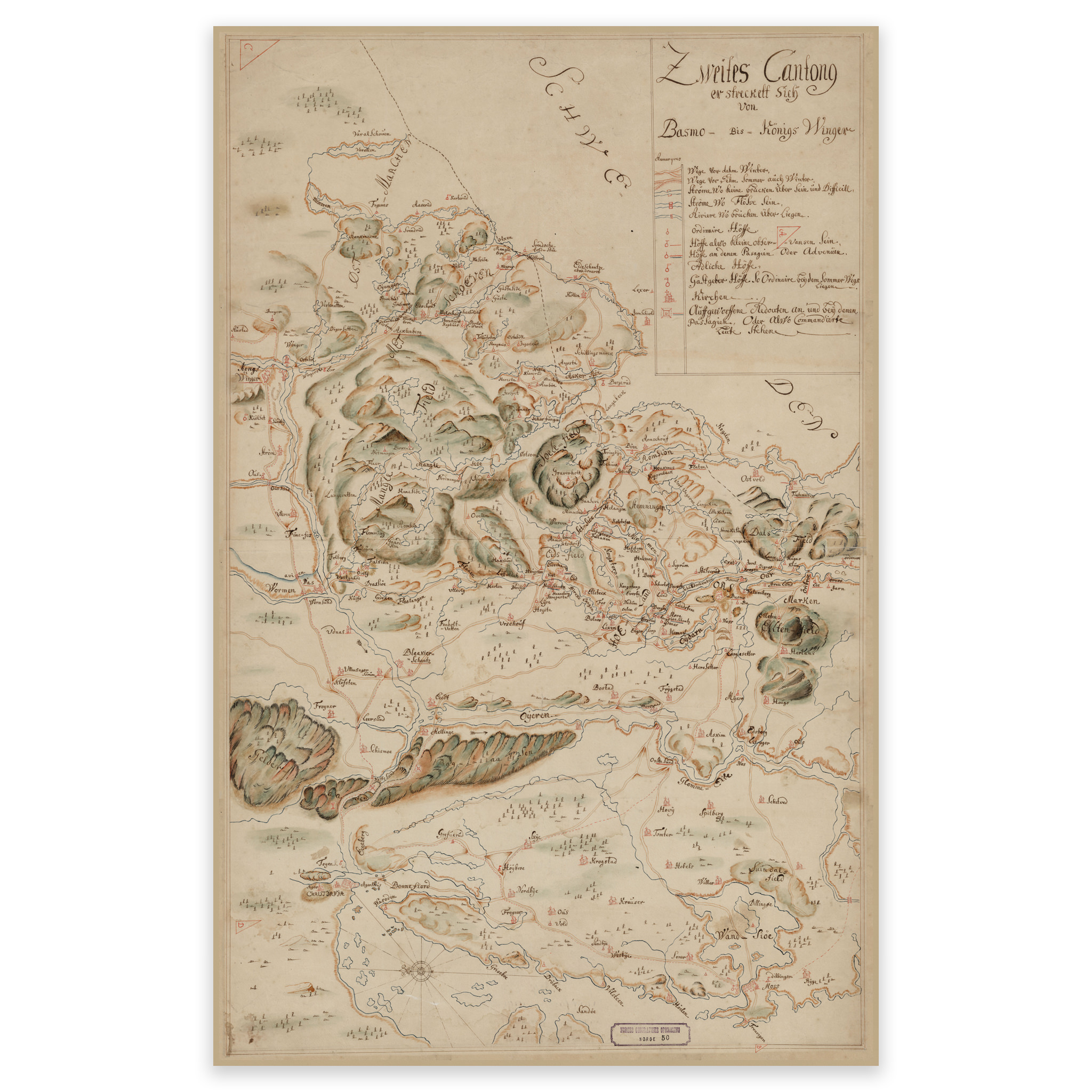
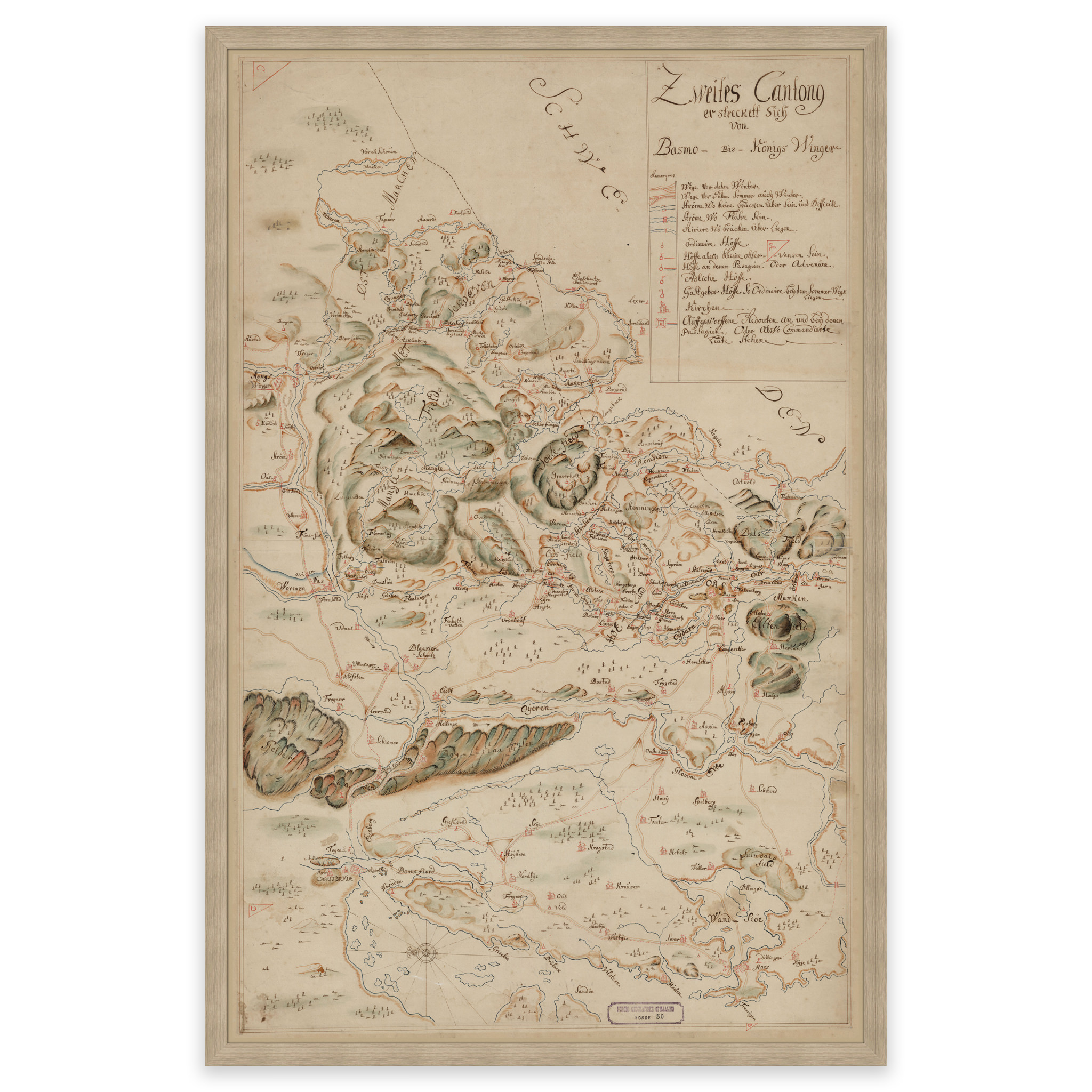

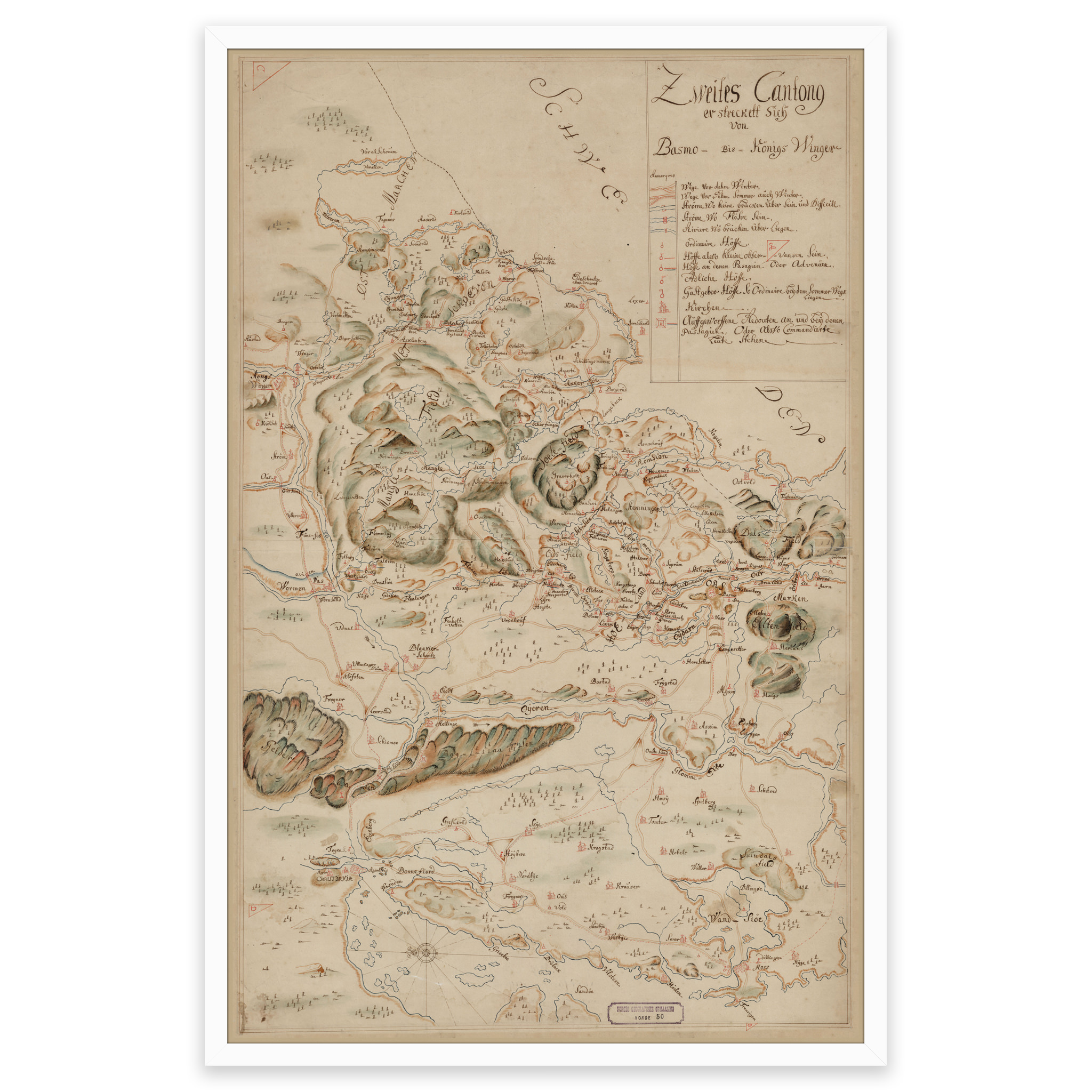
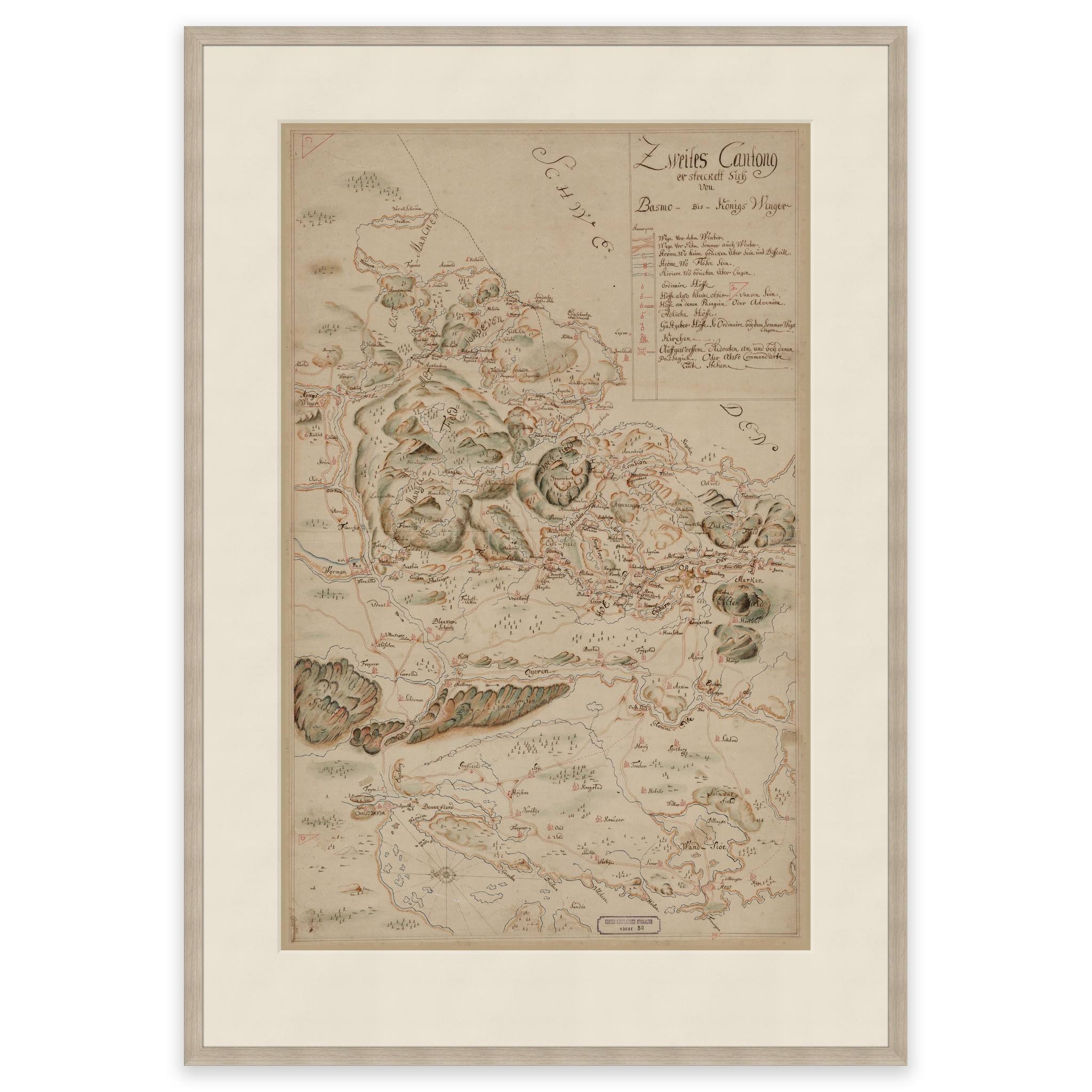
Akershus 1720
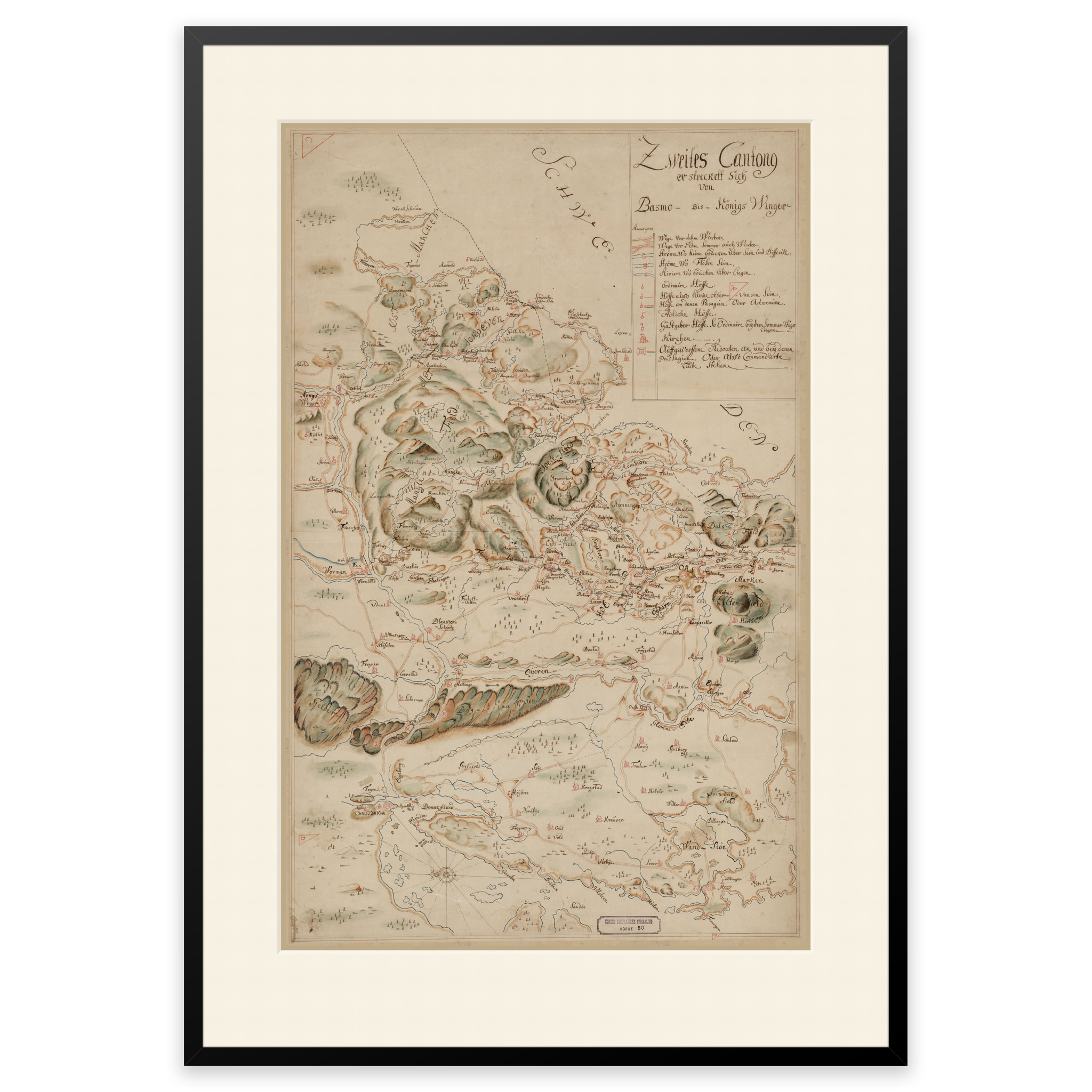
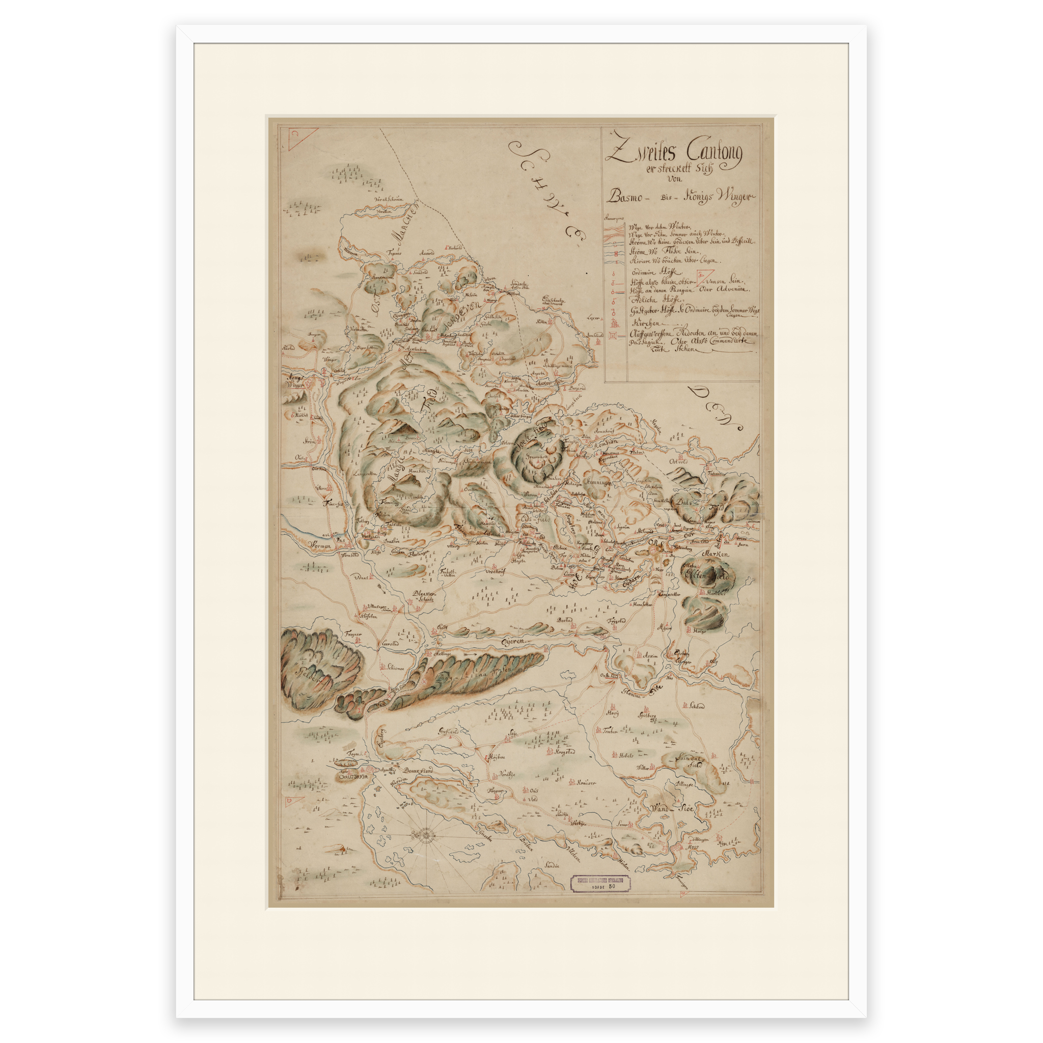
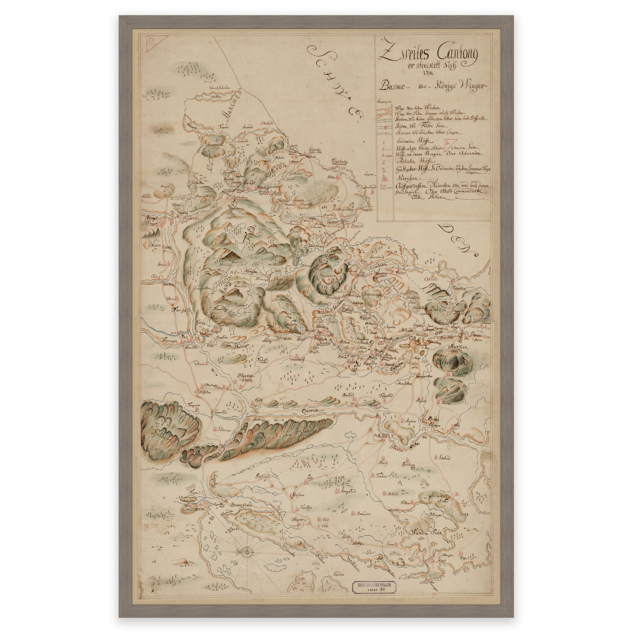
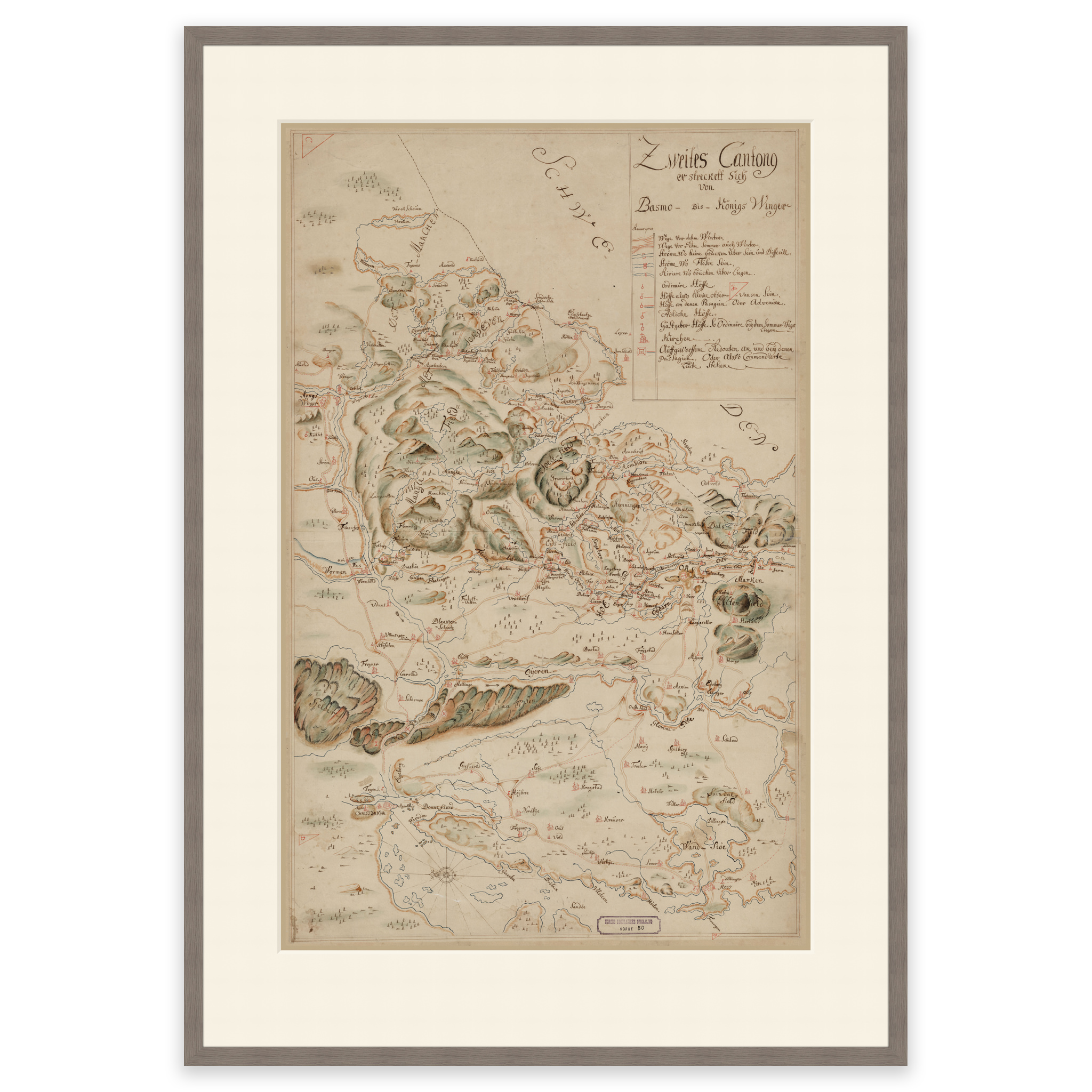
This hand-drawn map from 1720 covers the area from Oslo to the Swedish border between Kongsvinger and Ørje. The back of the map is labeled “Land Carte af Norge af Generallieutenant von Arentskiold”. The map is delivered in its original size of 67.3 x 73.5 cm. The size with frame and passepartout is 87.3 x 95.5 cm. Would you like the map in a different size? Just get in touch – we’ll be happy to give you a quote for customization.