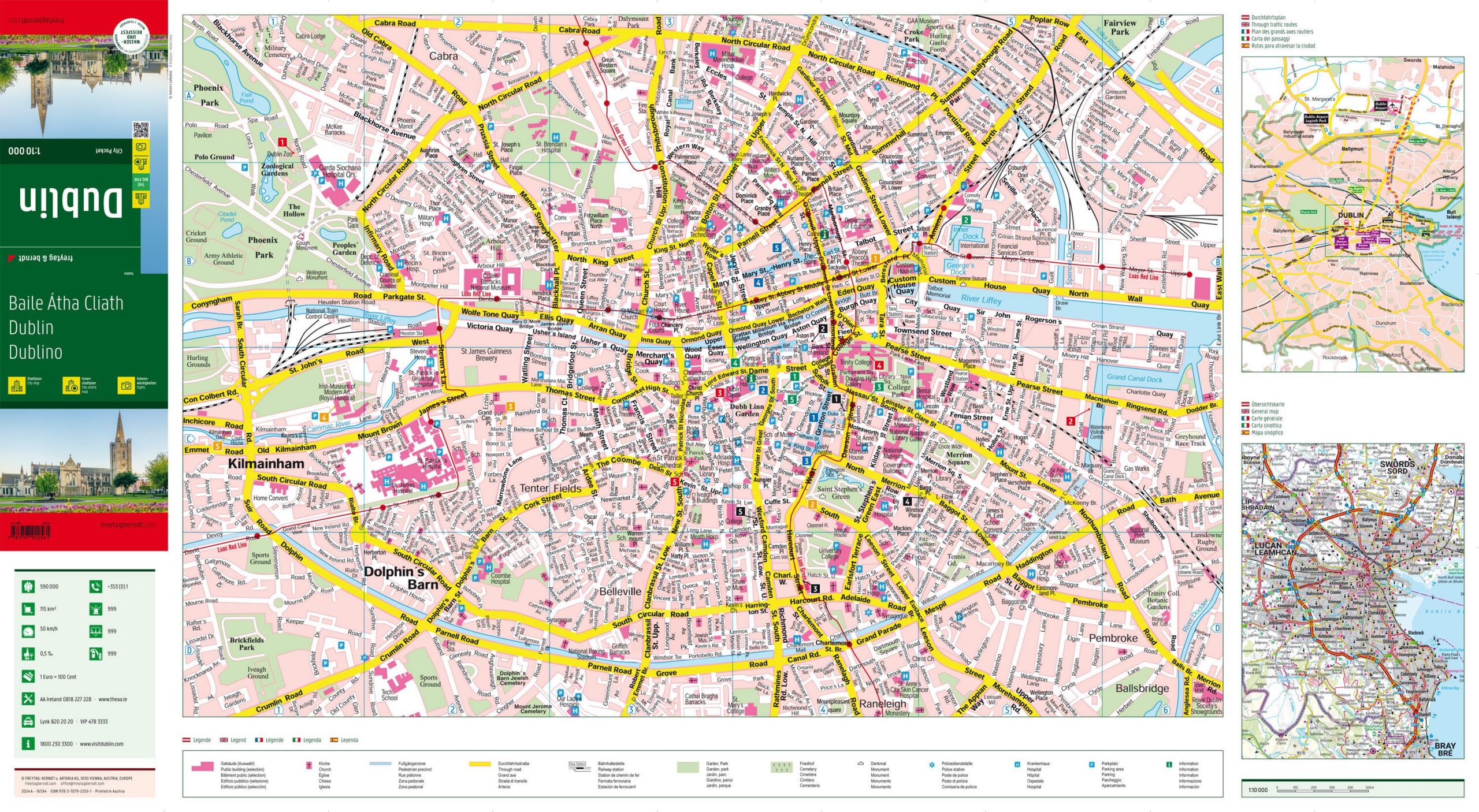
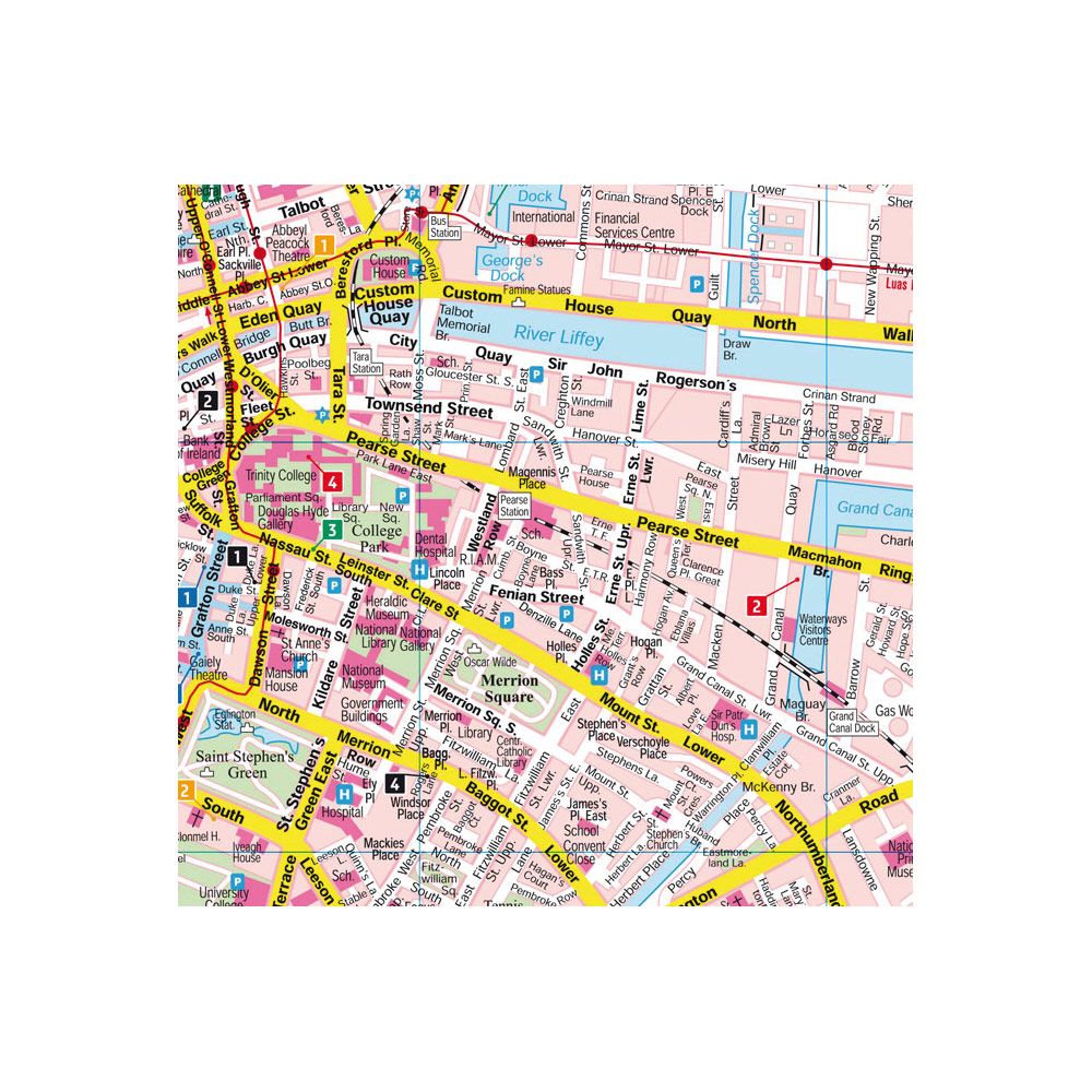
Description
This detailed city map shows the center of Dublin and provides a clear representation of the city center with a focus on streets, key areas and important connections. The map has been developed in a compact format that makes it easy to take with you and is suitable for both planning and orientation during your stay in the city.
The map provides a precise representation of the street network and makes it easy to find your way between sights, districts and important hubs. In addition, the map contains information about public transport and a street and place index that simplifies navigation. This makes the map useful for both short stays and more in-depth exploration of the city.
The map is printed on durable, water-resistant and tear-resistant material, making it suitable for outdoor use in varying weather conditions. The clear cartography provides good readability and makes it easy to orientate yourself in the city’s structure.
Release year: 2024.