Description
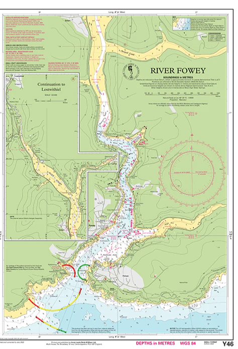
This nautical chart covers River Fowey in South West England, providing a detailed representation of the river course and approach from the coast. It is part of Imray’s Y-series, which consists of single maps in a convenient format, and is suitable both as a supplement to larger map packs and for local navigation.
The map covers the area from the entrance to the river and further up to Lostwithieland provides a good overview of the waters for smaller vessels. It includes detailed depth indications, navigational information and important landmarks that are useful for both approaching and traveling up the river.
The map is in A2 format and comes folded to A4, making it easy to handle on board. It is printed on water-resistant paper and delivered in a plastic folder to withstand use in maritime environments. The map is a reproduction of a section from Imray’s larger map package for the area, and therefore provides the same level of detail in a more compact format.
The map includes the following coverage: the approach to the River Fowey from the coast, the course of the river further inland with navigation details, as well as further coverage up to Lostwithiel at a scale of 1:20,000. The map provides a good basis for safe navigation in the river and is especially adapted for recreational boats and smaller vessels.
This is a practical and specialized map for sailors who want detailed coverage of one of the most distinctive river areas in Cornwall.
Release year: 2022.