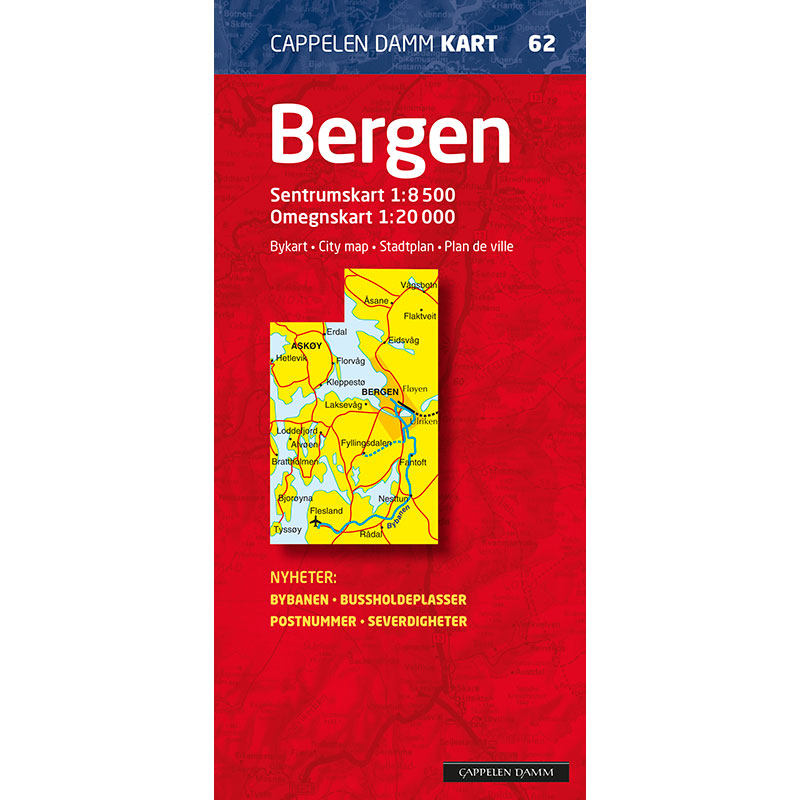
Description
Bergen city map 2019 from Cappelen Damm Kart is a detailed and updated city map that provides a full overview of Bergen city center and surrounding areas. The map was published in 2019 and is part of the Cappelen Damm city map series (no. 62).
This edition includes the light rail, bus stops and bus route numbers. The map covers urban areas such as Flesland, Lagunen, Nesttun, Paradis and Fyllingsdalen in the south, Askøy, Litle Sotra, Loddefjord and Mathopen in the west, and Eidsvåg and Åsane in the north. The detailed city center section extends from Sandviken in the north to Minde, Landås and Krohnsminde in the south.
All road names are clearly marked and a number of house numbers are included for easy navigation. The map has a comprehensive road name index with over 2300 names. Motorists will find information about one-way streets, toll booths, toll stations, gas stations, roundabouts, parking garages and parking lots.
Cyclists get an overview of recommended cycle paths, and pedestrians find pedestrian streets, walkways, paths and bus stops. For city tourists, museums, sights, shopping areas, pharmacies, liquor stores, hotels, tourist information, cinemas, theaters and parks are clearly marked. Explanations are provided in Norwegian, English, German and French.
Cappelen Damm no longer publishes maps and atlases. This product is sold from existing stock, and will be available while stocks last. When the stock is empty, the map will not be printed in a new edition.