

 Bodø 1906
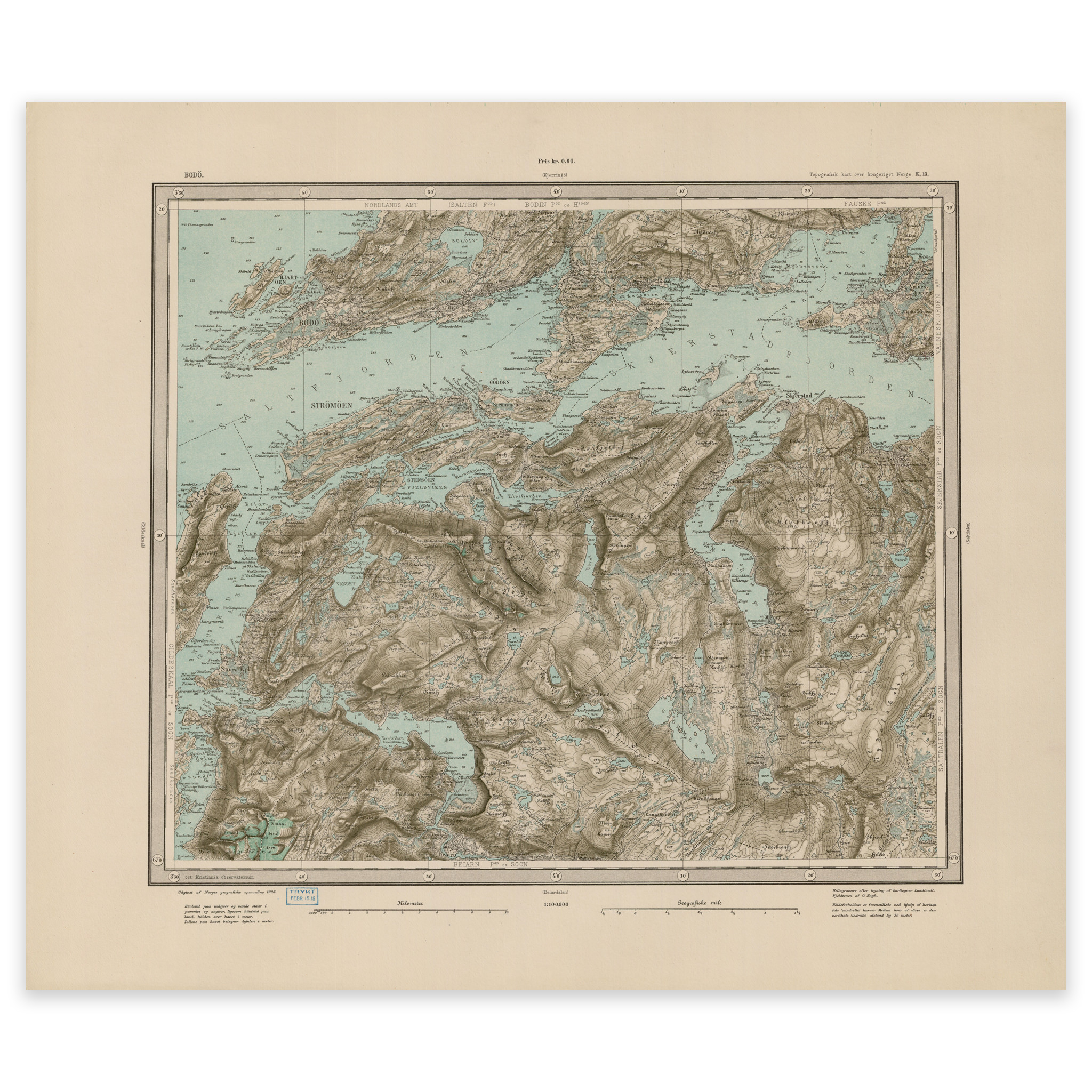


Bodø 1906
Map from 1906 made by Ole Engh and Torgrim Lundtvedt in 1906 over the area Bodø, Skjerstadfjorden and Beiarfjorden. The map is delivered in original size 59.4 x 50.7 cm. The size with frame and passe-partout is 77.4 x 69.7 cm. Would you like the map in a different size? Just get in touch – we’ll be happy to give you a quote for customization.