
 Bold 1883


Bold 1883
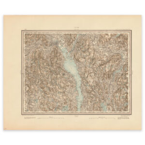
Map of the area Lillestrøm and Øyeren from 1883. The map is made by H. T. The map is delivered in original size 60.3 x 50.2 cm. The size with frame and passe-partout is 78.3 x 69.2 cm. Would you like the map in a different size? Just get in touch – we’ll be happy to give you a quote for customization.