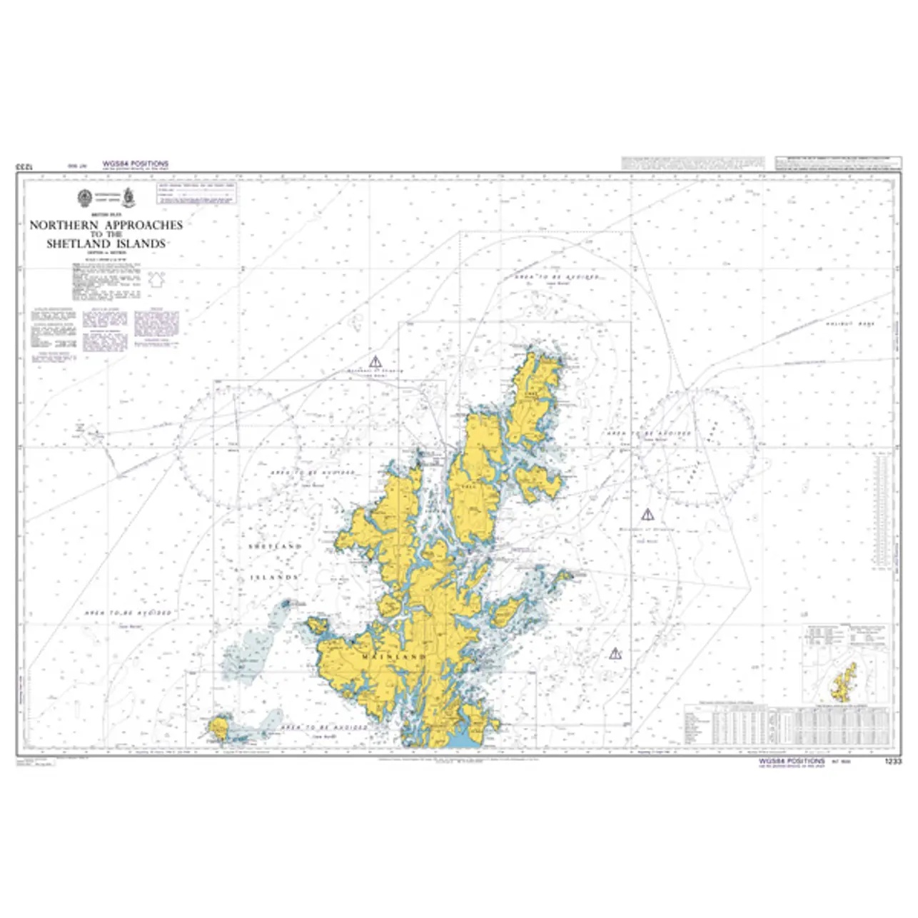
Description
British Admiralty Chart 1233 is an official nautical chart published by the UK Hydrographic Office and covers the main approaches and approaches to the Shetland Islands. The chart is intended for navigation in open and exposed waters and provides a comprehensive overview for sailing to and around the archipelago.
The chart shows the main shipping lanes, overseas approaches, depth conditions, seabed conditions, navigational hazards, lighthouses, beacons and other important navigational aids. It provides a solid planning basis for both professional shipping and experienced leisure sailors operating in the North Atlantic and the waters north of Scotland.
British Admiralty charts are used internationally by the merchant navy and meet current requirements for official navigation. The charts are printed on durable paper and are continuously updated through Admiralty Notices to Mariners, ensuring high reliability and navigational safety.