Description
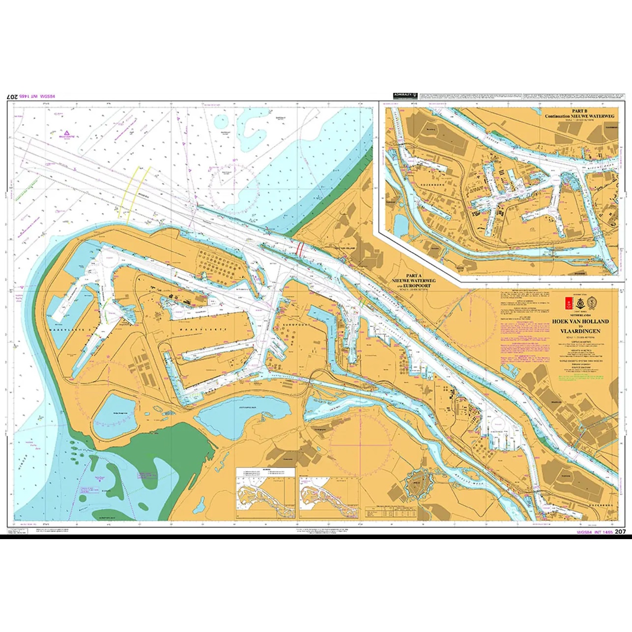
British Admiralty Chart 207 covers the stretch from Hoek van Holland to Vlaardingen along the Nieuwe Waterweg, including port facilities, wharves, docks, fairways and detailed navigational information in the river course towards Rotterdam.
The chart shows a highly trafficked and regulated waterway with extensive commercial shipping, and provides precise information on depths, leads, traffic separation and navigation installations. It is suitable both for active navigation and for planning voyages in and out of the Rotterdam port area via the Nieuwe Waterweg.
British Admiralty charts are official nautical charts with high cartographic precision and are used internationally by both professional navigators and recreational boaters operating in challenging waters.