Description
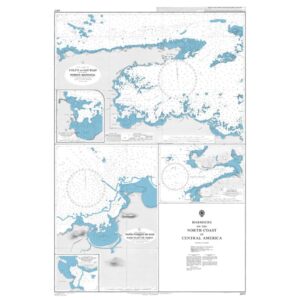
This British Admiralty nautical chart brings together detailed harbor charts along the north coast of Central America towards the Caribbean. The chart consists of several insets covering key ports, bays and approaches, providing detailed information on depths, navigation marks, wharves and local navigational obstructions.
The chart is particularly well suited for port entry, berthing and maneuvering in coastal and restricted waters. Developed for professional navigators, it provides a precise chart basis for safe operations in and around the ports along this part of the Central American coast.