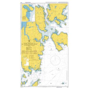
Description
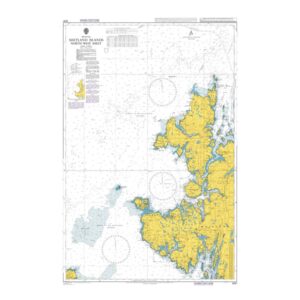
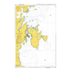
British Admiralty Chart 3292 covers the eastern approaches to Yell Sound in Shetland, including nearby coastlines, islands and sounds. The chart shows detailed depths, reefs, beacons and navigational information necessary for safe navigation in these complex waters.
Yell Sound is an important transit area between the islands of Shetland and is used by both local traffic and vessels in transit. The chart is well suited for coastal navigation, route planning and sailing in areas with narrow straits and varying currents.
British Admiralty charts are official nautical charts known for their high cartographic quality and are used internationally by both recreational sailors and professional navigators.