Description
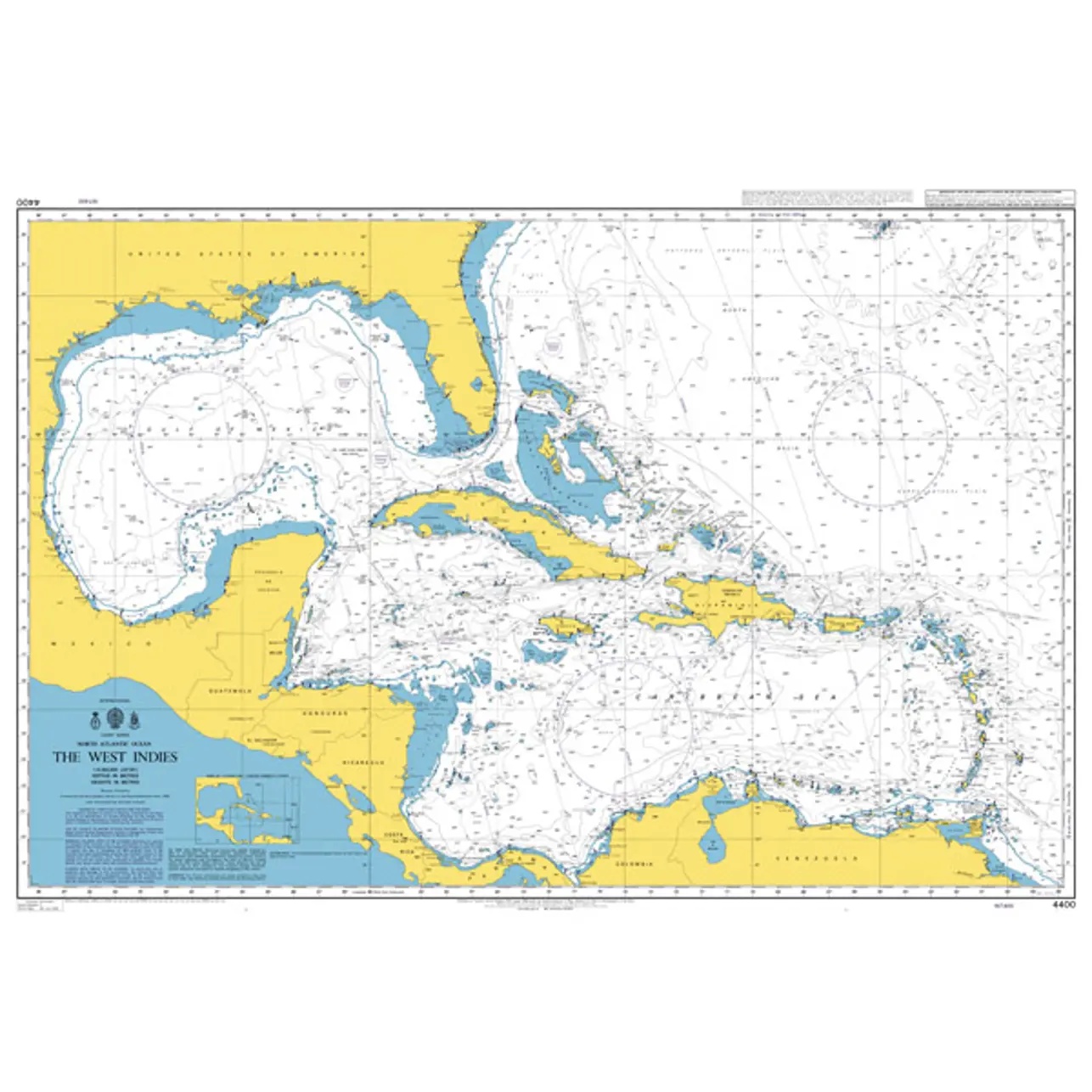
This British Admiralty chart covers much of the North Atlantic with a particular focus on the Caribbean and West Indies, as well as connections between the North American continent, Central America and the Caribbean archipelagos. The map provides a comprehensive picture of the main sailing routes in one of the world’s busiest ocean areas for transatlantic sailing.
The chart is designed for route planning and strategic navigation work, and is well suited as a support tool for long-distance sailing, teaching and general orientation. It provides an overview of large geographical contexts, rough currents and important sailing corridors, but is not intended for detailed coastal or harbor navigation.
This chart is suitable for sailors, professional navigators and maritime operators who need a planning chart of the North Atlantic and Caribbean, either as a supplement to operational charts or as part of preparatory navigation work.