
Description
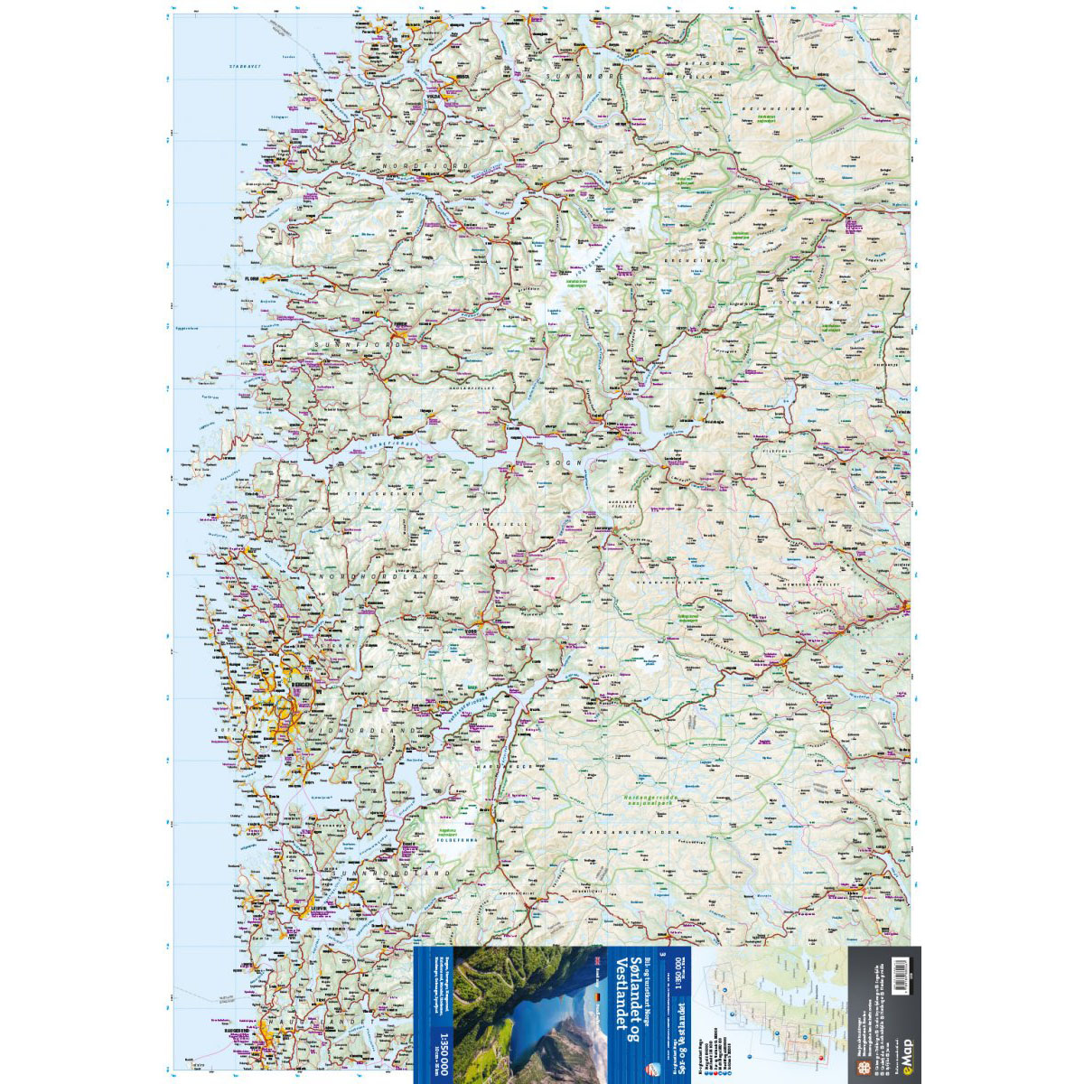
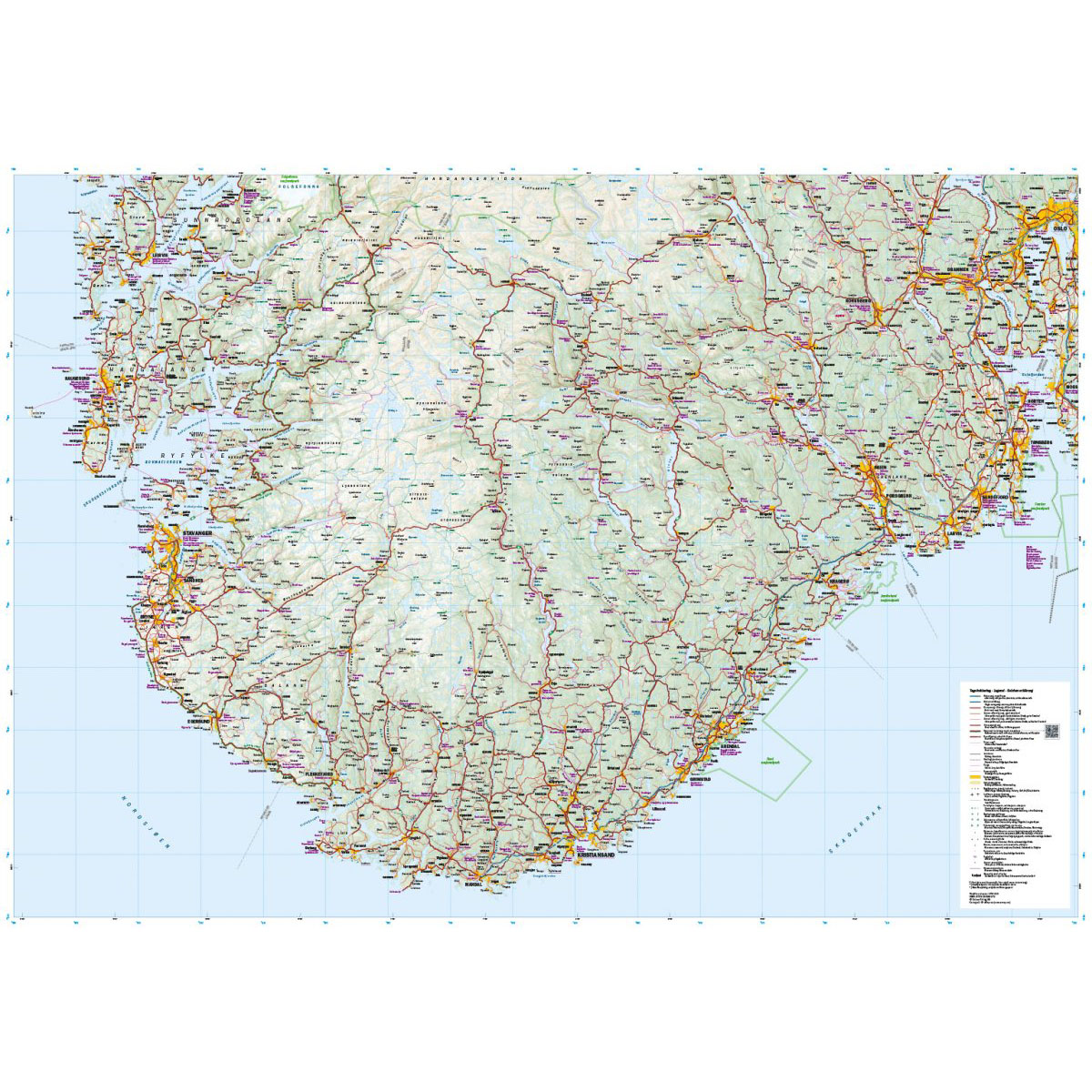
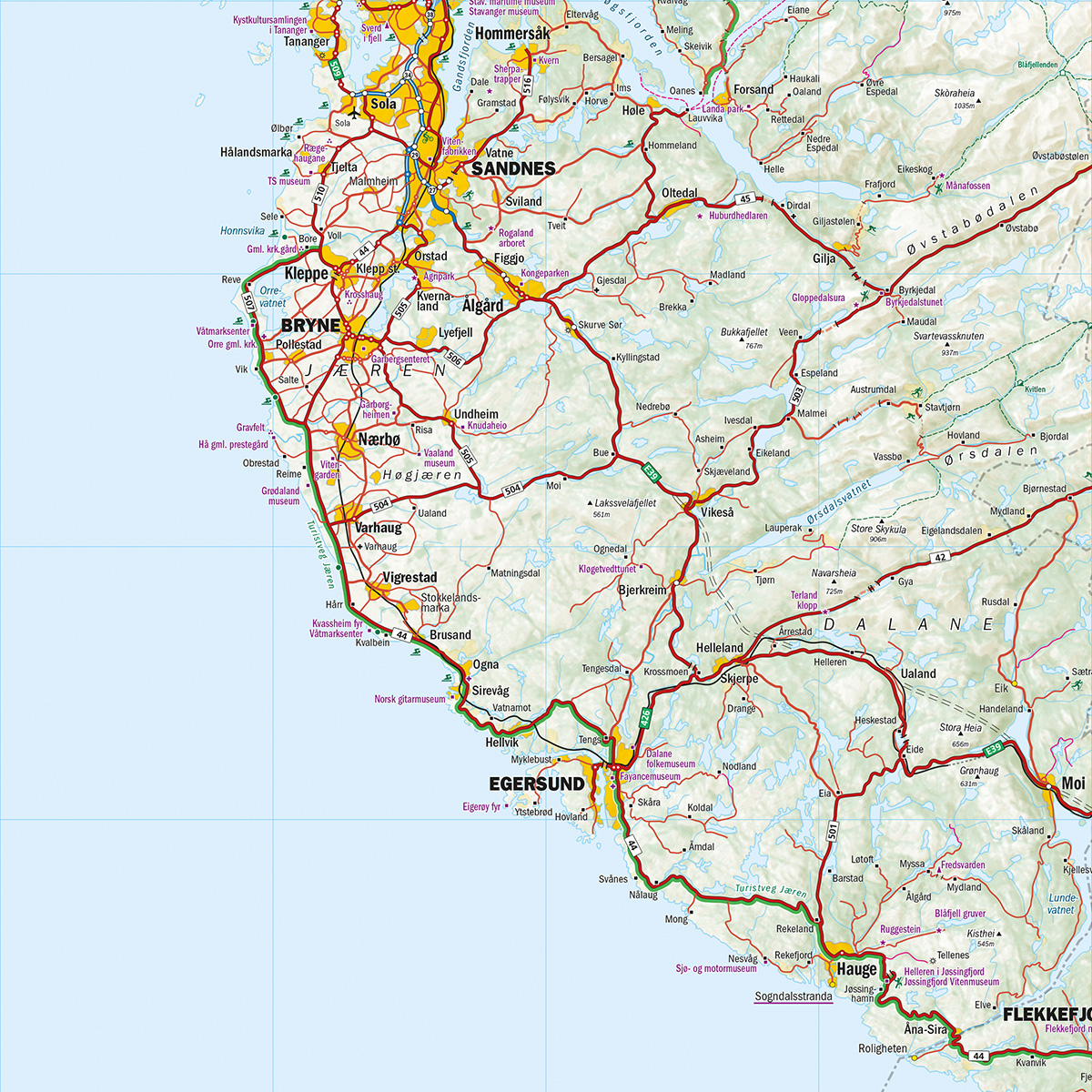
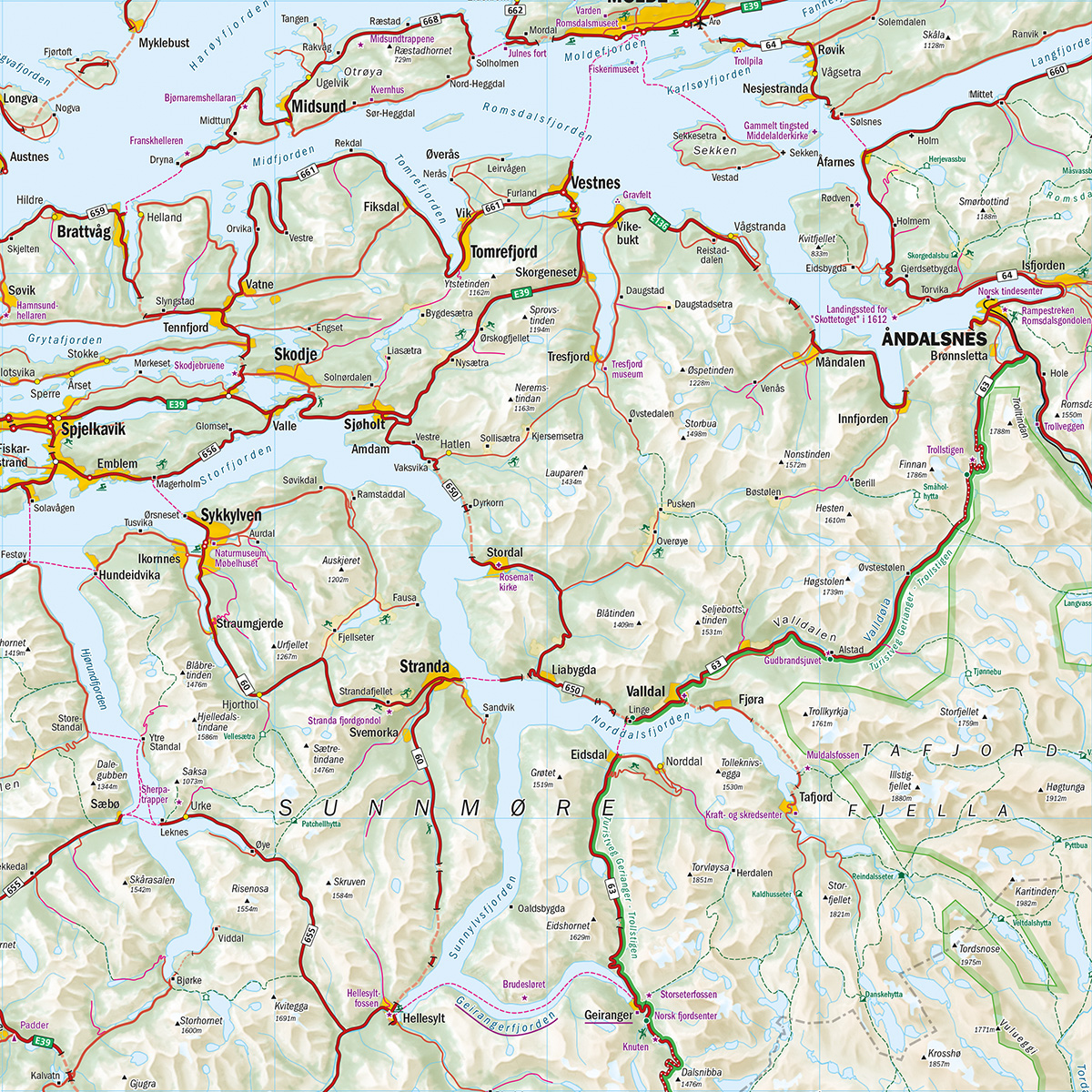
This car and tourist map covers southern and western Norway and provides an overview from Oslo to Stavanger, as well as western Norway around Bergen. The map includes Lysefjorden, Hardangervidda and Sognefjorden, and provides a good overview of the region’s road network and travel options.
Roads, ferry connections and towns are clearly marked, and the map highlights national tourist routes as well as key natural and cultural attractions. This makes it easy to plan routes between the coast, fjords and mountains – whether you’re traveling by car, motorhome or motorcycle.
The map is at a scale of 1:350,000, which provides a good regional overview. At this scale, 1 cm on the map corresponds to 3.5 km in the terrain, which makes the map well suited for planning longer stages and travel through larger areas.
The map is printed on durable paper suitable for travel.
Calazo Förlag is a Swedish publishing house specializing in maps and books for outdoor life in the Nordic region.
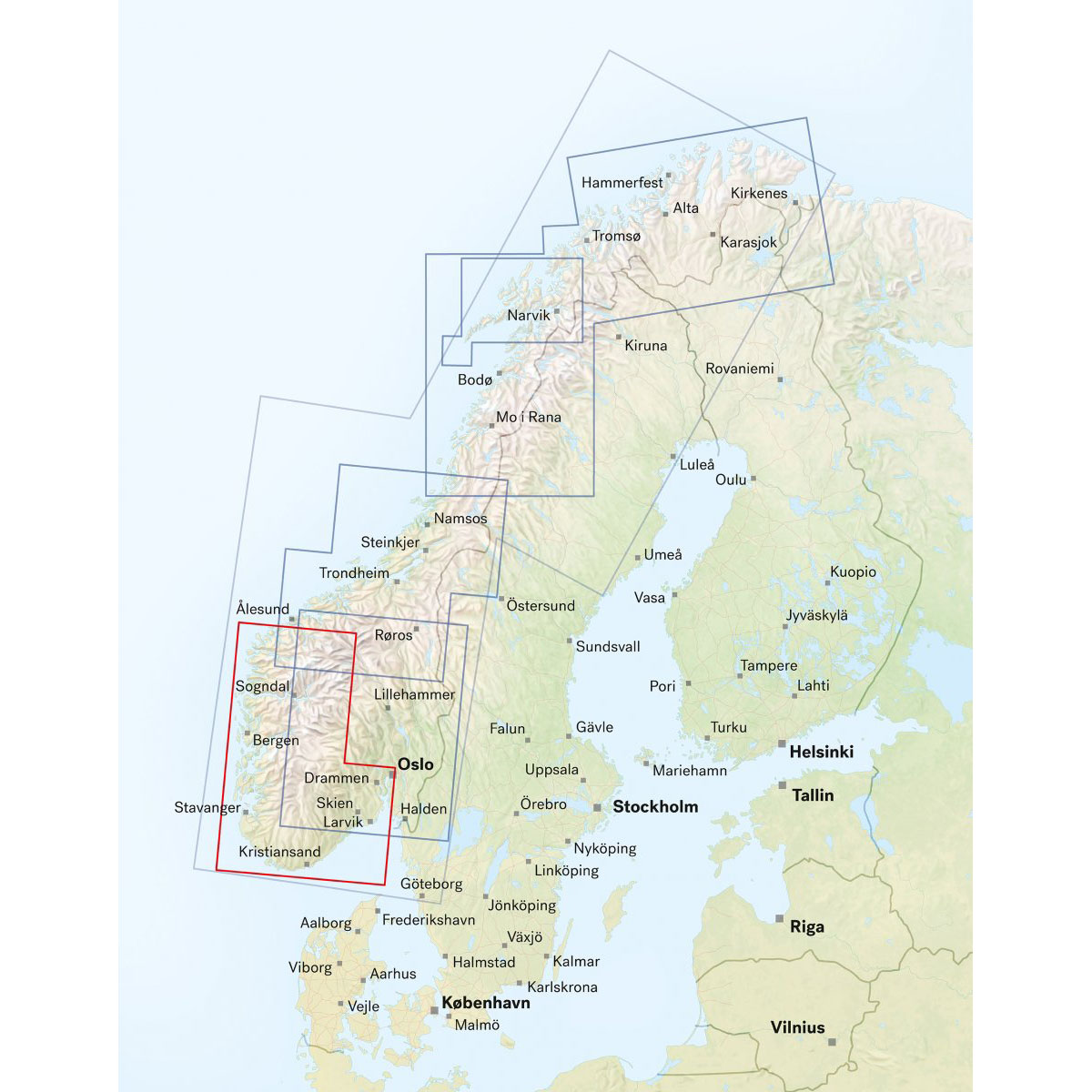
Here you can see the area the map covers:
The map is released in 2025.