Description
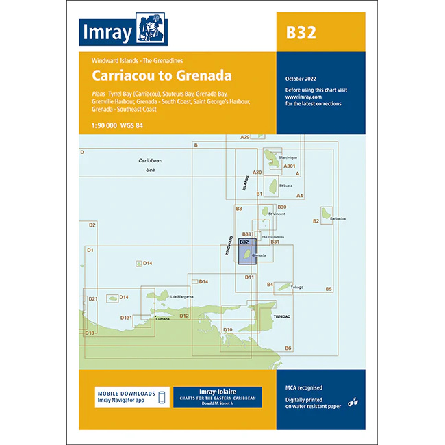
This boating chart covers the sailing area between Carriacou and Grenada in the Windward Islands / Grenadines in the southern Caribbean. The chart provides detailed plans for both coastal waters and key ports and anchorages in a popular area for island hopping and long distance sailing.
The map includes detailed chart sections for Tyrrel Bay (Carriacou), Saline Bay, St. George’s Harbour, Grenada – southeast coast, as well as approaches and coastal stretches around Grenada. The area is characterized by stable trade winds, short sailing distances between the islands and good anchoring conditions.
The chart is well suited for leisure boats and sailboats sailing locally between Carriacou and Grenada or as part of a voyage through the Grenadines. Imray is a renowned British chart manufacturer and their charts are developed with a focus on high readability, practical navigation and clear presentation of navigation-relevant information.