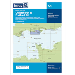
Description
This boating map covers the English south coast from Christchurch in the east to Portland Bill in the west. The map includes detailed plans of key harbors and ports of call such as Portland Harbour, Weymouth Harbour, Lulworth Cove, Worbarrow Bay, Chapman’s Pool, Swanage, Studland Bay and Christchurch.
The map is well suited for leisure boats and sailboats traveling along this part of the south coast of England, either as part of coastal sailing in the English Channel or in connection with longer legs westward. The area offers varied navigational conditions, with tidal currents, exposed coastal areas and several popular anchorages.
Imray is a recognized British chart manufacturer with extensive experience in nautical cartography for leisure and long-distance sailing. Their charts are renowned for their legibility, practicality and clear presentation of information relevant to leisure boating navigation.