

 Christiania 1774
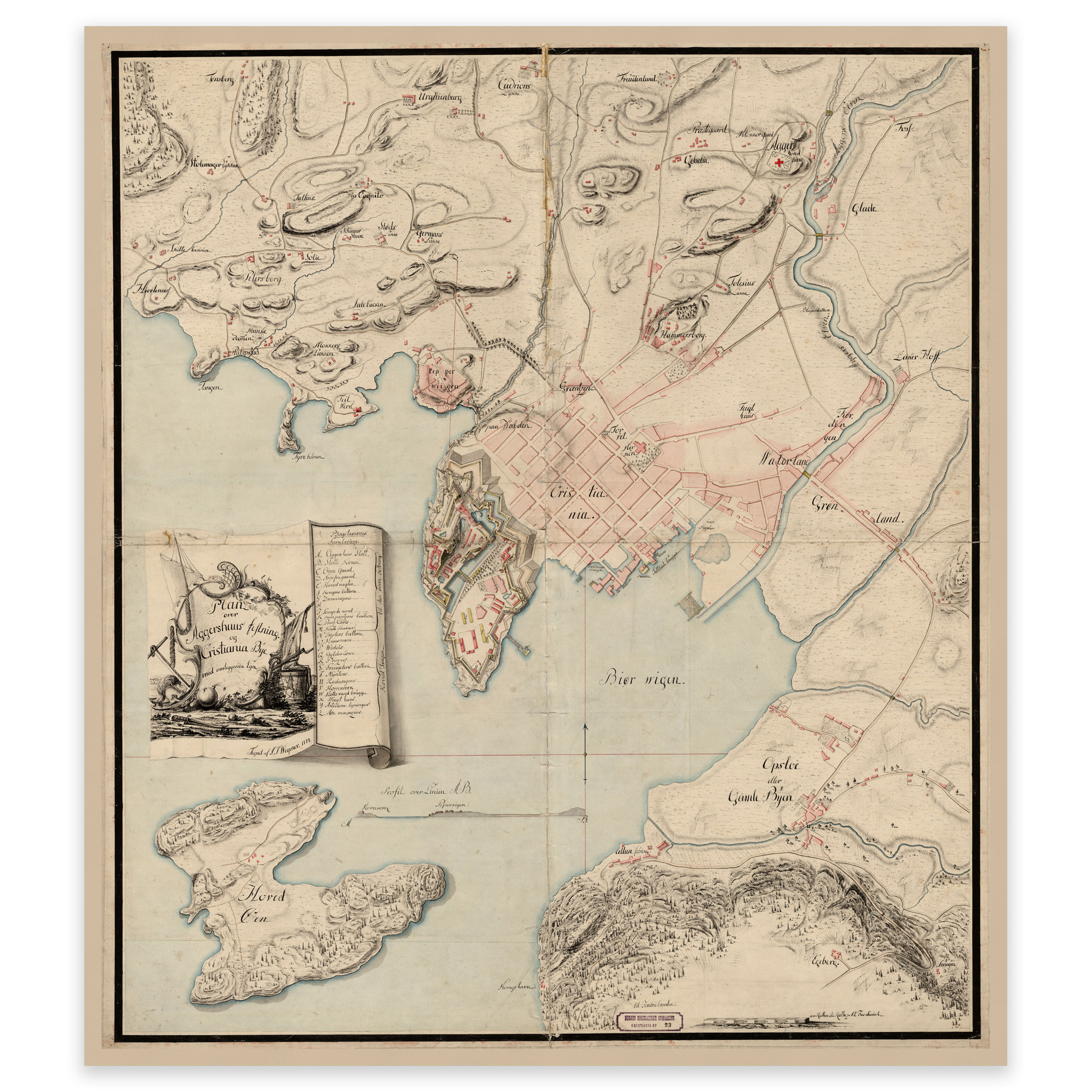

Christiania 1774
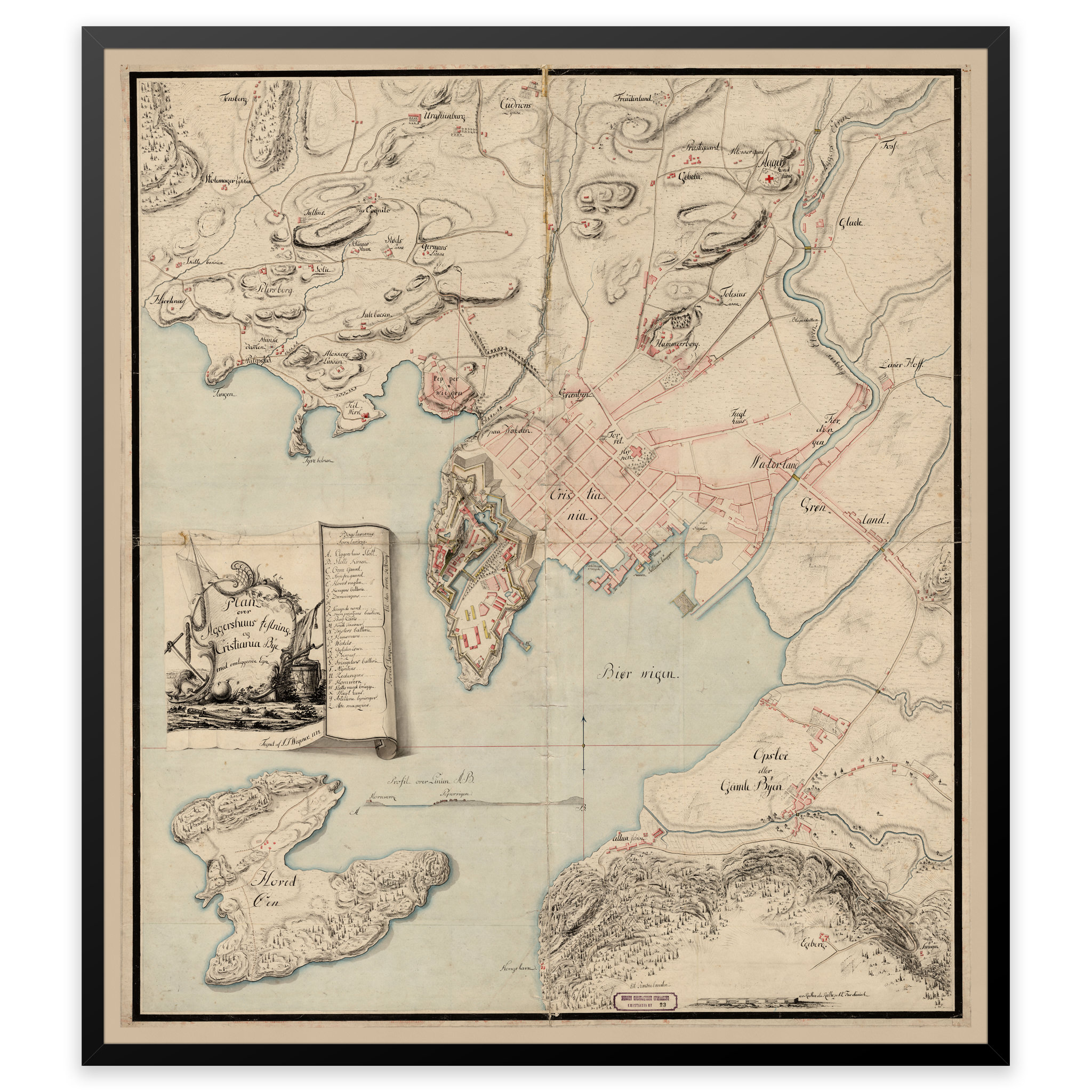
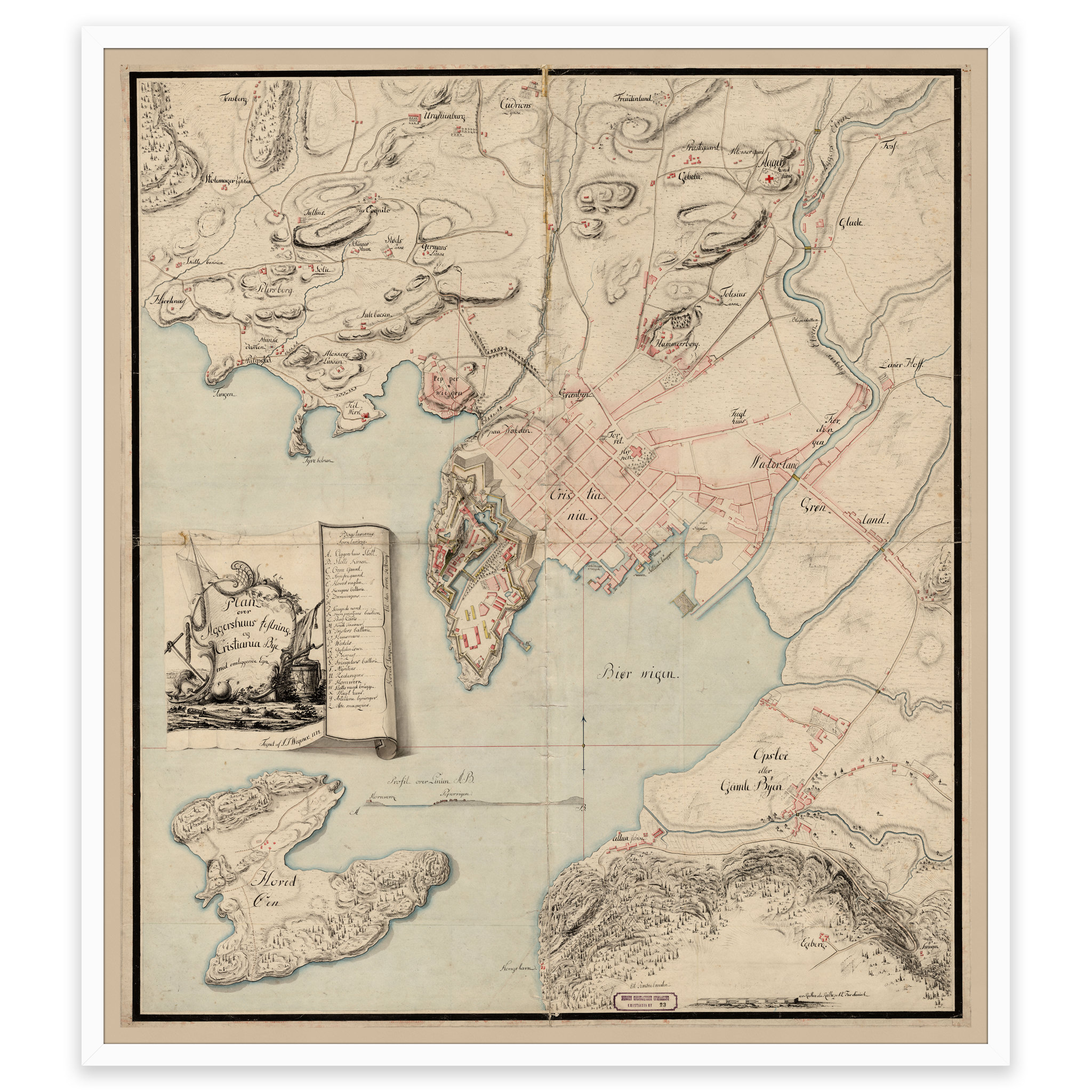
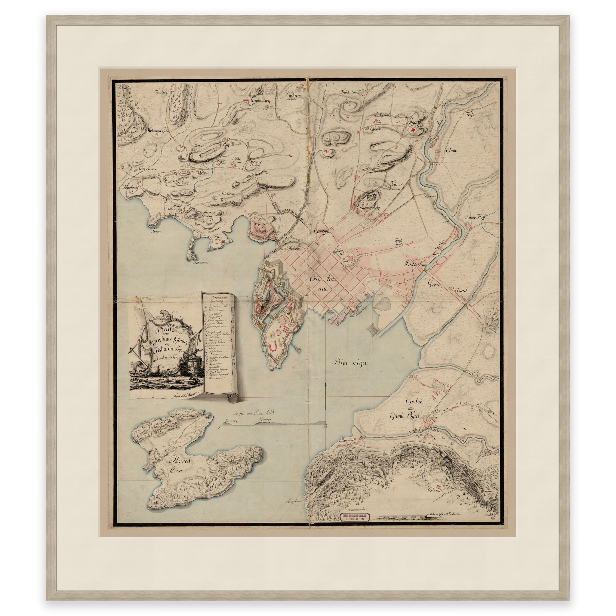
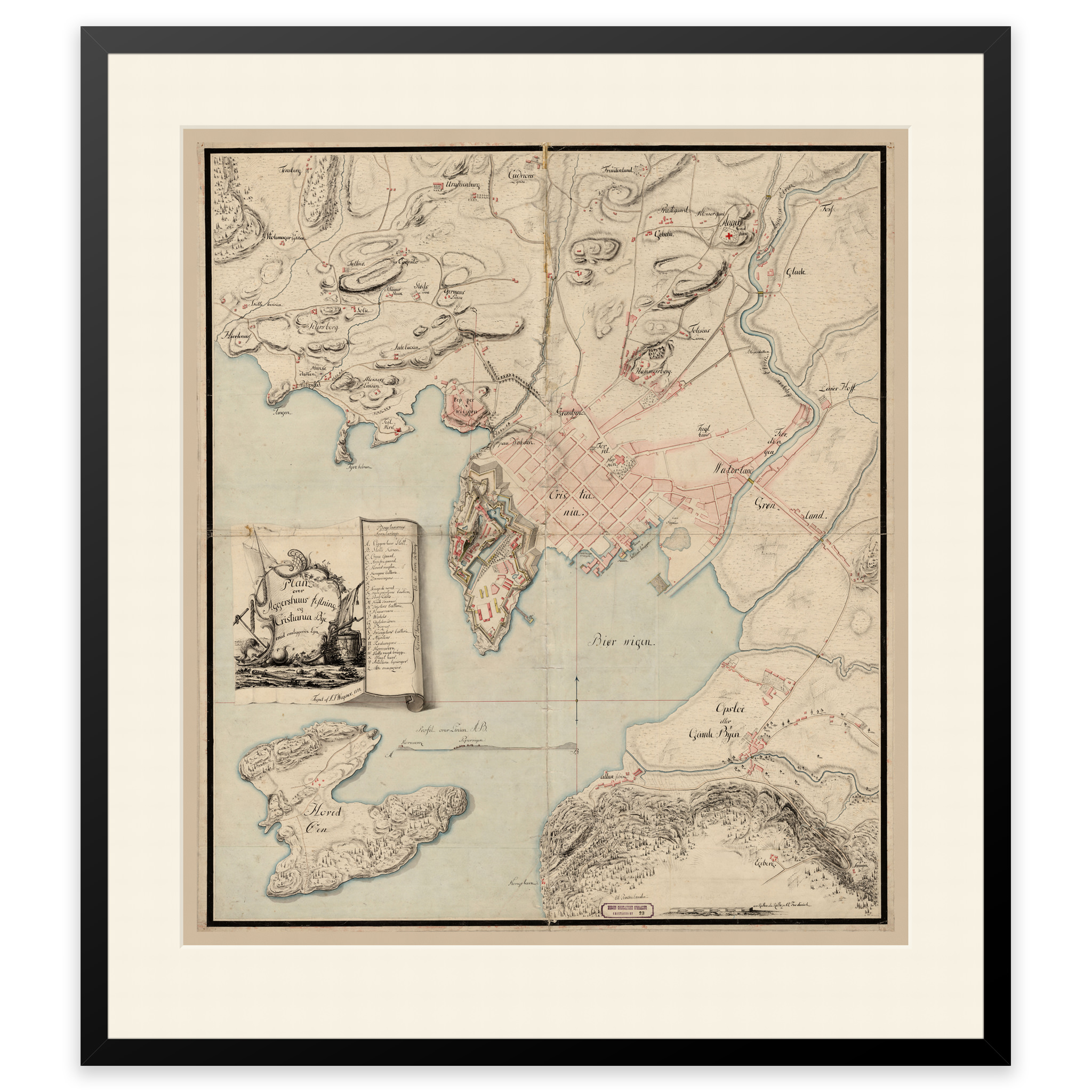
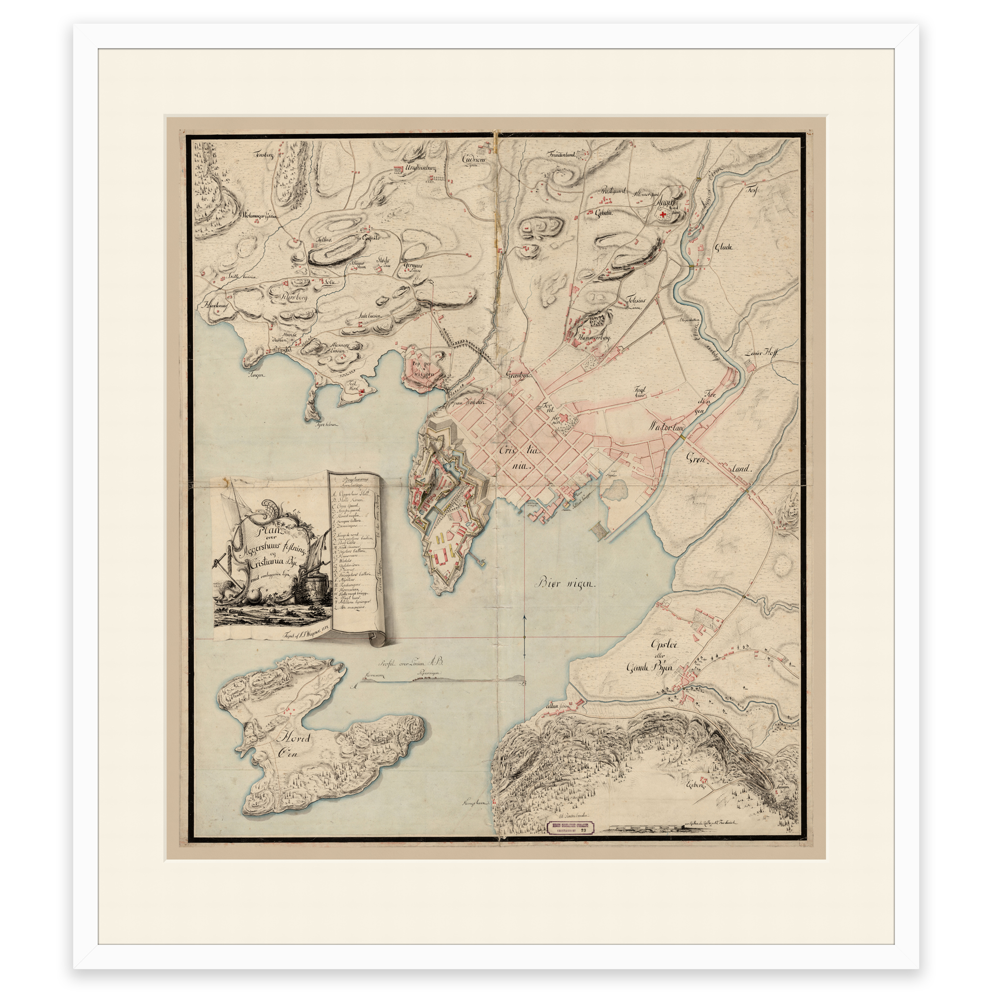
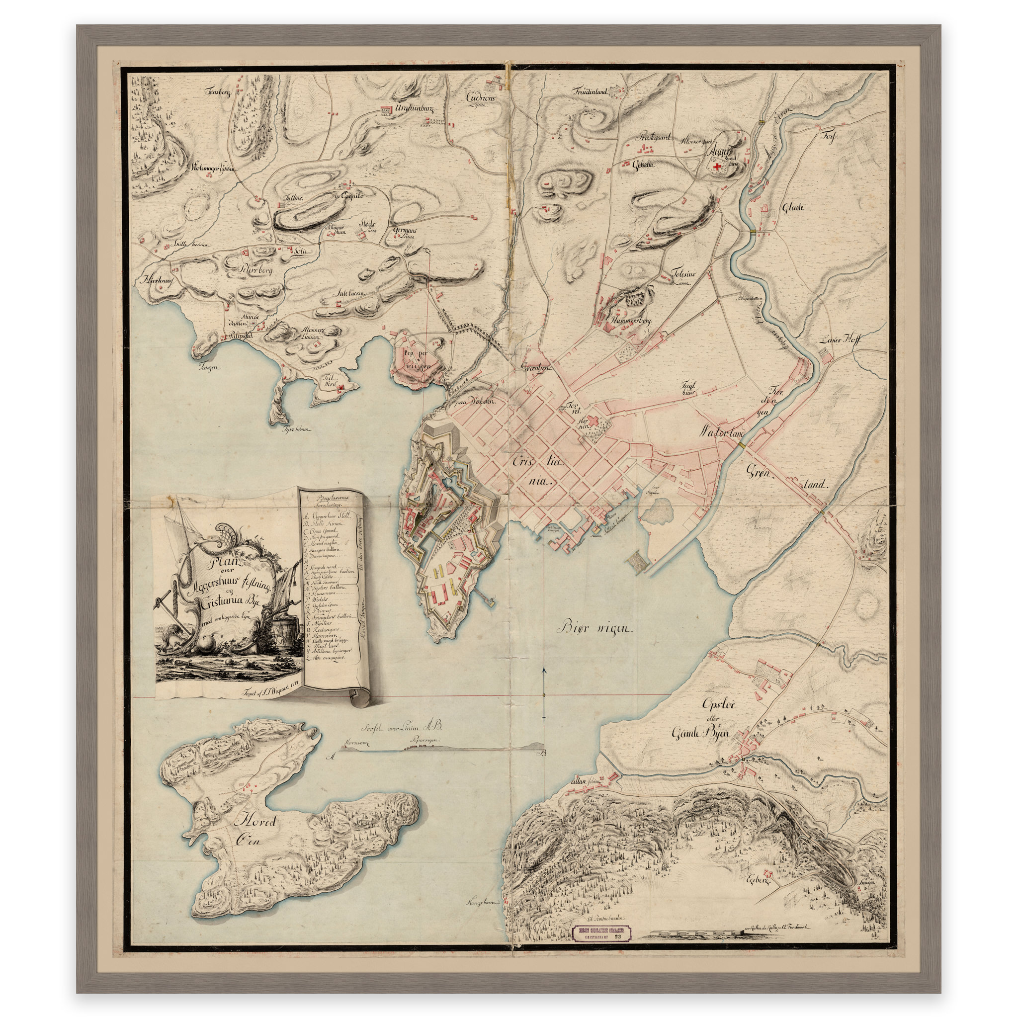
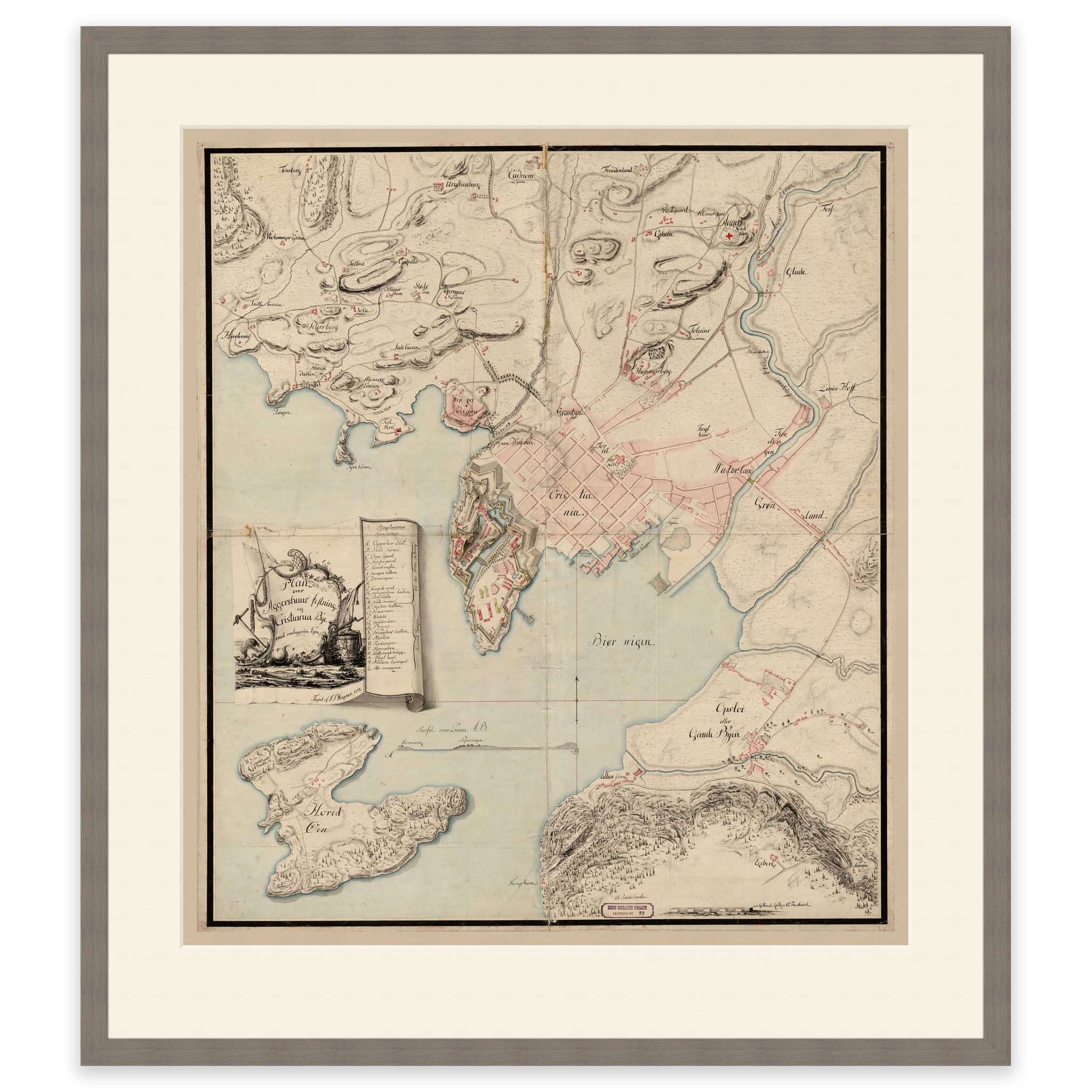
Hand-drawn map of Christiania, Akershus Fortress, Gamlebyen and Hovedøya from 1774. T. Wegner. The map is delivered in original size 64.1 x 113.2 cm. Do you want the map in a different size? Just get in touch – we’ll be happy to give you a quote for customization.